
Images


July 14, 2022 - Munga-Thirri–Simpson Desert National Park
 Tweet
Tweet
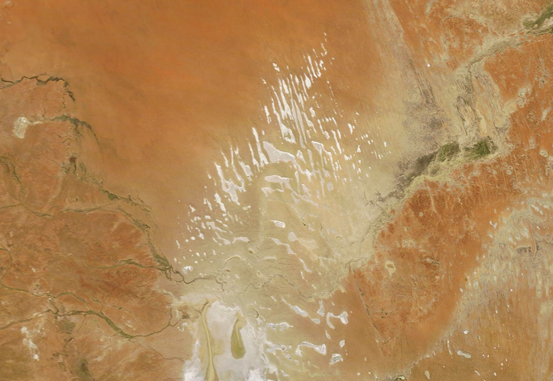
Sand and salt playas crea te high-contrast scenery in the Munga-Thirri - Simpson Desert Conservation Park. The Moderate Resolution Imaging Spectroradiometer (MODIS) on board NASA’s Terra satellite acquired this true-color, sunshine-filled image of the arid desert on July 11, 2022.
The Munga-Thirri-Simpson Desert Conservation Park sits in north-eastern South Australia, and spans 3.6 million hectares, making it Australia’s biggest national park. This is only part of the entire Simpson Desert, a huge intact desert system which also stretches into Northern Territory and Queensland. It is famous for its massive acreage filled with parallel, linear sand dunes that have formed as a result of wind erosion and sand deposition taking place over thousands of years. Some of the dunes stretch more than 100 km (60 miles) in length. Almost as spectacular, especially when seen from space, are the extensive array of playa (salt) lakes. These are flat, shallow lake beds that are covered with a layer of salt deposits. When flushes of rain come to the desert, these playa lakes may become temporarily moistened, but for much of the year most remain dry. They appear bright white because of the high reflectivity of the salt and minerals that encrust the lakes.
Image Facts
Satellite:
Terra
Date Acquired: 7/12/2022
Resolutions:
1km (200.7 KB), 500m (503.7 KB), 250m (1.1 MB)
Bands Used: 1,4,3
Image Credit:
MODIS Land Rapid Response Team, NASA GSFC
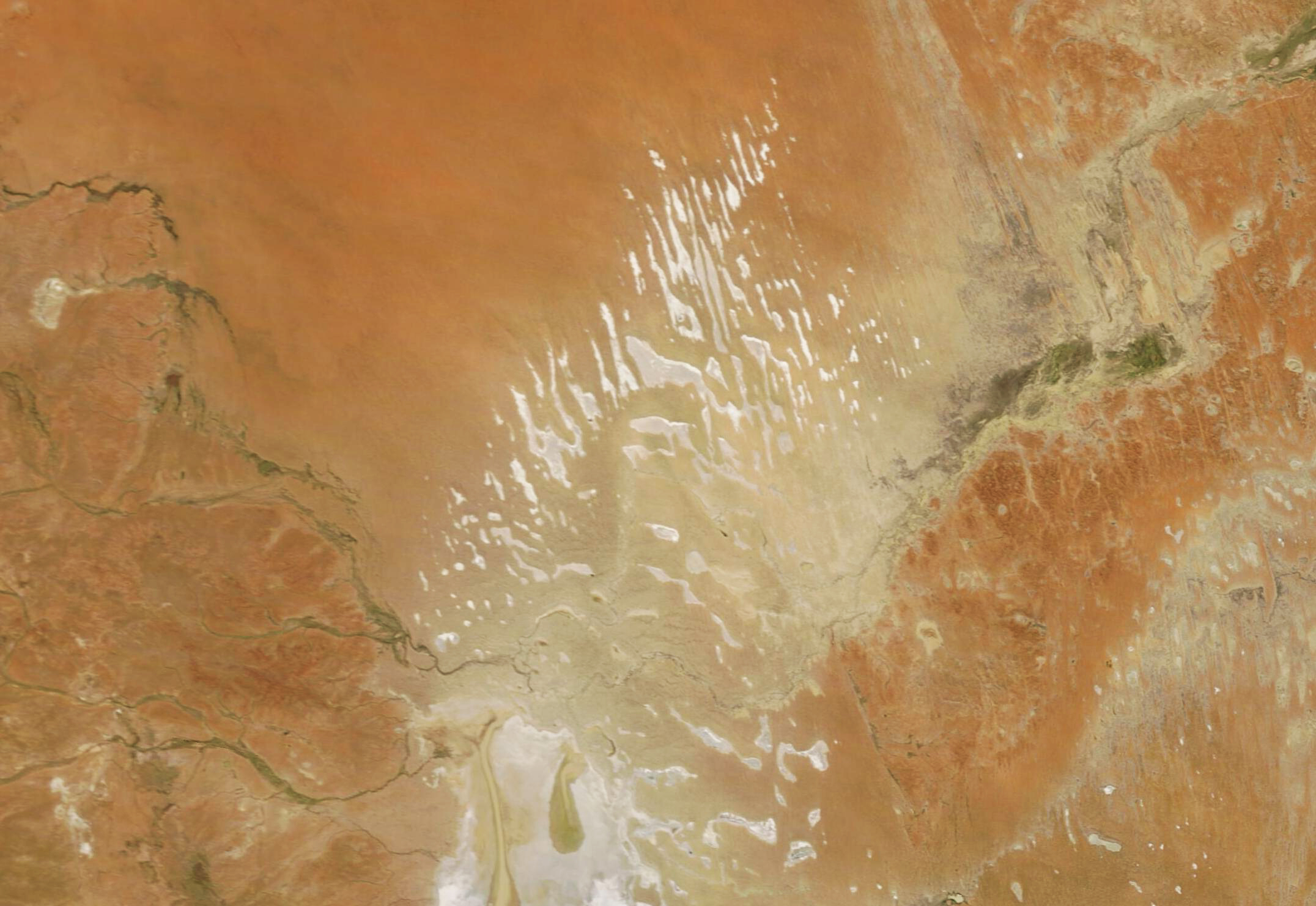
