
Images


August 29, 2022 - Open- and Closed-Cell Clouds over the Pacific
 Tweet
Tweet
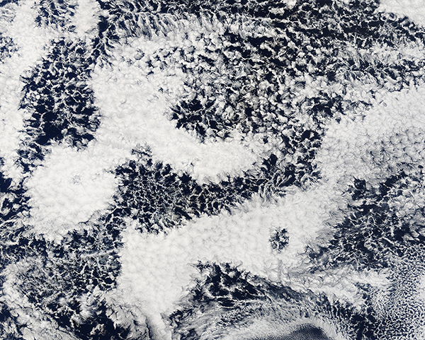
A lovely layer of lace-like cloud stretched across the Pacific Ocean on August 25, 2022, when the Moderate Resolution Imaging Spectroradiometer (MODIS) on board NASA’s Terra satellite acquired a true-color image of the region. On that day, large banks of similar clouds were found off of the coast of both North America and South America—areas particularly favorable for formation of large banks of marine stratocumulus clouds. This particular image was captured about 1000 miles (1,609 km) west of the cost of Chile.
Marine stratocumulus clouds usually form at low altitudes (below 6,000 feet), especially where the atmosphere is stable, such as off the western coasts of large land masses. They are quite common, covering about 20 percent of the low-latitude oceans, which translates to about 6.5 percent of the Earth’s surface. Marine stratocumulus are separated into “organized” and “disorganized” types, then the organized forms are further divided into “open-celled” or “closed-cell” types. The clouds viewed here are organized, with both open-celled and closed-celled clouds present.
Open-celled clouds often look like a honeycomb, with an open center surrounded by thin lines of cloud, giving the clouds a lacy look. Closed-cell clouds are more like capped honeycombs, with thick, puffy center of a fainter or absent edge. Despite their open, moisture-free appearance, pockets of open cells are actually associated with the development of precipitation. Uninterrupted decks of closed-cell stratocumulus clouds produce little to no drizzle; pockets of open cells occur as drizzle begins to fall.
Image Facts
Satellite:
Terra
Date Acquired: 8/26/2022
Resolutions:
1km (2 MB), 500m (5.5 MB), 250m (4.2 MB)
Bands Used: 1,4,3
Image Credit:
MODIS Land Rapid Response Team, NASA GSFC
