
Images


October 29, 2022 - Aerosols over India
 Tweet
Tweet
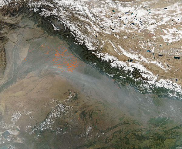
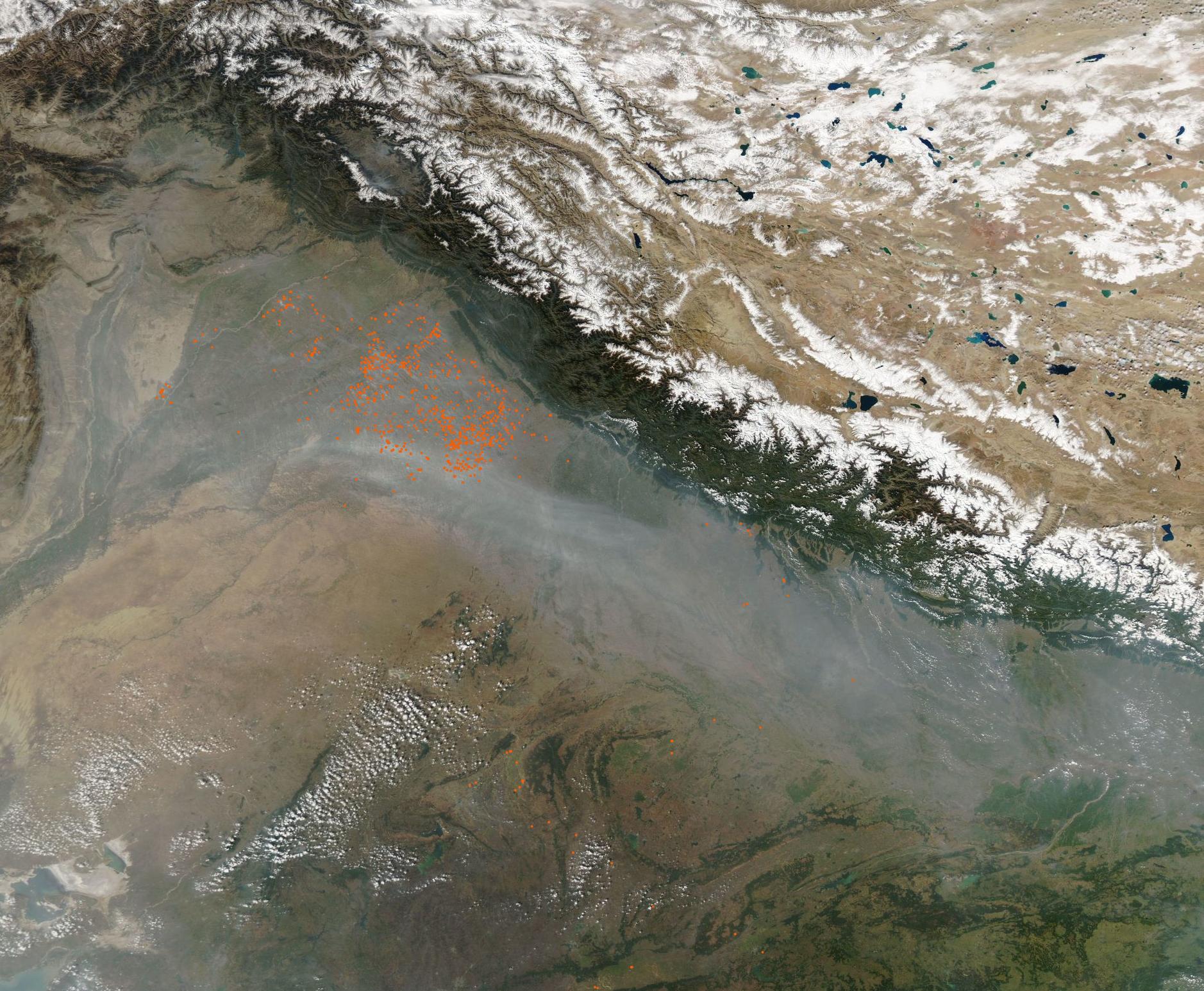
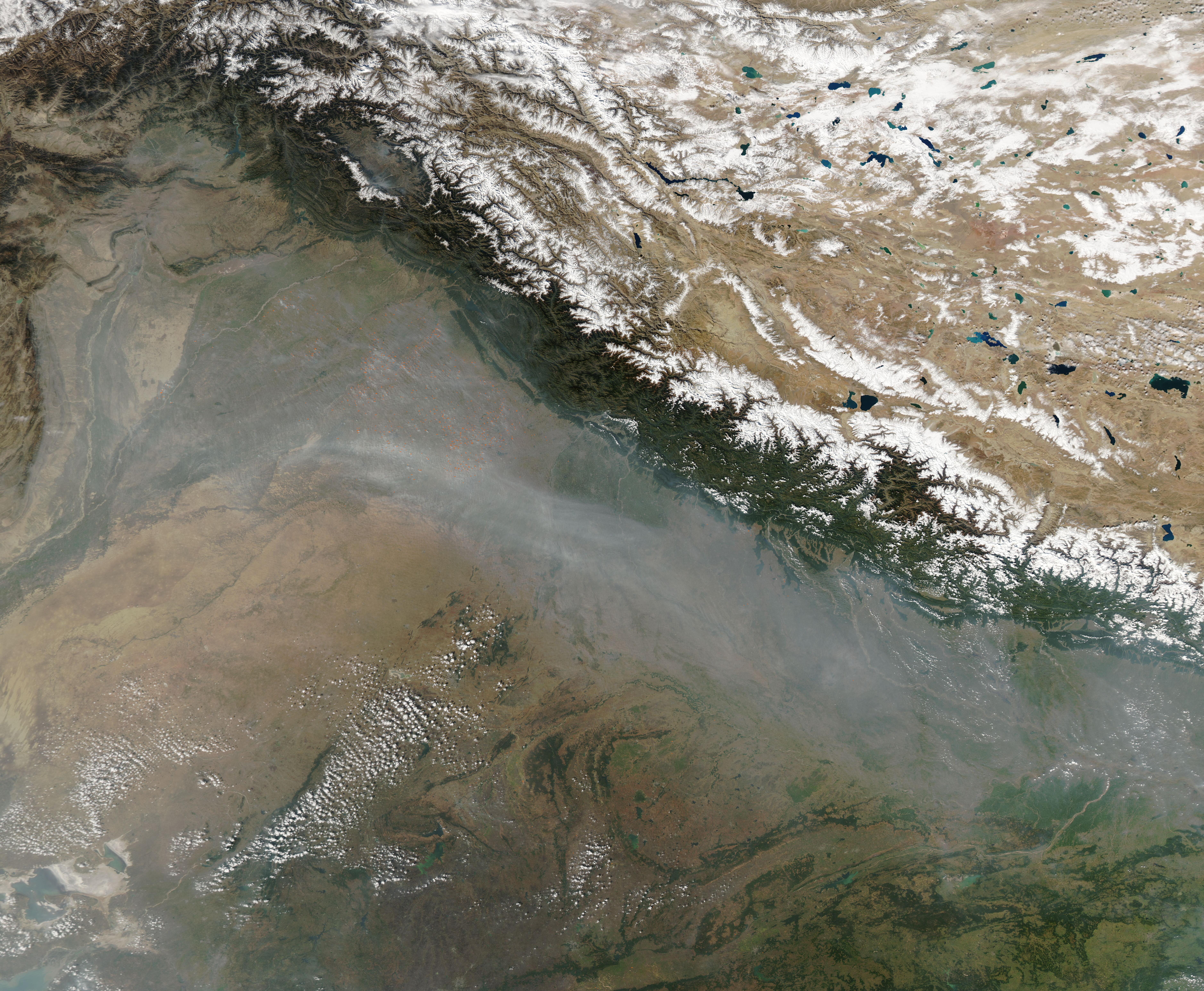
A shroud of haze stretched along the Indo-Gangetic Plain, stretching from Pakistan in the west to reach Bangladesh in the east in late October 2022.
The Moderate Resolution Imaging Spectroradiometer (MODIS) on board NASA’s Aqua satellite acquired a true-color image of about half of the gray cloud of aerosols on October 26. The gray haze becomes thickest over Utter Pradesh, where it obscures the land beneath from view.
Clusters of red hot spots, each representing actively burning fire, sit in northeastern Pakistan and northwest India. They are thickest in the Indian states of Punjab and Haryana, where rice and wheat are widely grown. These are primarily agricultural fires, primarily used to clear stubble from fields after harvest. Crop burning typically peaks during the first week of November a time that often coincides with falling temperatures and slow wind speeds, meteorological conditions that can lead to temperature inversions, which trap smoke in place.
The fires release several types of gases into the atmosphere, including smog-forming carbon monoxide and nitrogen dioxide. They also release aerosols, such as black carbon and organic carbon, that contribute to elevated levels of PM2.5, which can cause health problems.
While agricultural burning contributes heavily to the aerosol pollution and haze over the Indo-Gangetic Plain, it is not the only factor. Industry, coal burning for heat, and automobile emissions also heavily contribute to aerosol pollution in the region.
Image Facts
Satellite:
Aqua
Date Acquired: 10/28/2022
Resolutions:
1km (522.7 KB), 500m (1.8 MB), 250m (5.7 MB)
Bands Used: 1,4,3
Image Credit:
MODIS Land Rapid Response Team, NASA GSFC
