
Images


December 8, 2022 - Cuba and the Gulf of Batabanó
 Tweet
Tweet
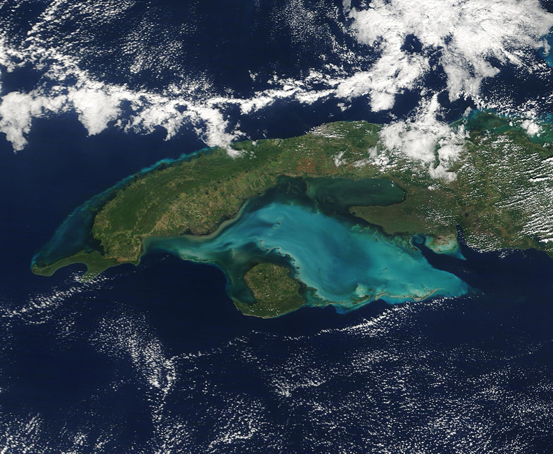
The glorious, jewel-toned waters of the Gulf of Batabanó highlight this true-color image of western Cuba which was acquired by the Moderate Resolution Imaging Spectroradiometer (MODIS) on board NASA’s Terra satellite on December 6, 2022.
Cuba is the largest island in the Caribbean, stretching about 750 miles (1,207 km) in length and measuring about 60 miles (97 km) wide on average. A curved shape with numerous peninsulas and inlets brings the island a remarkable 2,300 miles (3,700 km) of coastline.
From space, the most outstanding feature associated with Cuba is the Gulf of Batabanó, a shallow inlet of the Caribbean Sea. The Gulf has a surface area of about 20,850 square kilometers (8,050 square miles), which is a slightly larger surface area of the U.S. state of Massachusetts, and an average depth of only 6 meters (19.6 feet). The typically turquoise waters sit over a carbonate bank, and this white, sandy bottom sediment can be easily stirred up by currents, tides, or wind-driven wave action. Wherever carbonate sediment is stirred up, the waters of the Gulf of Batabanó take on a milky tinge, as seen in this image.
Image Facts
Satellite:
Terra
Date Acquired: 12/6/2022
Resolutions:
1km (302.3 KB), 500m (800.2 KB), 250m (538.4 KB)
Bands Used: 1,4,3
Image Credit:
MODIS Land Rapid Response Team, NASA GSFC
