
Images


December 24, 2022 - Manicouagan Reservoir
 Tweet
Tweet
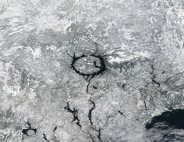
On December 12, 2022, the Moderate Resolution Imaging Spectroradiometer (MODIS) on board NASA’s Terra satellite acquired a true-color image of snow surrounding Manicouagan Reservoir in southeastern Quebec, Canada.
This strikingly circular lake is the most important reservoir of the Manicouagan Hydroelectric Complex. The reservoir itself was created in the 1960s when the Daniel-Johnson dam was completed, flooding two arched lakes that were previously present. The rising floodwaters also created a new island on a high plateau between the lakes.
While the reservoir is relatively new, it has been built on a truly ancient foundation—one of the Earth’s largest and oldest impact craters. Manicouagan Crater was formed 214 million years ago, near the end of the Triassic Period, when an asteroid 5 kilometers (3 miles) wide struck what is now Canada. The asteroid's impact not only created a rounded impact crater, but the massive power of the impact shattered rock and debris, causing it to uplift in the center of the crater. This uplifted area is now the Ile Rene-Levasseur. The highest point on the island, Mount Babel, rises about 1,970 feet (600 meters) above the lake level on its northern end.
Image Facts
Satellite:
Terra
Date Acquired: 12/15/2022
Resolutions:
1km (337.3 KB), 500m (937.9 KB), 250m (739.4 KB)
Bands Used: 1,4,3
Image Credit:
MODIS Land Rapid Response Team, NASA GSFC
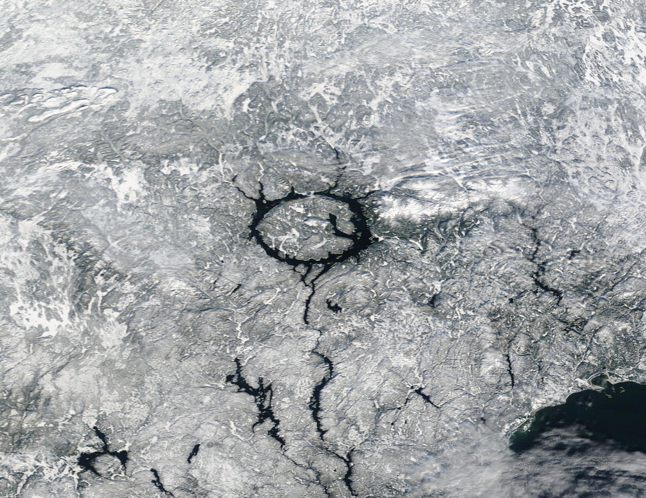
