
Images


February 14, 2023 - Fires in South Sudan and Ethiopia
 Tweet
Tweet
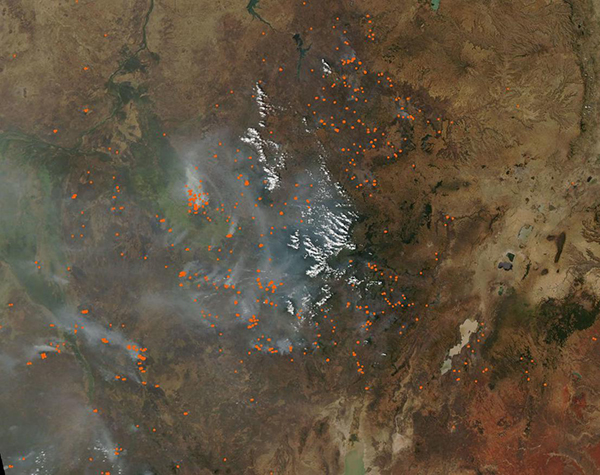
On February 13, 2023, many dozen fires were burning across Ethiopia and South Sudan as heavy smoke sprawled over the region. The Moderate Resolution Imaging Spectroradiometer (MODIS) on board NASA’s Aqua satellite acquired a true-color image of the scene on that same day. Each red “hot spot” marks an area where the thermal bands on the instrument detected temperatures higher than background. When combined with typical smoke—as in this image—such hot spots mark actively burning fires.
While it’s not possible to know, for certain, the cause of a fire via satellite imagery, the location, time of year, and number of fires strongly suggest that these are agricultural fires—fires that are deliberately set to manage lands. Agricultural fire serves a variety of purposes. It is often used to open new savanna, grassland, or forest into cropland or pasture. In established fields, fire is an easy tool used to clear stubble and waste at the end of a growing season and to return nutrients to the soil. Pastureland is sometimes renewed by burning, as it clears the field of unwanted weeds and encourages fresh growth of forage.
While fire is a commonly used tool in traditional agriculture, it can produce tremendous amounts of smoke that can harm the health of both human and animals. Fire may also slip out of control to create wildfire that may damage large areas. Widespread use of fire in “slash-and-burn” practices is a major factor in deforestation across the Earth.
Image Facts
Satellite:
Aqua
Date Acquired: 2/13/2023
Resolutions:
1km (130.6 KB), 500m (463.7 KB), 250m (1.5 MB)
Bands Used: 1,4,3
Image Credit:
MODIS Land Rapid Response Team, NASA GSFC
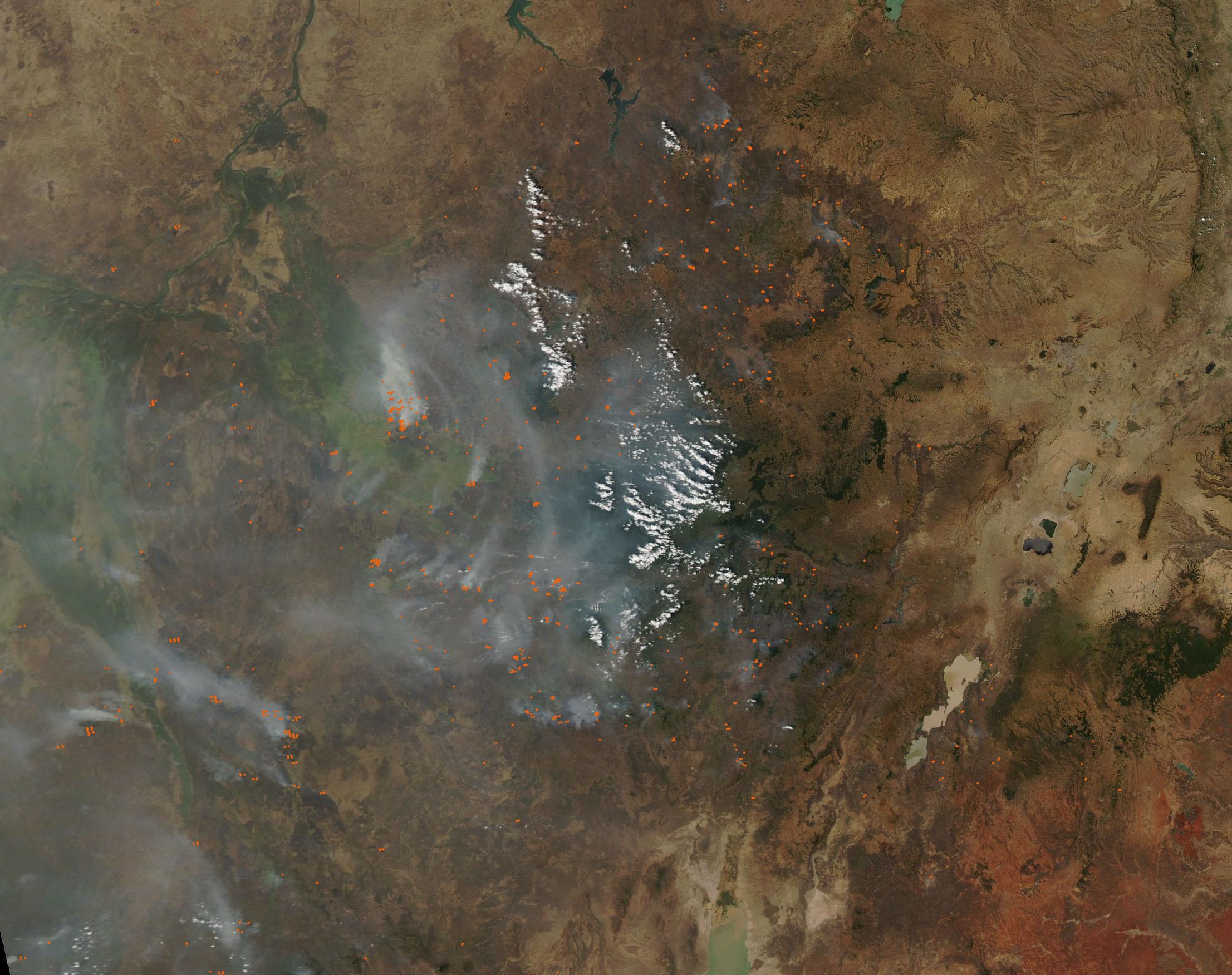
