
Images


March 13, 2023 - Cloud Streets and Sea Ice off Eastern Greenland
 Tweet
Tweet
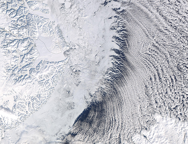
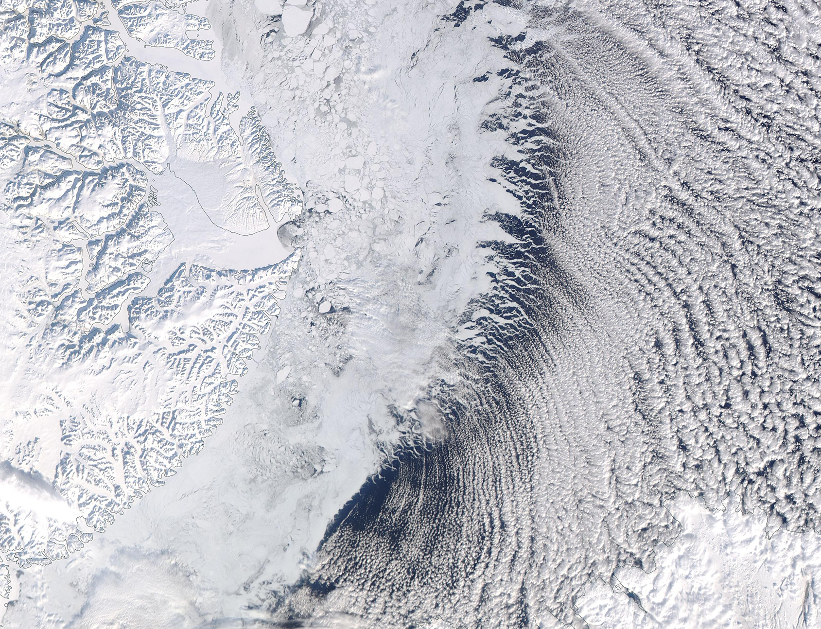
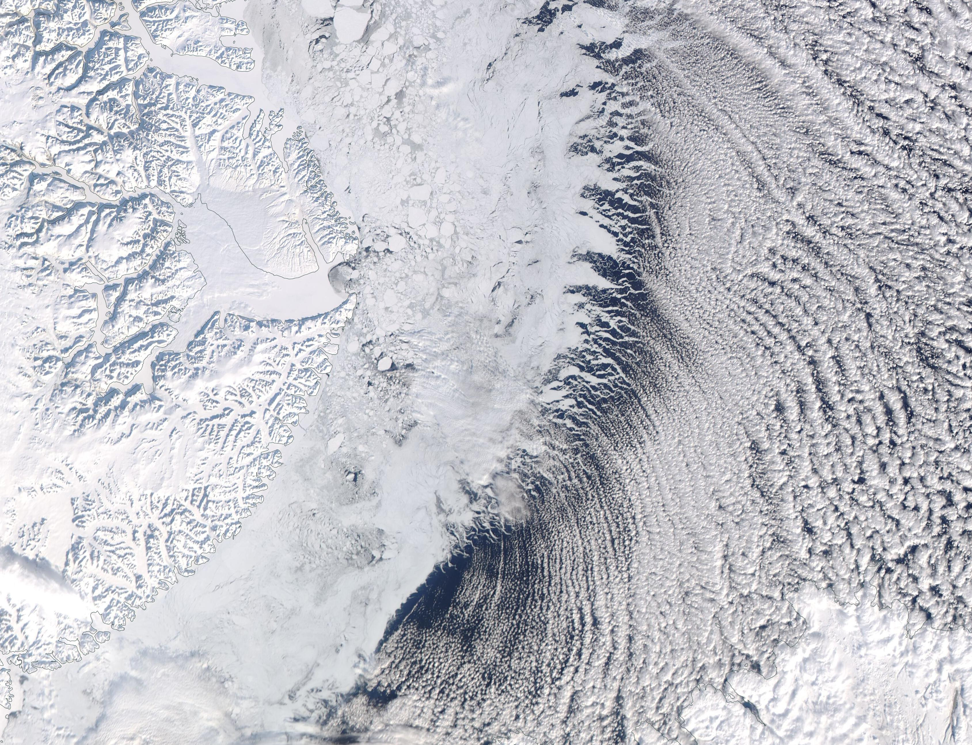
Despite the approach of spring, with lengthening days and warming temperatures, on March 10, 2023, the Moderate Resolution Imaging Spectroradiometer (MODIS) acquired a true-color image of a very wintery scene across eastern Greenland. The combination of snow, sea ice, and cloud streets is a hallmark of frigid, windy days.
The rugged terrain of central Greenland’s central coast is covered with ice, snow, and glaciers. The edge of the land itself has been marked with a gray boundary line, making it easier to see where the land ends and fast ice (ice which clings to the land) begins. In some areas, the sheet of fast ice is broken into chunks or, where it is starting to melt and becoming waterlogged, takes on a gray appearance.
Just past the edge of the ice, clouds line up in parallel rows that arc to the southeast. Called “cloud streets”, because they look something like giant highways crossing the sky, this feature is formed when strong winds blow across a frigid surface and then over warmer waters, especially when a warmer air layer (a temperature inversion) rests over the top of both. The comparatively warm water gives up heat and moisture to the cold air, leading columns of heated air (thermals) to rise through the atmosphere.
The warm air in the temperature inversion acts like a lid such that the moist, rising thermals hit the air mass above and roll over on themselves. This creates parallel horizontal cylinders of rotating air. On the upward side of the cylinders (rising air), the moisture cools and condenses into flat-bottomed, fluffy-topped cumulus clouds that line up parallel to the direction of the wind. Along the downward side (descending air), clouds remain thin, creating the thick-thin-thick cloud pattern, as seen in this image.
Image Facts
Satellite:
Aqua
Date Acquired: 3/10/2023
Resolutions:
1km (683.7 KB), 500m (1.8 MB), 250m (3.7 MB)
Bands Used: 1,4,3
Image Credit:
MODIS Land Rapid Response Team, NASA GSFC
