
Images


May 20, 2023 - Wildfires in Western Spain
 Tweet
Tweet
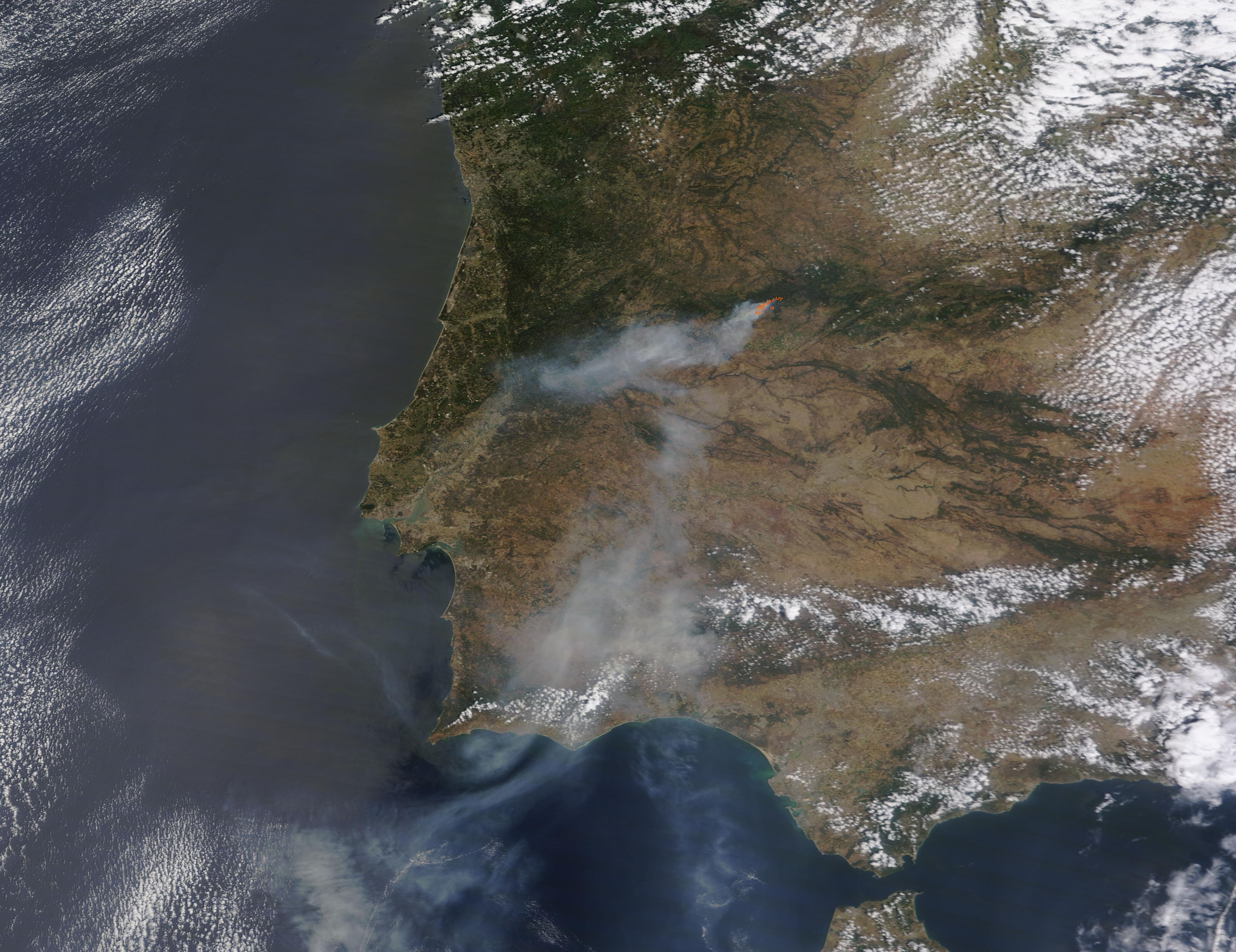
A massive wildfire was raging through dry forestland in western Spain on May 19, 2023, when the Moderate Resolution Imaging Spectroradiometer (MODIS) on NASA’s Terra satellite captured a true-color image of the scene. A large patch of red marks actively burning fire near Spain’s border with Portugal. Heavy gray smoke rising from the fire is carried westward and then southward by strong winds blowing across the region.
The fire initially started near Pinofranqueado, a municipality located in Las Hurdes, province of Cáceres on May 17 and moved westward towards Sierra de Gata. By May 19, the blaze had spread to an estimated 8,000 hectares (19,800 acres). Gusting winds and dry vegetation make further spread likely, despite the efforts of 260 firefighters and 165 soldiers engaged in beating back the blaze. Approximately 550 villagers near the fire were evacuated on May 18. The cause of this fire is under investigation as potential arson.
Poor rainfall over the last three years, followed by an unusually dry winter, have rendered the forests tinder dry. In Spain, fires typically become severe in June as summer heat arrives, but this year’s fire season started early with an intense blaze that raged in the eastern Castellon province from March 23-27. That fire consumed more than 4,300 hectares (10,500 acres) before it was quenched.
Image Facts
Satellite:
Terra
Date Acquired: 5/19/2023
Resolutions:
1km (136.7 KB), 500m (463.6 KB), 250m (1.4 MB)
Bands Used: 1,4,3
Image Credit:
MODIS Land Rapid Response Team, NASA GSFC
