
Images


September 18, 2023 - Southeastern Utah
 Tweet
Tweet
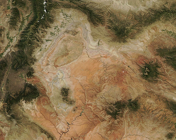
On September 6, 2023, the Moderate Resolution Imaging Spectroradiometer (MODIS) on NASA’s Aqua satellite acquired a true-color image of southeastern Utah.
The reddish-orange rocks of the Colorado Plateau highlight the region, marking remarkable desert-land filled with arches, needles, mesas, canyons, and other geological wonders. Some of the most well-known features located in this portion of Utah include Arches National Park, Canyonlands National Park, and Glen Canyon.
Two major rivers flow through southeast Utah. The Green River flows for 730 miles through the state and is a major tributary of the Colorado River. Lake Powell, seen in the south and near the center of this image, was formed by flooding of the Colorado River behind Glen Canyon Dam in the 1960s. The National Park Service estimated that the Glen Canyon National Recreation Area was visited by more than 3.1 million people in 2021 and more than 4 million people each year between 2017 and 2019.
Image Facts
Satellite:
Aqua
Date Acquired: 9/6/2023
Resolutions:
1km (163.3 KB), 500m (445.6 KB), 250m (986 KB)
Bands Used: 1,4,3
Image Credit:
MODIS Land Rapid Response Team, NASA GSFC
