
Images


November 28, 2023 - Iceberg A23a at the Tip of the Antarctic Peninsula
 Tweet
Tweet
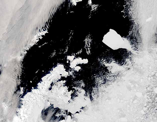
On November 27, 2023, a break in the swirling cloud cover allowed a glimpse of the Earth’s largest iceberg drifting past the tip of the Antarctic Peninsula. The Moderate Resolution Imaging Spectroradiometer (MODIS) on NASA’s Terra satellite acquired this true-color image of Iceberg A23a northeast of the Joinville Island group, which are the northernmost-group of islands on the Antarctic Peninsula, on that same day.
The massive iceberg calved from the Filchner Ice Shelf in 1986 but didn’t drift far before it grounded in the Weddell Sea—and was stuck there for decades. Very slowly the massive iceberg lost a bit of mass here and there, until its long keel finally was able to loosen from the muddy bottom of the Weddell Sea and begin to drift. Scientists first spotted tiny movements in A23a’s position in 2020, but only recently has it caught the currents to drift quickly eastward towards the relatively warm waters of the South Atlantic Ocean.
A23a is estimated to measure about 1,312 feet (400 meters) thick and span an area of about 1,544 square miles (4,000 square kilometers). That’s more than twice the area of Greater London, which covers 607 square miles (1,572 square kilometers).
Image Facts
Satellite:
Terra
Date Acquired: 11/27/2023
Resolutions:
1km (60.2 KB), 500m (130.5 KB), 250m (236.1 KB)
Bands Used: 1,4,3
Image Credit:
MODIS Land Rapid Response Team, NASA GSFC
