
Images


December 2, 2023 - Cloud Streets off New England and New Brunswick
 Tweet
Tweet
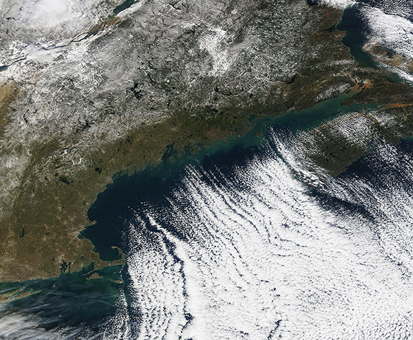
A blast of frigid air swept across the northeastern United States and the Canadian Maritimes on November 24-25, 2023. Temperatures plunged as low as 14°F (-10°C) in St. John, New Brunswick and to 16°F (-8.9°C) in Bangor, Maine on November 25, with highs of only 25°F (-3.9°C) and 29°F (-1.7°C), respectively.
The winter-like chill, along with strong winds, helped create a stunning pattern of clouds over the North Atlantic Ocean. The Moderate Resolution Imaging Spectroradiometer (MODIS) on NASA’s Terra satellite acquired a true-color image of the scene on November 25. Lines of clouds stretch from northwest to southeast over the North Atlantic, while the cloudless skies over land afford a peek at the snow that fell across the region only a few days earlier.
This type of cloud pattern is known as “cloud streets” or, more technically, as “horizontal convective rolls.” They form when cold air blows over warmer waters, while a warmer air layer—or temperature inversion—rests over top of both. The comparatively warm water of the ocean gives up heat and moisture to the cold air mass above, and columns of heated air—thermals—naturally rise through the atmosphere. As they hit the temperature inversion like a lid, the air rolls over like the circulation in a pot of boiling water. The water in the warm air cools and condenses into flat-bottomed, fluffy-topped cumulus clouds that line up parallel to the wind.
Image Facts
Satellite:
Terra
Date Acquired: 11/25/2023
Resolutions:
1km (1.1 MB), 500m (3.1 MB), 250m (6.6 MB)
Bands Used: 1,4,3
Image Credit:
MODIS Land Rapid Response Team, NASA GSFC
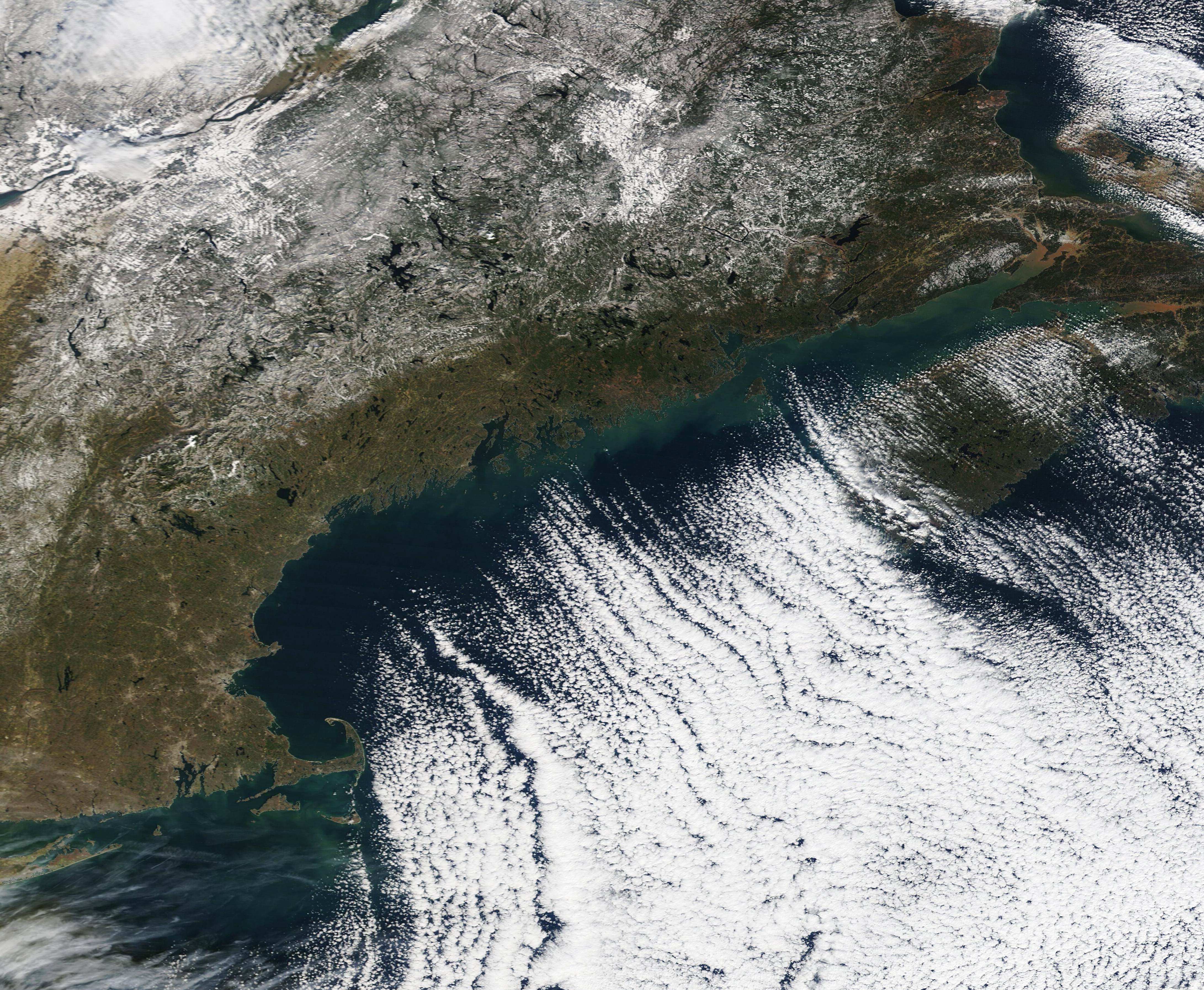
