
Images


December 4, 2023 - Ice in the Strait of Tartary
 Tweet
Tweet
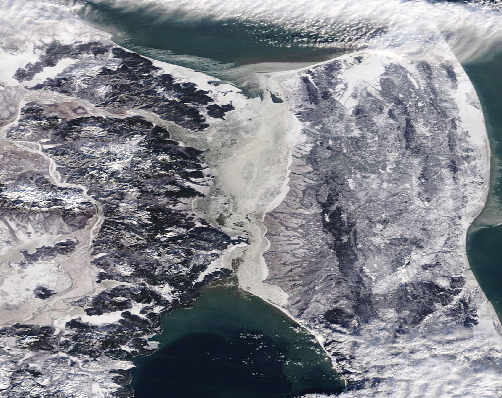
Ice covered the Strait of Tartary on November 27, 2023, when the Moderate Resolution Imaging Spectroradiometer (MODIS) on NASA’s Terra satellite acquired this true-color image. In addition, the Amur River, which pours into to the Strait in the northwest, also wears a coating of ice and both mainland Russia and Sakhalin Island are crusted with ice and snow. The Amur is the world’s tenth-longest river, which flows east along the Chinese-Russian border before turning northeast and emptying into the strait.
Sandwiched between Russia’s Far East and Sakhalin Island, the Strait of Tartary connects the Sea of Okhotsk (north) and the Sea of Japan (south). It is a major shipping route and the location of such Russian ports as Sovetskaya Gavan, Lesogorsk, and Aleksandrovsk-Sakhalinsky. When the Strait of Tartary becomes covered with ice, typically about mid-November, port operations are severely restricted or come to a halt until the Strait becomes navigable once again in mid-May.
Image Facts
Satellite:
Terra
Date Acquired: 11/27/2023
Resolutions:
1km (187.8 KB), 500m (534.5 KB), 250m (1.3 MB)
Bands Used: 1,4,3
Image Credit:
MODIS Land Rapid Response Team, NASA GSFC
