
Images


February 7, 2024 - Contrails over Iowa and Missouri
 Tweet
Tweet
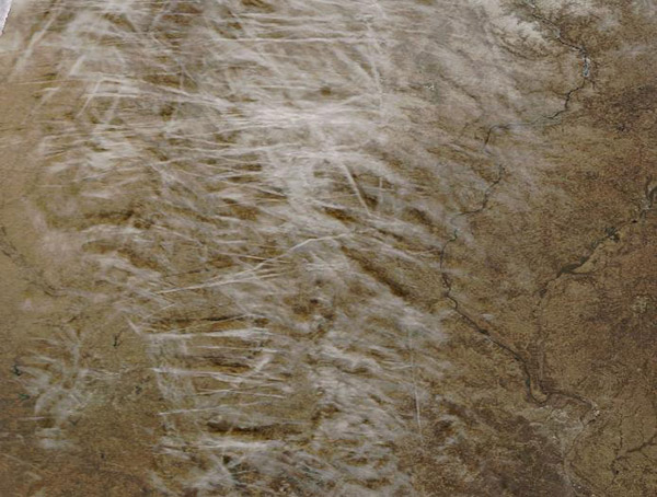
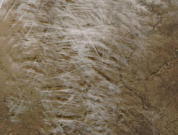
Dozens of contrails streaked the sky over Iowa and Missouri on February 5, 2024, when the Moderate Resolution Imaging Spectroradiometer (MODIS) on NASA’s Terra satellite acquired this true-color image. In some areas, contrails mingle with cloud. In other areas distinct tracks crisscross in the wake of the passage of jets.
Condensation trails, also called “contrails,” are created when hot, humid air from a jet engine mixes with colder, drier air in the surrounding atmosphere. If the air through which the airplane is flying is already close to being saturated with water vapor, the condensation trail will last longer than it will if the air is dry. A contrail that lingers can spread out into a layer of cirrus (thin, wispy clouds).
Airplane engines produce water vapor as they burn jet fuel. At high altitudes (above 20,000 feet), the air is so cold that the expelled vapor quickly condenses and freezes. In dry air, these ice crystals will undergo sublimation, changing directly from solid into a gas, leaving no visible trace. However, when the air is humid, long, linear cirrus clouds form along the track of the passing plane.
Image Facts
Satellite:
Terra
Date Acquired: 2/5/2024
Resolutions:
1km (64.6 KB), 500m (214.8 KB), 250m (615.8 KB)
Bands Used: 1,4,3
Image Credit:
MODIS Land Rapid Response Team, NASA GSFC
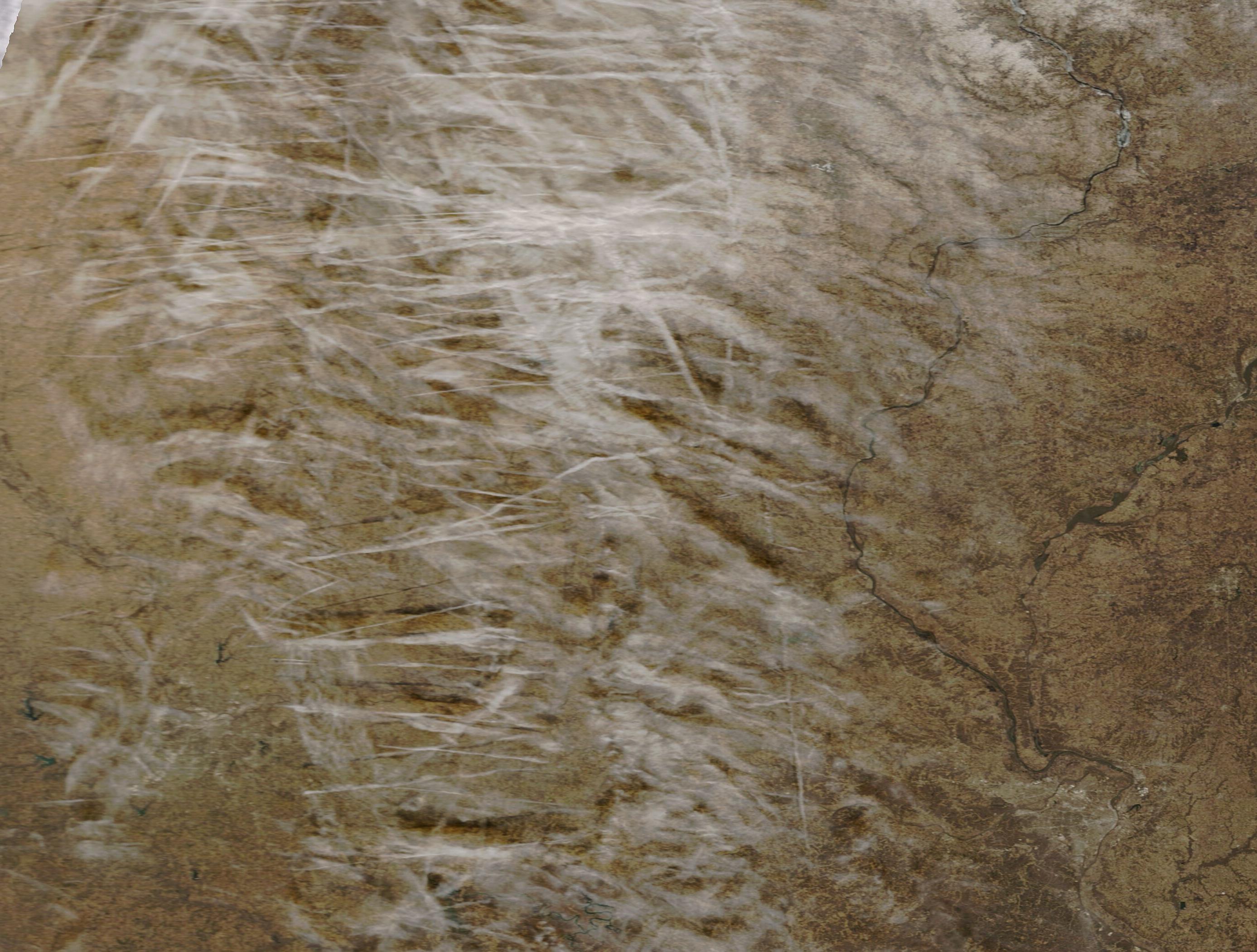
