
Images


February 10, 2024 - Tropical Cyclone 12p
 Tweet
Tweet
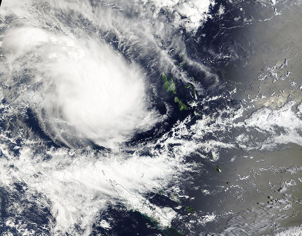
On February 7, 2024, the Moderate Resolution Imaging Spectroradiometer (MODIS) acquired a true-color image of a new tropical cyclone forming in the Coral Sea west of Vanuatu. Tropical Cyclone 12p was moving southeastward towards central Vanuatu and was carrying maximum sustained winds of about 45 mph (72.4 km/h) shortly after this image was captured. The green islands visible to the east of the storm include Espiritu Santo, Malakula, and Efate, all part of Vanuatu.
At 6:00 UTC (1:00 a.m. EST) on February 9, the center of 12p was located about 112 miles (180 km) northwest of Port Vila, Efate Island. It was carrying maximum sustained winds of about 40 mph (65 km/h).
Although it is not an exceptionally strong storm, Tropical Cyclone 12p is expected to bring strong winds, surf, and heavy rain to Vanuatu as it travels between Efate and Erromango Islands on the morning of February 10. Maximum sustained winds of 46 mph (74 km/h) are forecast as it moves through the islands. By February 11 -12, the storm should be moving over the open waters of the South Pacific Ocean, where increasingly unfavorable conditions should cause it to dissipate by February 12.
Image Facts
Satellite:
Terra
Date Acquired: 2/7/2024
Resolutions:
1km (421.6 KB), 500m (1.3 MB), 250m (3.8 MB)
Bands Used: 1,4,3
Image Credit:
MODIS Land Rapid Response Team, NASA GSFC
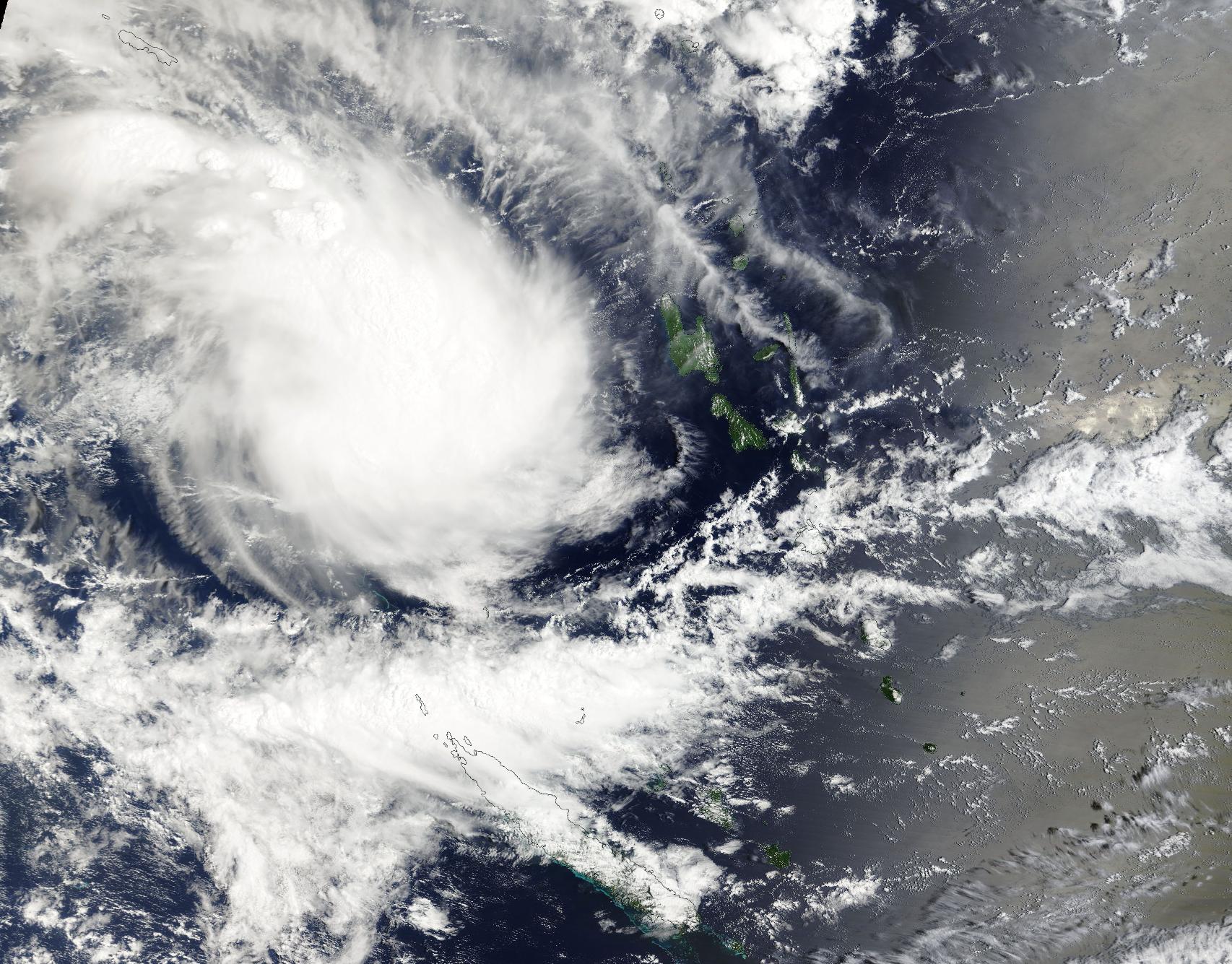
