
Images


February 24, 2024 - Tropical Cyclone Elanor Passes Mauritius
 Tweet
Tweet
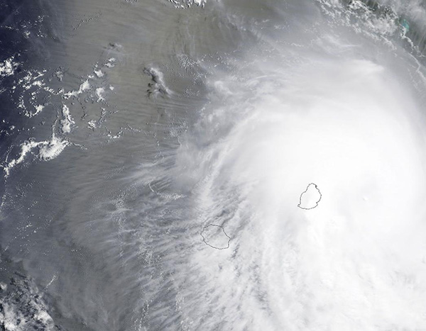
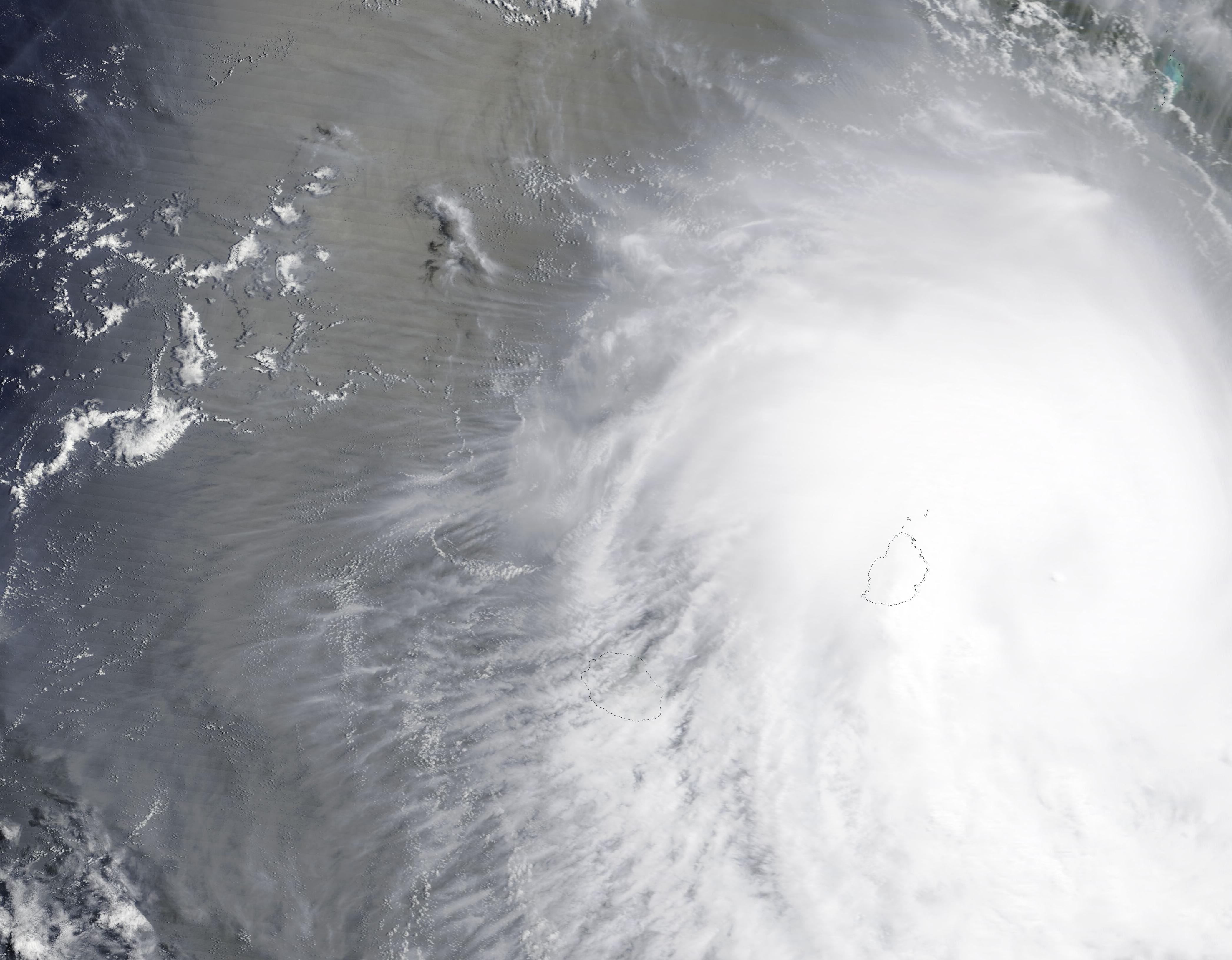
Tropical Cyclone Eleanor dumped rain and brought heavy wind to Mauritius as it passed east of the island on February 22, 2024. Public transportation was shut down, schools were closed, and all flights were grounded as the storm passed the island as a strong tropical storm. Early reports suggest that neither Mauritius nor the nearby island of Reunion suffered severe damage.
The Moderate Resolution Imaging Spectroradiometer (MODIS) on NASA’s Terra satellite acquired a true-color image of Tropical Cyclone Eleanor over the Indian Ocean. Mauritius is outlined and sits near the center of the storm. Reunion is located southwest of Mauritius. The image was acquired near the time Elanor was at its peak strength, carrying maximum sustained winds of about 70 mph (112.6 km/h).
After passing Mauritius, the storm faced unfavorable wind shear on February 23, which steered it strongly towards the west and quickly sapped Eleanor’s strength.
At 10:00 p.m. EST on February 23 (0300 UTC February 24) the Joint Typhoon Warning Center (JTWC) issued its final advisory on Tropical Cyclone Eleanor. At that time, the cyclone was located about 260 miles (418 km) south of Port Louis, Mauritius and was tracking westward. Maximum sustained winds were reduced to about 40 mph (64 km/h) and Eleanor was expected to fully dissipate by early on February 24. The remnants will slowly track west-northwestward and the JTWC will closely monitor for signs of regeneration.
Image Facts
Satellite:
Terra
Date Acquired: 2/22/2024
Resolutions:
1km (84.6 KB), 500m (273.3 KB), 250m (795.3 KB)
Bands Used: 1,4,3
Image Credit:
MODIS Land Rapid Response Team, NASA GSFC
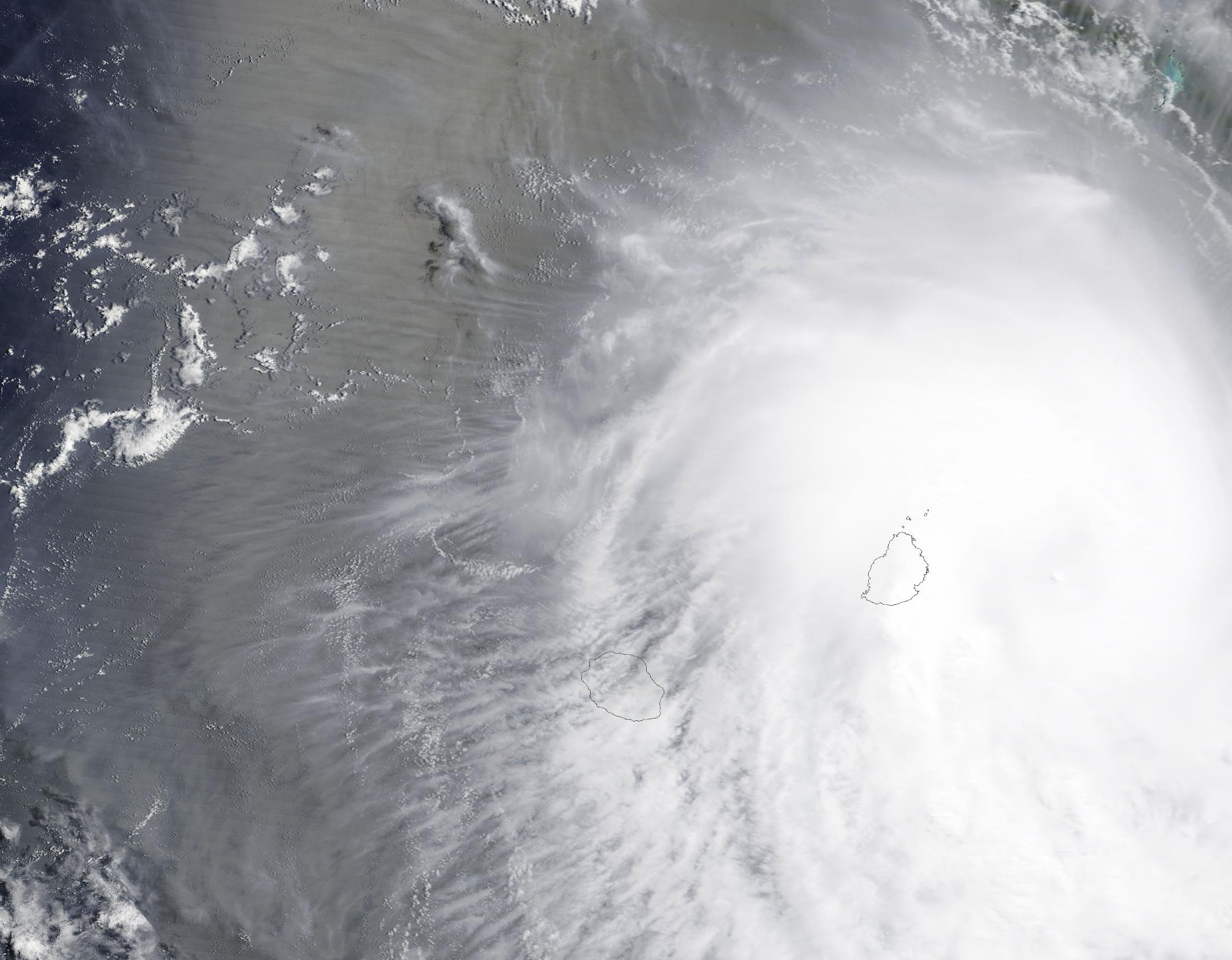
