
Images


February 28, 2024 - Fires in Guatemala
 Tweet
Tweet
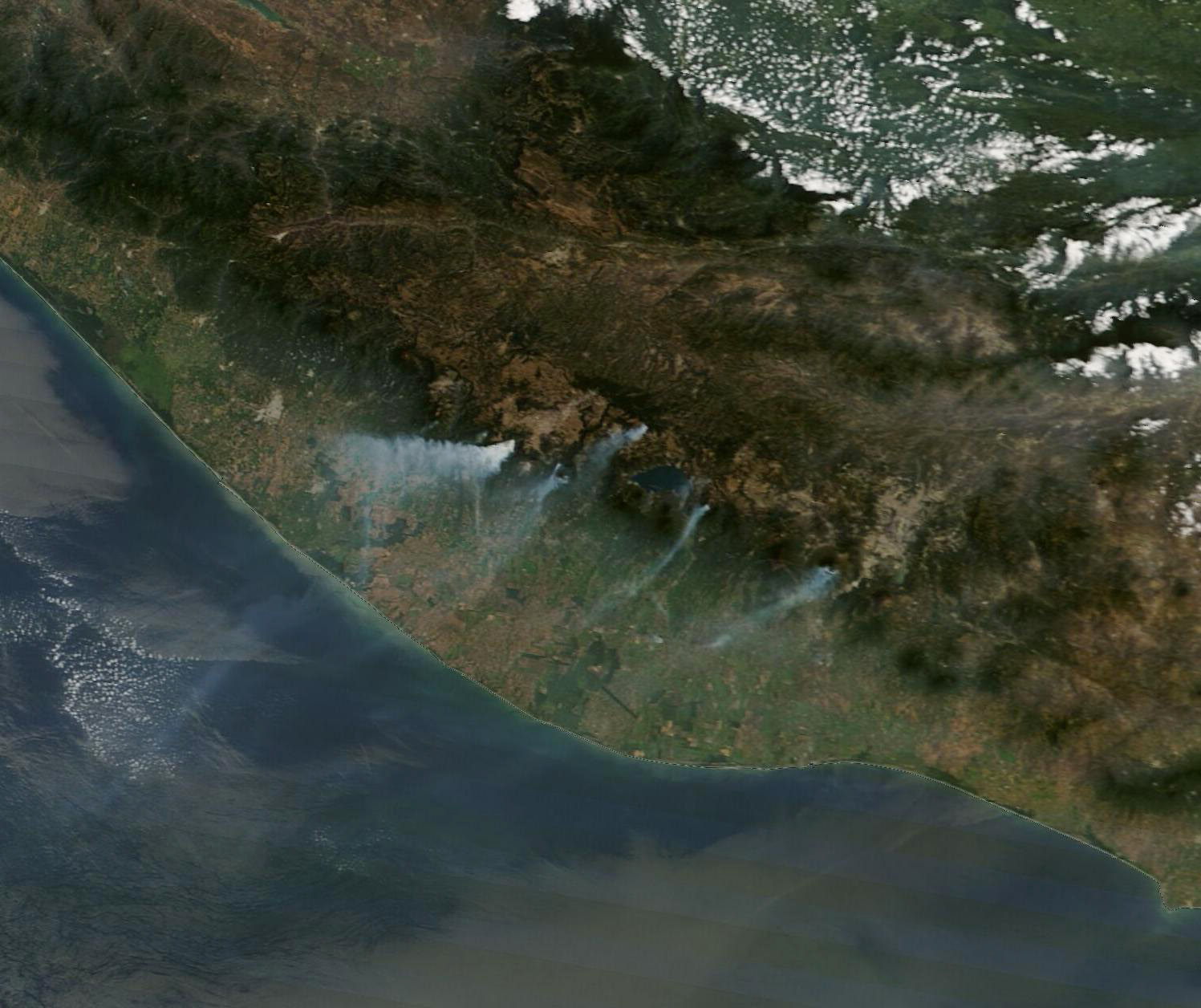
Late in February 2024, hot, dry, and windy weather fueled several large forest fires in the highlands of Guatemala. On February 25, the Moderate Resolution Imaging Spectroradiometer (MODIS) on NASA’s Terra satellite acquired this true-color image of several fires burning in the Sierra Madre Mountains.
Exceptionally heavy smoke billowed from a large fire southwest of Quetzaltenango. That fire burned across the forested slopes of Siete Orejas, an inactive volcano that last erupted between 126,000 and 85,000 years ago. Siete Orejas hosts several endemic species, including the endangered Guatemalan fir or “pinabete.”
In Guatemala, fire season typically begins in February and lasts around three months. It is not possible to know the cause of a given fire based on satellite imagery alone, but many fires are initially lit to clear land for planting crops or to encourage the growth of pasture grasses. As rains taper off during the dry season, these small fires sometimes escape into forests and burn as wildfires.
About 200 kilometers (125 miles) southeast of Siete Orejas, firefighters are battling another large fire on Agua, a dormant volcano near the city of Antigua. Local media reported that the fire had “devastated” the vegetation on the upper part of the volcano, which rises to 3,766 meters (12,300 feet).
On February 27, the Guatemalan Coordinating Agency for Disaster Reduction (CONRED) reported that firefighters were battling 27 fires, including fires in the departments of Alta Verapaz, Baja Verapaz, Chimaltenango, El Progreso, Huehuetenango, Quiché, Sacatepéquez, Sololá, Suchitepéquez, Totonicapán, and Zacapa. They reported that 478 fires have burned 1,377 hectares since the start of the current fire season.
Image Facts
Satellite:
Terra
Date Acquired: 2/25/2024
Resolutions:
1km (73.4 KB), 500m (180.2 KB), 250m (335.6 KB)
Bands Used: 1,4,3
Image Credit:
MODIS Land Rapid Response Team, NASA GSFC
