
Images


February 29, 2024 - Ice Swirls in the Labrador Sea
 Tweet
Tweet
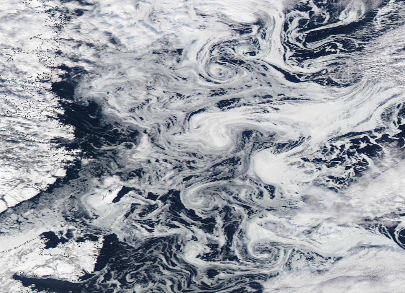
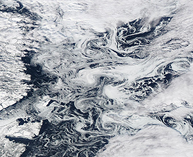
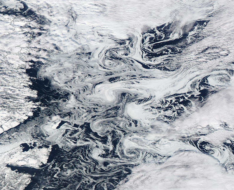
Fanciful filaments of swirling sea ice filled the Labrador Sea off the coast of eastern Canada in February 2024. The Moderate Resolution Imaging Spectroradiometer (MODIS) on NASA’s Aqua satellite captured a true-color image of the stunning winter scene on February 27.
Not only was ice floating freely atop the currents of the Labrador Sea, smaller pieces of sea ice churned along the crumbling edge of the more consolidated ice pack off the coast of Labrador Inuit Lands, in the Newfoundland and Labrador province.
Ocean currents can stir ice chunks into circular vortices, or eddies. Eddies form frequently along boundaries between cold and warm ocean currents in the spring and fall, due to differences in water density. Even then, however, an ice eddy won’t form except under certain conditions: it must be warm enough for the ice to fragment, but cool enough for it to remain frozen.
On February 5, the National Snow and Ice Data Center reported that sea ice growth throughout the Arctic region—including the Labrador Sea—has been slower than usual for the end of January. The Gulf of St. Lawrence, on the eastern coastline of Newfoundland and Labrador, would normally contain more sea ice this time of year. But as of the end of January, the area was mostly open water. Sea ice has continued to expand during February. Arctic sea ice maximum extent is typically reached in early to mid-March.
Image Facts
Satellite:
Aqua
Date Acquired: 2/27/2024
Resolutions:
1km (120.5 KB), 500m (306.1 KB), 250m (370.3 KB)
Bands Used: 1,4,3
Image Credit:
MODIS Land Rapid Response Team, NASA GSFC
