
Images


March 16, 2024 - Gravity Waves off the West Coast of the United States
 Tweet
Tweet
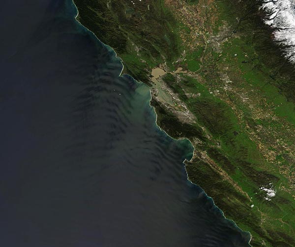
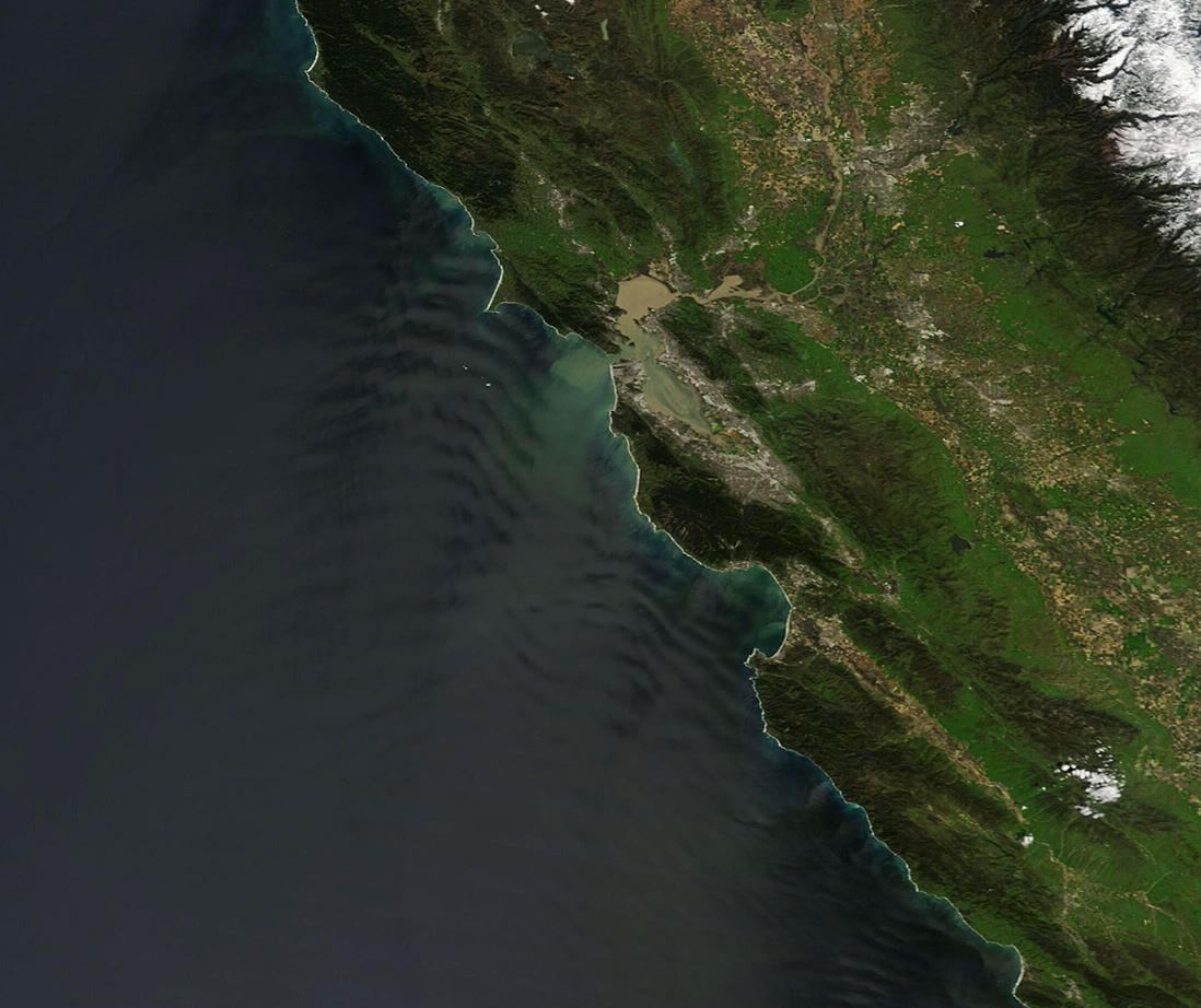
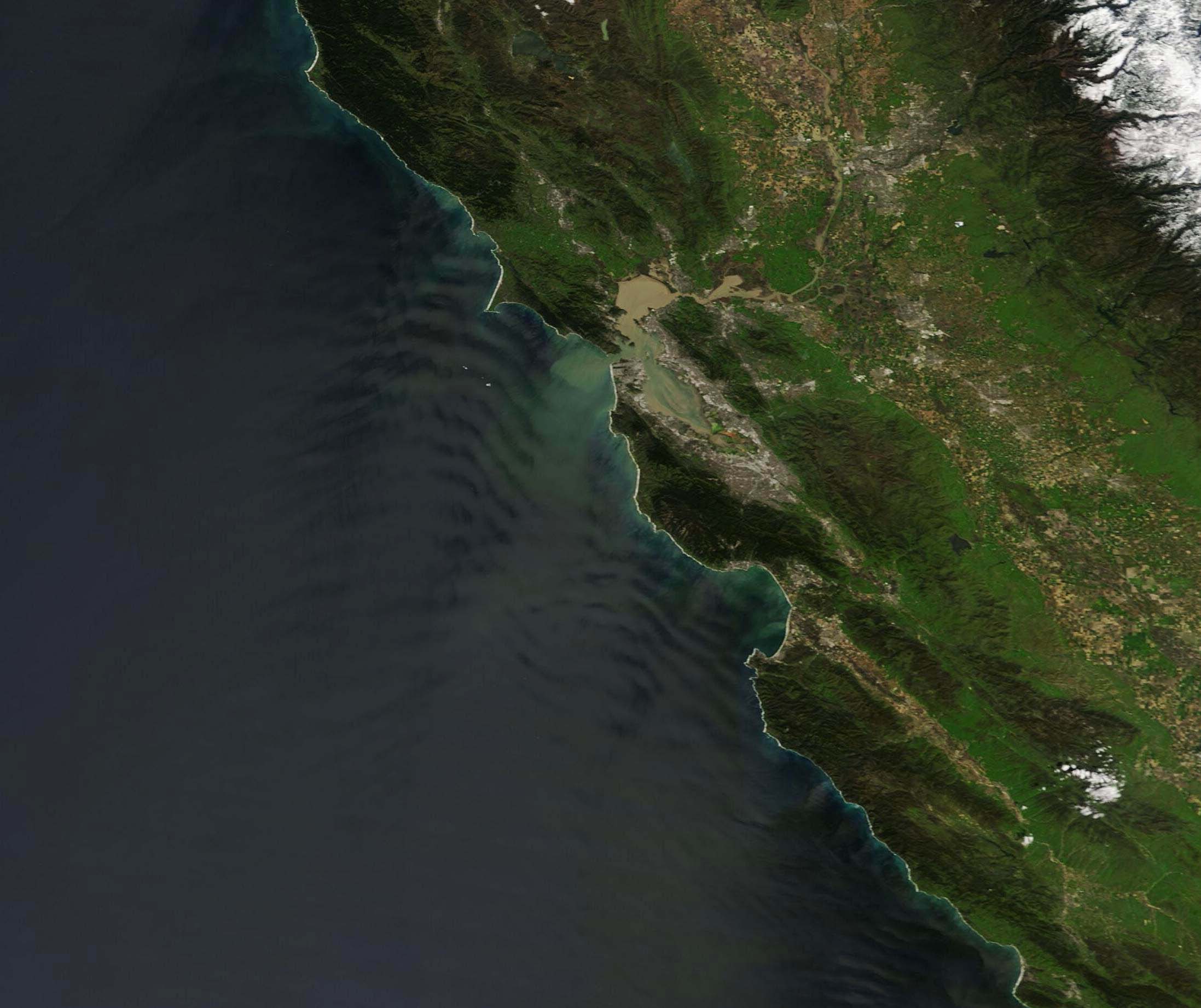
On March 14, 2024, the Moderate Resolution Imaging Spectroradiometer (MODIS) on NASA’s Terra satellite acquired a stunning true-color image showing gravity waves off the California coast. Two sets of waves are visible, one north of the mud-colored San Francisco Bay and another set south of the Bay.
Atmospheric gravity waves are similar to waves that occur when the surface layer of a pond is disturbed, creating rolling waves that can be seen from above. However, gravity waves form when the atmosphere, not water, is disturbed. When air is forced upward by hills or mountains into a layer of stable air, the result in rolling waves of air, creating a ripple effect. This also can occur when different air masses interact, such as when air flows off land surfaces and over the relatively warm, moist air mass formed over bodies of water. Gravity waves typically form perpendicular to the wind as it blows off coastlines.
Atmospheric waves are usually invisible, both to human eyes on Earth and in satellite imagery. An optical phenomenon called sunglint, which is present in this image, often makes such waves visible. Sunglint occurs when light is reflected directly back into the satellite sensor. This creates a silvery-toned patch, such as seen in this image, which can reveal air the motion of air within the sunglint area.
Image Facts
Satellite:
Terra
Date Acquired: 3/14/2024
Resolutions:
1km (199.7 KB), 500m (545.5 KB), 250m (258.4 KB)
Bands Used: 1,4,3
Image Credit:
MODIS Land Rapid Response Team, NASA GSFC
