
Images


March 30, 2024 - Fires in Mexico
 Tweet
Tweet
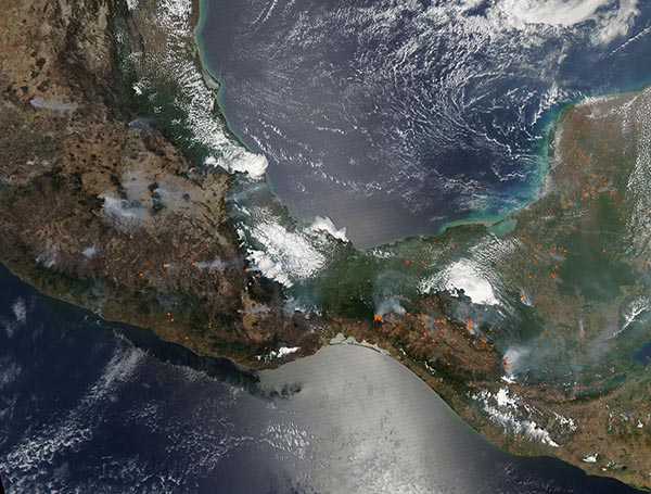
On March 27, 2024, the Moderate Resolution Imaging Spectroradiometer (MODIS) acquired a true-color image of dozens of fires burning across southern Mexico and Guatemala. Each red “hot spot” marks an area where the thermal bands on the MODIS instrument detected high temperatures. When combined with typical smoke, as in this image, such hot spots are diagnostic for actively burning fire.
One of the largest fires seen in this image, sitting just east of center, burns at Mactumatza hill in Tuxtla Guiterrez, Chiapas State, Mexico. Smoke blows northward. To the west, other intensely smoky fires are in mountainous regions south of Mexico City. Another large area of gray smoke is pumping from a fire in Guatemala.
Hot, dry, windy weather has been roasting southern Mexico and parts of South American since February, making conditions ripe for rapid spread from any spark. Some of these fires may have been deliberately set to manage agricultural land, or to open new land for crops and pastures. Such agricultural practices are common in the springtime in the region. Some may have begun through natural causes, such as lightning strikes. However, regardless of the initial cause, many of the fires are destructive wildfires. According to a report by the National Forestry Commission (Conafor), 120 forest fires were burning throughout Mexico on March 27. They had affected about 7.137 hectares across 19 different states.
The silvery sheen in the center of the image is not related to wildfires or smoke. It is an optical phenomenon called “sunglint” that occurs when sunlight reflects off the surface of the water that a satellite sensor views it. This results in a mirror-like reflection that shows up as long, bright areas in MODIS data.
Image Facts
Satellite:
Aqua
Date Acquired: 3/27/2024
Resolutions:
1km (368.5 KB), 500m (1.2 MB), 250m (3.6 MB)
Bands Used: 1,4,3
Image Credit:
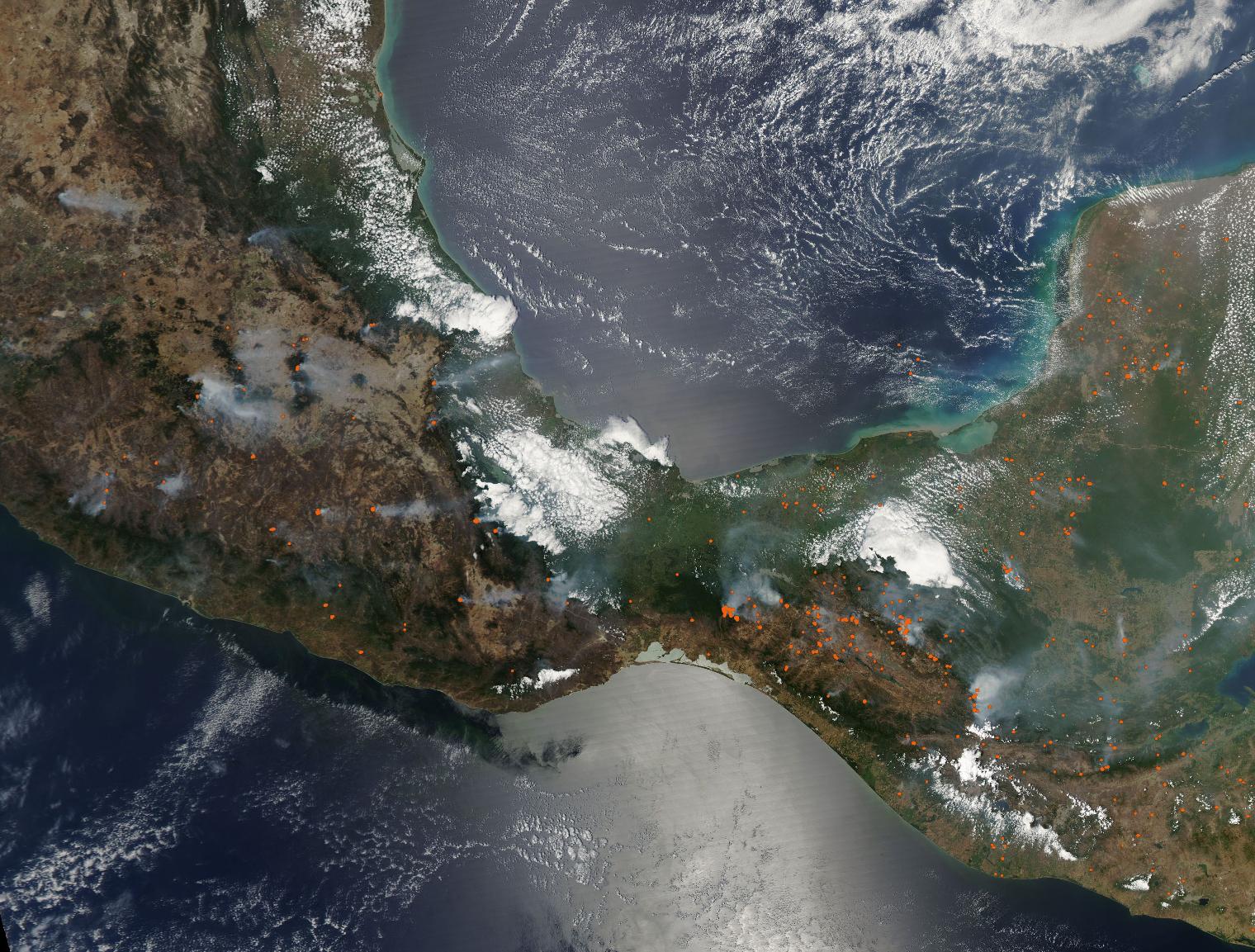
