
Images


April 7, 2024 - Smoke and Haze over Southeast Asia
 Tweet
Tweet
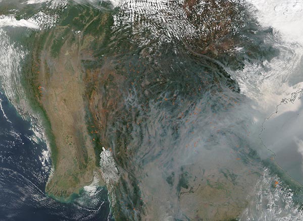
On April 4, 2024, the Moderate Resolution Imaging Spectroradiometer (MODIS) on NASA’s Terra satellite acquired a true-color image of smoke and haze over Southeast Asia.
The smoke rises from dozens of fires scattered across the region. These are most readily seen as red “hot spots” in Myanmar (Burma) where the air is the clearest. The smoke mixes with thick gray haze that obscures most of Laos (northeast) and Thailand (southeast) from view.
Each year in January and February, satellites begin to detect waves of smoke and fire in Southeast Asia, particularly in highland forests in Cambodia, Laos, Myanmar (Burma), and Thailand. Fire activity continues to increase through March and April, reaches a peak during the height of the dry season, and then fades in May with the start of the rainy season.
Individual fires are usually small and short-lived. But they are often so numerous that smoke, along with air pollution from rural and urban areas, mixes to produce thick layers of haze that blanket the landscape. Such hazes contain mixtures of small airborne particles called aerosols and gaseous pollutants such as nitrogen dioxide, sulfur dioxide, carbon monoxide, and ozone that degrade air quality and have harmful health effects.
Image Facts
Satellite:
Terra
Date Acquired: 4/4/2024
Resolutions:
1km (433.7 KB), 500m (1.4 MB), 250m (4.3 MB)
Bands Used: 1,4,3
Image Credit:
MODIS Land Rapid Response Team, NASA GSFC
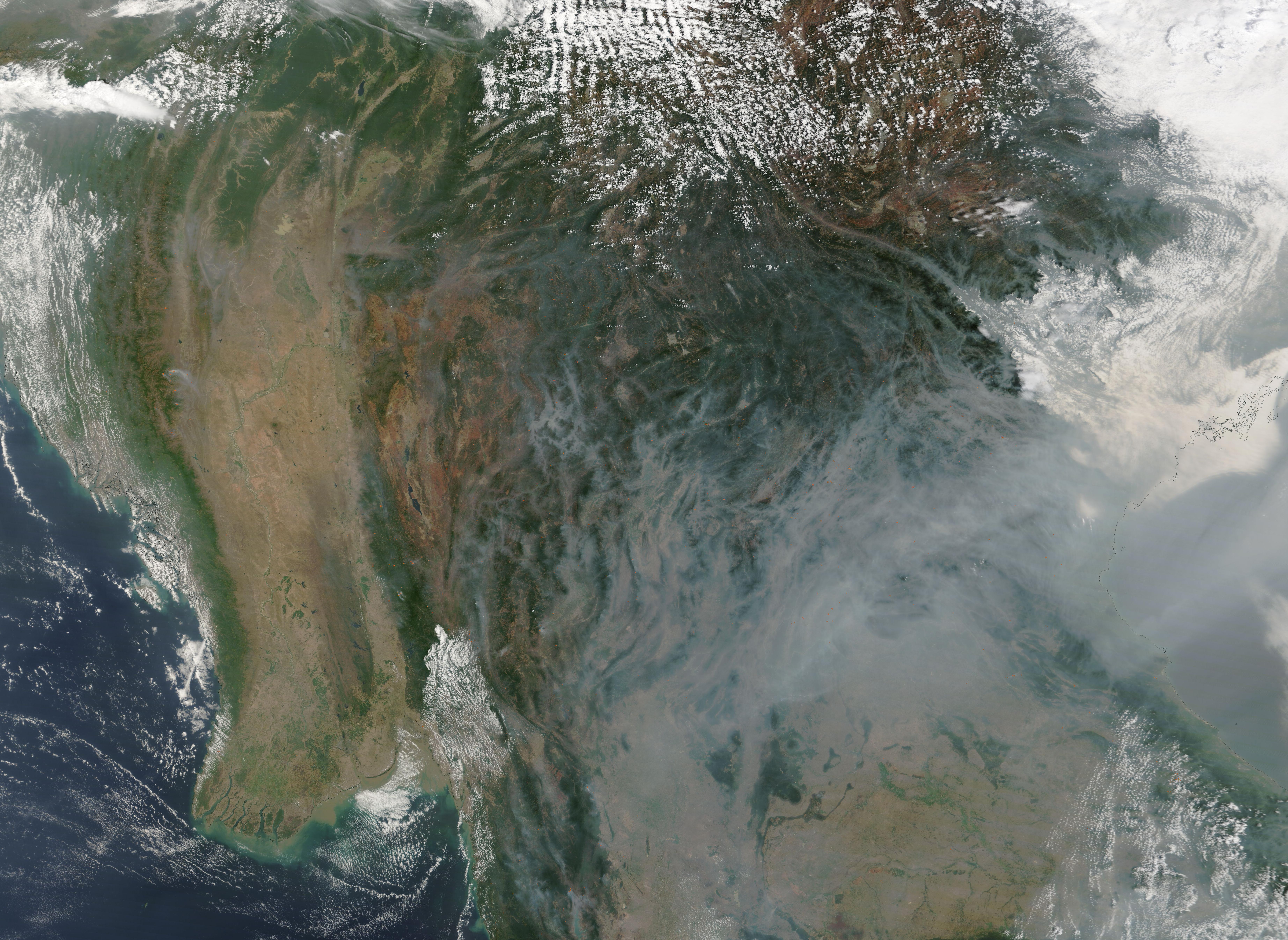
