
Images


July 9, 2024 - Beryl Batters Eastern Texas
 Tweet
Tweet
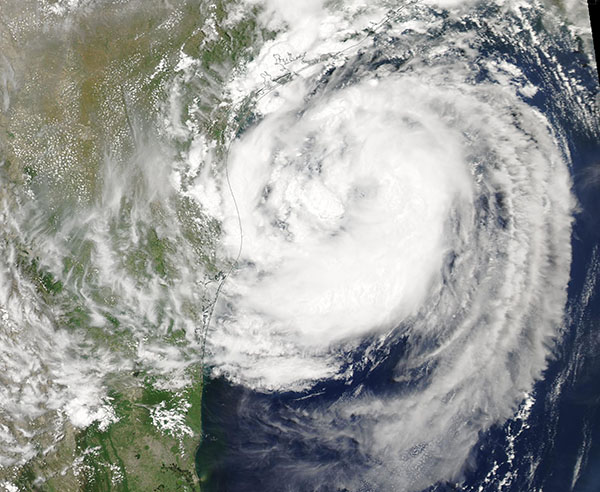
After tearing through the Caribbean and Mexico’s Yucatan Peninsula, Hurricane Beryl swept ashore over the Gulf Coast of Texas near the city of Matagorda at about 5:00 a.m. EDT (0900 UTC) on July 8, 2024. The Category 1 storm had maximum sustained winds of 80 miles per hour (129 km/h) at landfall and brought gusts as high as 92 miles per hour (148 km/h) and heavy rain to the Houston area.
As it moved north toward Houston, Beryl dumped 6 to 8 inches (15 to 20 centimeters) of rain over the metro area. Local authorities reported flooding along roads, downed trees, and power outages. The Weather Channel reported at least 11.5 inches (29.2 cm) of rain fell in Freeport, Texas.
Beryl was downgraded to a tropical storm a few hours after making landfall on July 8, but hazardous winds and flooding rain continued to batter the region throughout the day. Over 2.6 million people were without power in the state, according to PowerOutage.us. As it continued to move inland, the weakening storm still proved dangerous, spawning multiple tornadoes in Arkansas. As of late July 8, Beryl has been blamed for at least eight deaths in the United States.
The Moderate Resolution Imaging Spectroradiometer (MODIS) on NASA’s Aqua satellite acquired this true-color image of Hurricane Beryl ramping up over the Gulf of Mexico on July 7 as it careened toward Texas.
Image Facts
Satellite:
Aqua
Date Acquired: 7/7/2024
Resolutions:
1km (152 KB), 500m (463.4 KB), 250m (1.3 MB)
Bands Used: 1,4,3
Image Credit:
MODIS Land Rapid Response Team, NASA GSFC
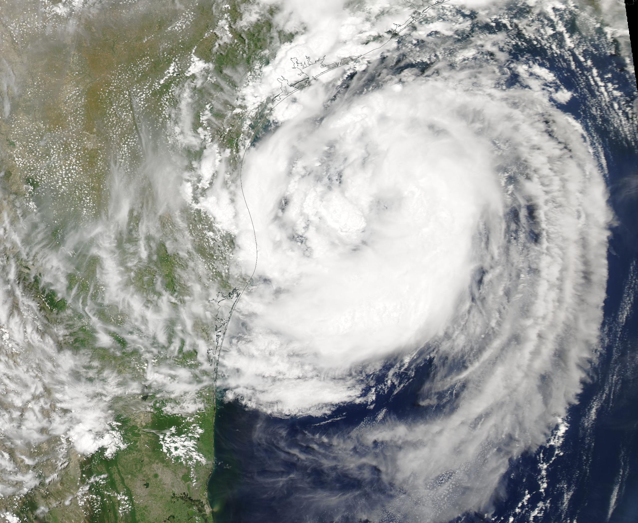
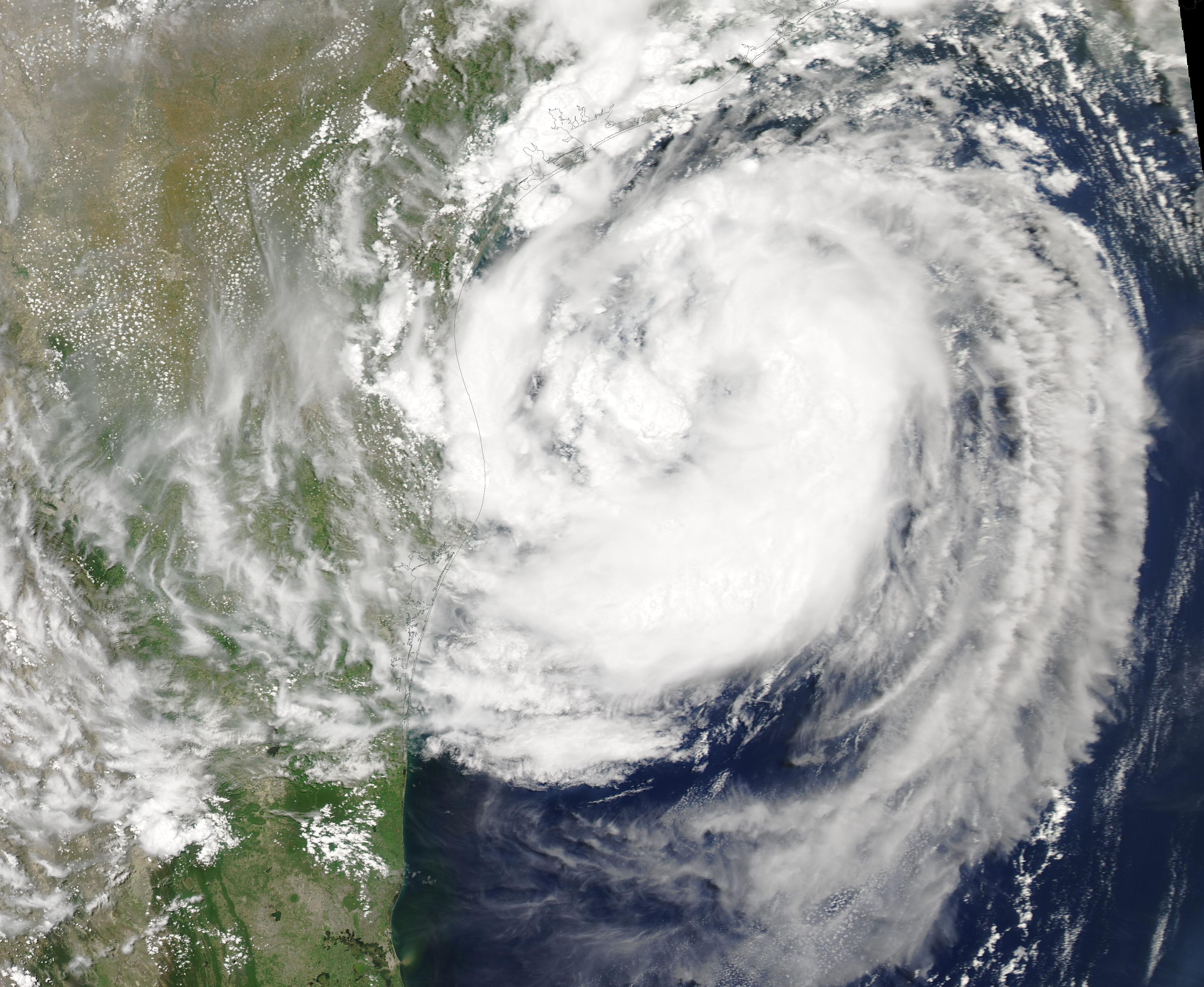
