
Images


July 14, 2024 - Clouds over the Galapagos
 Tweet
Tweet
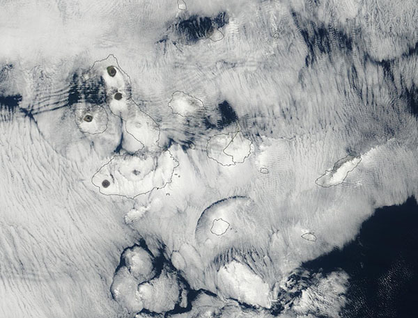
On July 11, 2024, the Moderate Resolution Imaging Spectroradiometer (MODIS) on NASA’s Terra satellite acquired a true-color image of clouds covering the Galapagos Islands. Black lines indicating the boundaries of each island have been overlain on the image.
Complicated patterns in the atmosphere, such as downslope wind flow off the island peaks and atmospheric turbulence, are made visible by the cloud layer. In addition, the tall summits of several volcanoes poke through the low clouds over the large Isabella Island and the smaller Fernandina Island. The large peak at the northern tip of Isabella Island is the Wolf Volcano, an active volcano that last erupted in 2020. It is located on the equator. The sole peak visible on Fernandina Island is La Cumbre Volcano. The most recent eruption here began in March 2024 and appeared to end in early May 2024.
The Galapagos Islands lie in the Pacific Ocean roughly 1,000 kilometers (700 miles) off the west coast of Ecuador. The extremely biologically diverse island group, filled with niche habitats, consists of 13 major islands and a handful of smaller islands and islets.
The bent shape of the largest island of the archipelago, Isabela Island, was created by the merging of several large volcanoes to create a single landmass. Five of the largest create a disturbance in the clouds in this image, either poking through the cloud completely or by forcing winds to become turbulent as they flow over and around the peaks. From north to south, these volcanoes are the Wolf Volcano, Darwin Volcano, Alcedo Volcano, Sierra Negra Volcano, and Cerro Azul Volcano.
Image Facts
Satellite:
Terra
Date Acquired: 7/11/2024
Resolutions:
1km (78.6 KB), 500m (216.3 KB), 250m (398.1 KB)
Bands Used: 1,4,3
Image Credit:
MODIS Land Rapid Response Team, NASA GSFC
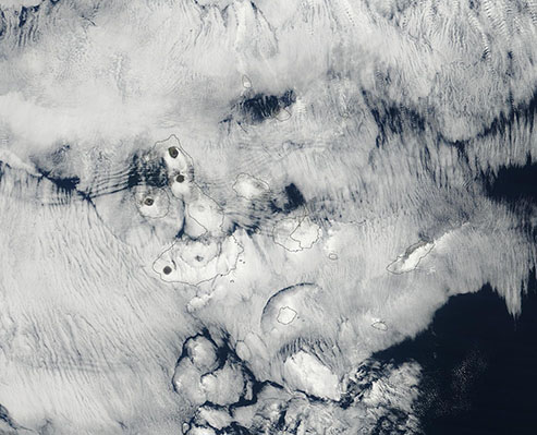
