
Images


July 10, 2024 - Wildfires Scorch Central Utah
 Tweet
Tweet
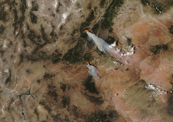
Dry, windy, and hot weather spurred Red Flag Warnings across Central Utah in early July 2024—and sparked several rapidly-growing wildfires. The Moderate Resolution Imaging Spectroradiometer (MODIS) on NASA’s Aqua satellite captured a true-color image of three wildfires burning in the region on July 8.
A Red Flag Warning means critical fire weather, in which fires can start easily and spread rapidly. Each red “hot spot” is an area where the thermal bands on the MODIS instrument detected high temperatures. When combined with typical smoke, as in this image, such hot spots mark actively burning fire. Heavy smoke rises from each fire and stretches to the southeast, indicating very strong wind.
The largest and most northern fire is the Silver King Fire, which was first reported on the afternoon of July 5 about 8 miles west of Marysvale, Utah. It was caused by a lightning strike and has expanded explosively to cover 11,290 acres and is zero percent contained, according to a July 9 update by Central Utah Fire Interagency. Fishlake National Forest has issued closure orders as firefighters work to protect historic mining structures and interpretive sites in and around the National Forest area. Marysvale itself was founded in 1880 as a mining town. Currently, the town does not appear to be in imminent danger.
The second largest fire visible in the image is the Deer Springs Fire. It ignited on July 7 and has grown rapidly to cover 11,800 acres with ten percent containment. It is located in rural Kane County south of Bryce County National Park. The cause is under investigation. The Deer Springs Fire became the largest fire in Utah on July 9 as it surpassed the Silver King Fire in area.
A third and much smaller fire can be seen tucked between the two large fires. This is the Little Twist Fire, which was discovered on June 13. As of July 9, the fire has scorched 5,096 acres and has reached 45 percent containment. It is burning four miles southeast of Beaver, Utah in steep, rugged terrain. Little Twist began as a controlled burn but escaped the boundaries to become a wildfire. Despite extreme fire conditions, this fire has not shown significant growth in recent days.
Image Facts
Satellite:
Aqua
Date Acquired: 7/8/2024
Resolutions:
1km (72.3 KB), 500m (239.2 KB), 250m (691.6 KB)
Bands Used: 1,4,3
Image Credit:
MODIS Land Rapid Response Team, NASA GSFC
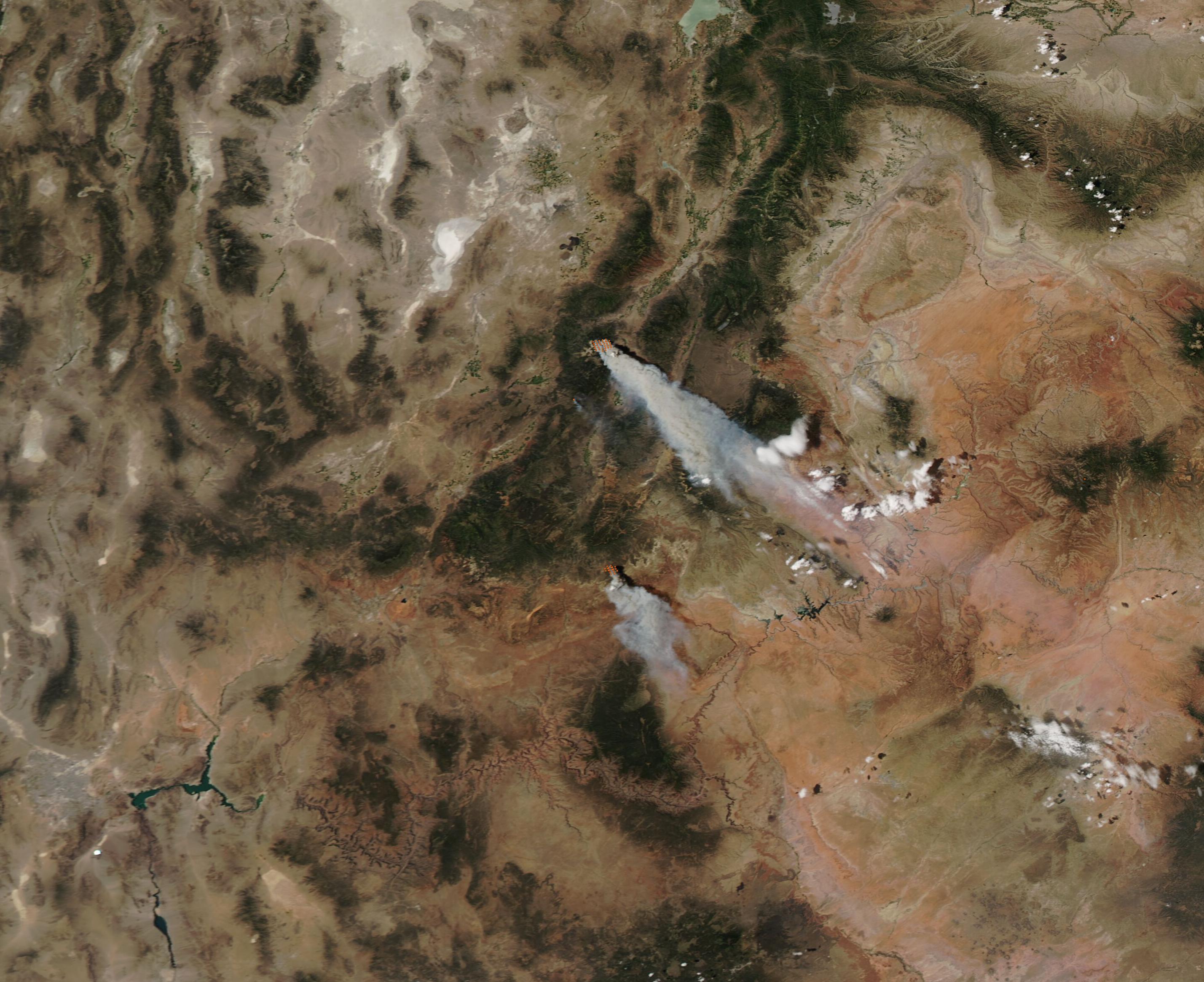
