
Images


August 3, 2024 - Birth of Tropical Storm Debby
 Tweet
Tweet
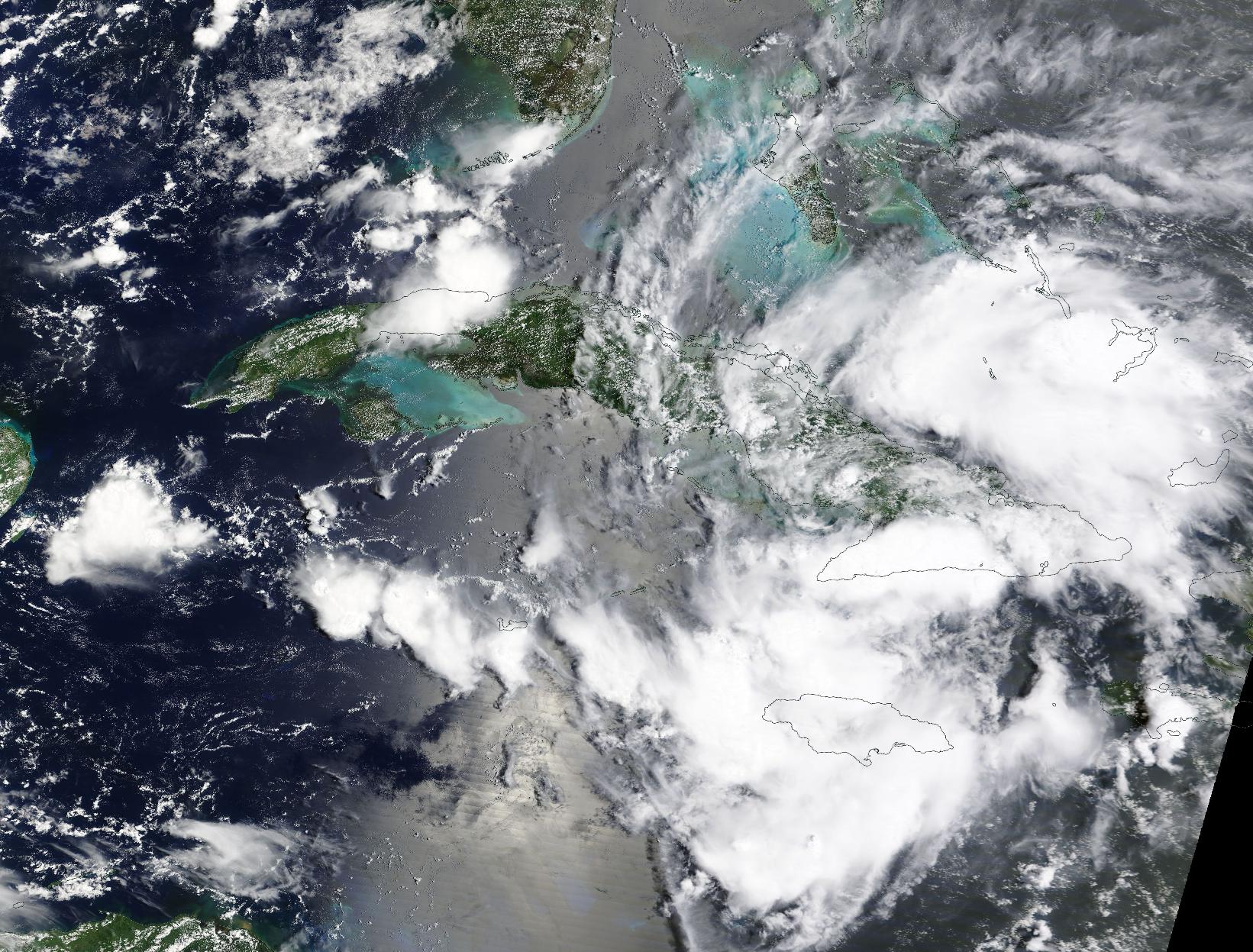
On August 2, 2024, the Moderate Resolution Imaging Spectroradiometer (MODIS) on NASA’s Terra satellite acquired a true-color image of a disturbance over eastern Cuba. The National Hurricane Center (NHC) named the disturbance Potential Tropical Cyclone Four and began issuing advisories early that same morning. It is expected to become a tropical storm by late on August 3 and possibly a hurricane before making landfall in the Big Bend region of Florida.
After kicking up surf and dumping rain on eastern Cuba, the system had strengthened to a tropical depression by 11:00 p.m. EDT August 2 (0300 UTC August 3). According to the NHC, Tropical Depression Four was located about 75 miles (125 km) south of Caibarien, Cuba and about 260 miles (415 km) south-southeast of Key West, Florida. Maximum sustained winds were 30 miles per hour (45 km/h) and Four was moving west-northwest at 17 miles per hour (28 km/h).
The NHC advised that the current track shows a westward shift, which will keep the system over the warm waters of the Gulf of Mexico, where favorable conditions will encourage the intensification into tropical storm strength. Models are now suggesting that it may even become a hurricane near the time it makes landfall.
Whether it is a strong tropical storm or a Category 1 hurricane, the storm, which will be named Debby, will bring heavy rainfall that may result in flash and urban flooding across parts of Florida and the coastal areas of the Southeast United States through August 7. Severe storm surge may inundate portions of the west coast of Florida from Bonita Beach to Suwannee River.
Image Facts
Satellite:
Terra
Date Acquired: 8/2/2024
Resolutions:
1km (414.5 KB), 500m (1.3 MB), 250m (3.7 MB)
Bands Used: 1,4,3
Image Credit:
MODIS Land Rapid Response Team, NASA GSFC
