
Images


August 22, 2024 - Burn Scars in the Western United States
 Tweet
Tweet
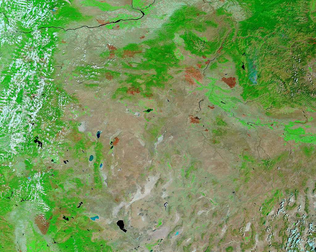
Hundreds of wildfires burst to life across the Western United States in spring and summer 2024. Spurred by a combination of high temperatures, low humidity, gusting winds, tinder-dry vegetation, and widespread dry lightning strikes, the Western wildfire season has already set records. For example, wildfires in Oregon have burned more acres of land already this year than any year since reliable records began, according to data from the Northwest Interagency Center. Quoting that data, local media reported that, as of August 13, a total of 1,399 fires had burned 1.49 million acres or 2,200 square miles, surpassing the 2012 total of 1.2 million acres and the 2020 total of 1.14 million acres. The largest fires were grass fires located on the eastern side of the state.
On August 18, 2024, the Moderate Resolution Imaging Spectroradiometer (MODIS) on NASA’s Terra satellite acquired a false-color image that highlights burn scars across Oregon and surrounding states. In this type of image, vegetation appears bright green, water is blue, clouds are white or tinted with light blue, and dry salt flats look white. Burn scars may range in color from brick red to brown or even black, depending on how long ago the fire burned, type of soil, completeness of the burn, and other factors.
Most of the burn scars in this image are located in eastern Oregon, roughly encircling the Malheur National Forest region. The largest scar in the east is located in western Idaho and some orange “hot spots” mark active fire activity to the east of that burn scar. Pyramid Lake, the deep blue lake near the bottom of the image, and the nearby white salt flats sit in Nevada.
The large area of brown in the lower left (southwest) corner of this image is the scar from the Park Fire, which is ranked as the fourth-largest fire in California’s history. According to CAL FIRE, as of August 20, that fire has scorched 429,460 acres north of Chico since it was first detected on July 24. The fire is estimated to be 59 percent contained.
Image Facts
Satellite:
Terra
Date Acquired: 8/18/2024
Resolutions:
1km (416.6 KB), 500m (1 MB), 250m (2.1 MB)
Bands Used: 7,2,1
Image Credit:
MODIS Land Rapid Response Team, NASA GSFC
