
Images


September 10, 2024 - Open- and Closed-Cell Clouds over the Southern Atlantic Ocean
 Tweet
Tweet
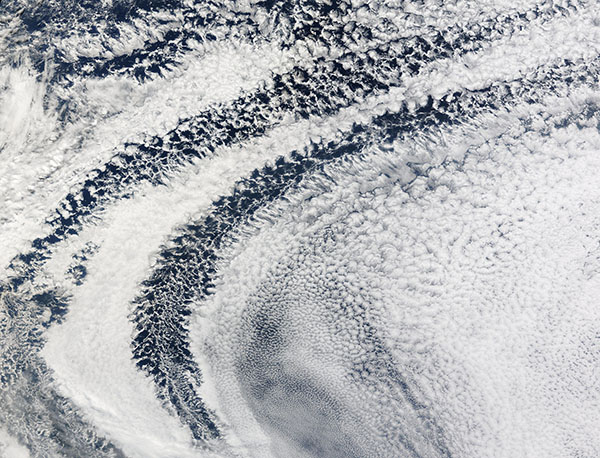
On September 8, 2024, the Moderate Resolution Imaging Spectroradiometer (MODIS) captured a stunning pattern of clouds over the Southern Pacific Ocean west of the tip of Africa.
The large bank of cloud is made up of marine stratocumulus clouds, a common type of cloud that span wide swaths of the global oceans on any given day. They lie at relatively low altitudes (below about 1 miles) and are so vast that it is hard to see patterns contained within the clouds from below. When viewed by satellites from high above, the patterns become visible.
Organized marine stratocumulus clouds, a subcategory of marine stratocumulus clouds found in the subtropics and midlatitudes, take two forms: open-celled and closed-cell. Open-celled clouds appear as thin wisps surrounding empty pockets (the “cells”) and do not block much of the Sun’s radiation. Closed-cell clouds appear denser, fluffier, and without open centers, which allows them to reflect more of the Sun’s radiation back to space. Both types result from parcels of warm air rising, expanding, cooling, and condensing into visible liquid droplets. In open-celled clouds, cool air sinks in the vacant center while warm air rises along the edges; in closed-cell clouds, warm air rises in the center and cool air sinks along the edges.
It might seem counterintuitive, but it is the open-celled clouds that generate rainfall, while closed-cell clouds produce little to no rain. This contributes to open-celled clouds’ tendency to break up in shape over just a few hours, while closed-cell clouds can retain their form for up to half a day.
Image Facts
Satellite:
Terra
Date Acquired: 9/8/2024
Resolutions:
1km (1 MB), 500m (2.5 MB), 250m ( B)
Bands Used: 1,4,3
Image Credit:
MODIS Land Rapid Response Team, NASA GSFC
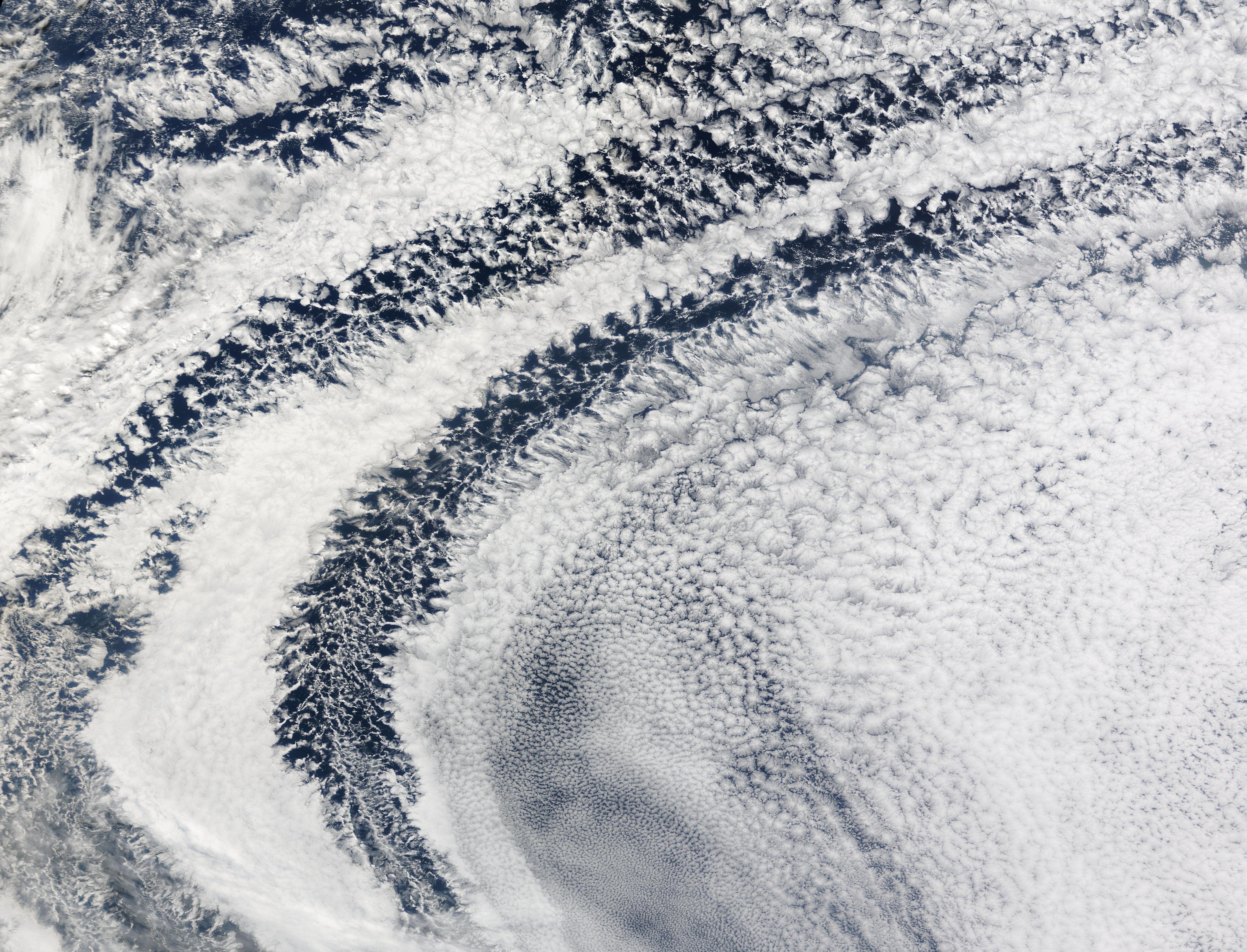
