Images
December 15, 2024 - Cloud Streets over Lake Superior
Tweet
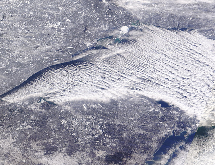
The blue waters of Lake Superior were completely hidden under a large bank of cloud streets in mid-December 2024. The Moderate Resolution Imaging Spectroradiometer (MODIS) on NASA’s Terra satellite acquired this true-color image of the wintery scene on December 12.
For orientation, the frosty land to the north of Lake Superior belongs to the province of Ontario, Canada. The land south of the lake is occupied by three U.S. states. From west to east, they are Minnesota, Wisconsin, and Michigan. Slightly less than one-third of the area of Lake Superior belongs to Canada, with the United States claiming the remainder.
Cloud streets are parallel bands of cumulus clouds that form when frigid air near the surface blows over warmer waters, while a warmer air layer (a temperature inversion) rests over the top of both. The comparatively warm water gives up heat and moisture to the cold air, leading columns of heated air (thermals) to rise through the atmosphere. The cloud streets line up parallel to the direction of the wind, so, in this case, an icy blast of wind from the Canadian northwest drives the formation of these dramatic clouds.
Image Facts
Satellite:
Terra
Date Acquired: 12/12/2024
Resolutions:
1km (275 KB), 500m (652.6 KB), 250m (986 KB)
Bands Used: 1,4,3
Image Credit:
MODIS Land Rapid Response Team, NASA GSFC


