
Images


February 10, 2025 - Bay of Fundy
 Tweet
Tweet
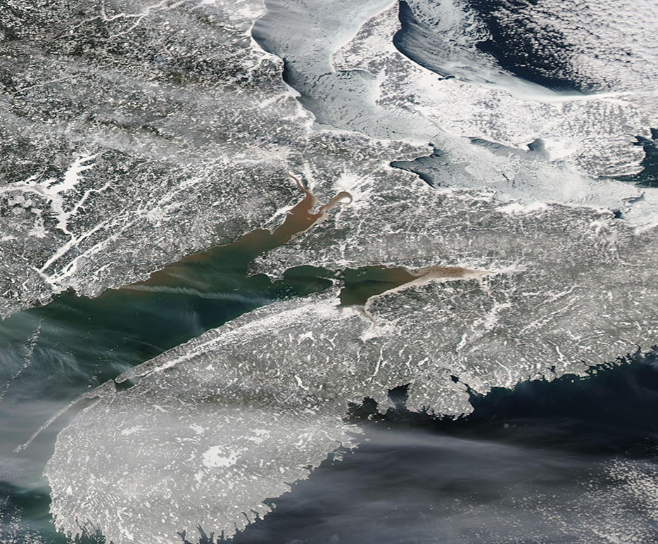
The Bay of Fundy is a 94-mile- (151-kilometer-) long inlet of the Atlantic Ocean which separates the Canadian provinces of Nova Scotia and New Brunswick. Only 32 miles (52 kilometers) wide at its opening, it is famous for extreme tidal action. The tides, which are said to be the highest on Earth, may rise as much as 70 feet (21 meters). The extreme wave action stirs up sediment, especially at the northern end, giving Bay of Fundy its famously mud-toned coloration when seen from space.
The Moderate Resolution Imaging Spectroradiometer (MODIS) on NASA’s Aqua satellite acquired this true-color image of the Bay of Fundy on February 2, 2025. The winter-time image contrasts the snow-laden landscape with the muddy northern waters of the Bay.
Image Facts
Satellite:
Aqua
Date Acquired: 2/2/2025
Resolutions:
1km (138.4 KB), 500m (377.3 KB), 250m (493.7 KB)
Bands Used: 1,4,3
Image Credit:
MODIS Land Rapid Response Team, NASA GSFC
