
Images


February 11, 2025 - Bushfires Blast Western Tasmania
 Tweet
Tweet
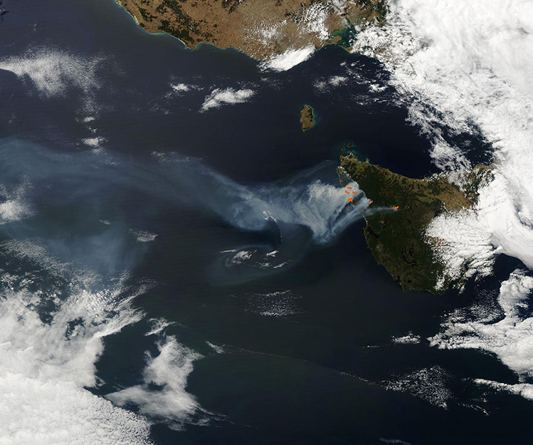
On February 1, 2025, the Tasmanian Fire Service suspended all fire permits statewide as High Fire Danger gripped the region. The warnings were unfortunately prescient, as more than a dozen fires broke out within the next several days, primarily due to lightning strikes, according to media reports.
On February 10, when the Moderate Resolution Imaging Spectroradiometer (MODIS) on NASA’s Aqua satellite acquired this true-color image, sixteen blazes continued to rage across the West Coast of Tasmania. Each red “hot spot” marks an area where the thermal bands on the MODIS instrument detected high temperatures. When combined with typical smoke, as in this image, such hot spots are diagnostic for actively burning fire.
By late that same day, an estimated 45,000 hectares had been scorched and, despite intense firefighting efforts, the fires are generally expanding. According to the Tasmania Times, the State Fire Commander expects high fire conditions to continue for the next three days.
Image Facts
Satellite:
Aqua
Date Acquired: 2/10/2025
Resolutions:
1km (185.3 KB), 500m (613.3 KB), 250m (1.8 MB)
Bands Used: 1,4,3
Image Credit:
MODIS Land Rapid Response Team, NASA GSFC
