
Images


March 21, 2025 - Another Storm System Batters the United States
 Tweet
Tweet
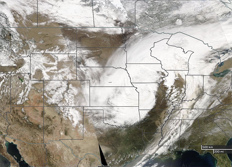
A sprawling low pressure system brought severe weather to a wide swath of the United States from March 18-20, 2025. The Moderate Resolution Imaging Spectroradiometer (MODIS) on NASA’s Aqua satellite acquired this true-color image of the dangerous system on March 19.
At the time the image was acquired, the main storm stretched from northern Texas in the southwest to the province of Ontario, Canada in the northeast. To the east, an associated frontal system covered parts of Louisiana, Mississippi, Alabama, Tennessee, Kentucky, Indiana, and Ohio before merging with the storm in the north.
This storm, the third major and devastating system to strike the Central U.S. since March 1, brought another round of dust, extreme wind, red-flag fire warnings, blizzards, hail, rain, and tornados to areas already reeling from a deadly “mega storm” that followed a similar path from March 13-17. That earlier storm left at least 42 people dead, according to news reports. Most fatalities were from a large tornado outbreak that battered Alabama, Missouri, Arkansas, Mississippi, and North Carolina, but extreme dust storms caused traffic accident fatalities in Texas and Kansas, and wildfires killed at least one person in Oklahoma.
The latest storm began on March 18, kicking up plumes of dust in part of New Mexico, Texas, Oklahoma, and Kansas. On March 19, Bryan Jackson, a National Weather Service meteorologist, was quoted by U.S.News & World Report as estimating that 72 million people were under a wind advisory or warning. At the same time, the system was cranking out substantial snow and hail and spinning up tornadoes. According to the National Weather Service (NWS), on March 19, central Iowa and south-central Minnesota were struck by a narrow band of heavy, wet snow accompanied by winds as high as 50 miles per hour (95 km/h). This band caused whiteout conditions with snowfall generally ranging from 2-10 inches, but the highest snow total was in Lakota, Iowa where 14.5 inches (36.8 cm). Tornadoes were centered in Indiana and Illinois, with 12 reported by the National Weather Service on March 19.
The storm continued to take a toll on the first day of spring, with tens of millions of people remaining under severe weather watches or warnings on March 20. High winds were responsible for power outages across several states. The winds fanned flames in Arkansas, where 38 wildfires were reported, and southern Florida was under a red-flag warning as a wildfire in Miami-Dade County had grown to cover 22,000 acres.
Weather forecasters expect the Great Lakes region to be hit with rain and snow by March 21. As the storm continues its northeast track, high wind is also expected to cause delays at airports from Chicago through the Mid-Atlantic. By late on the 21st, New England and the Northeast will feel the impact before the storm sweeps out to the Atlantic.
Image Facts
Satellite:
Aqua
Date Acquired: 3/19/2024
Resolutions:
1km (2.4 MB), 500m (6.2 MB),
Bands Used: 1,4,3
Image Credit:
MODIS Land Rapid Response Team, NASA GSFC
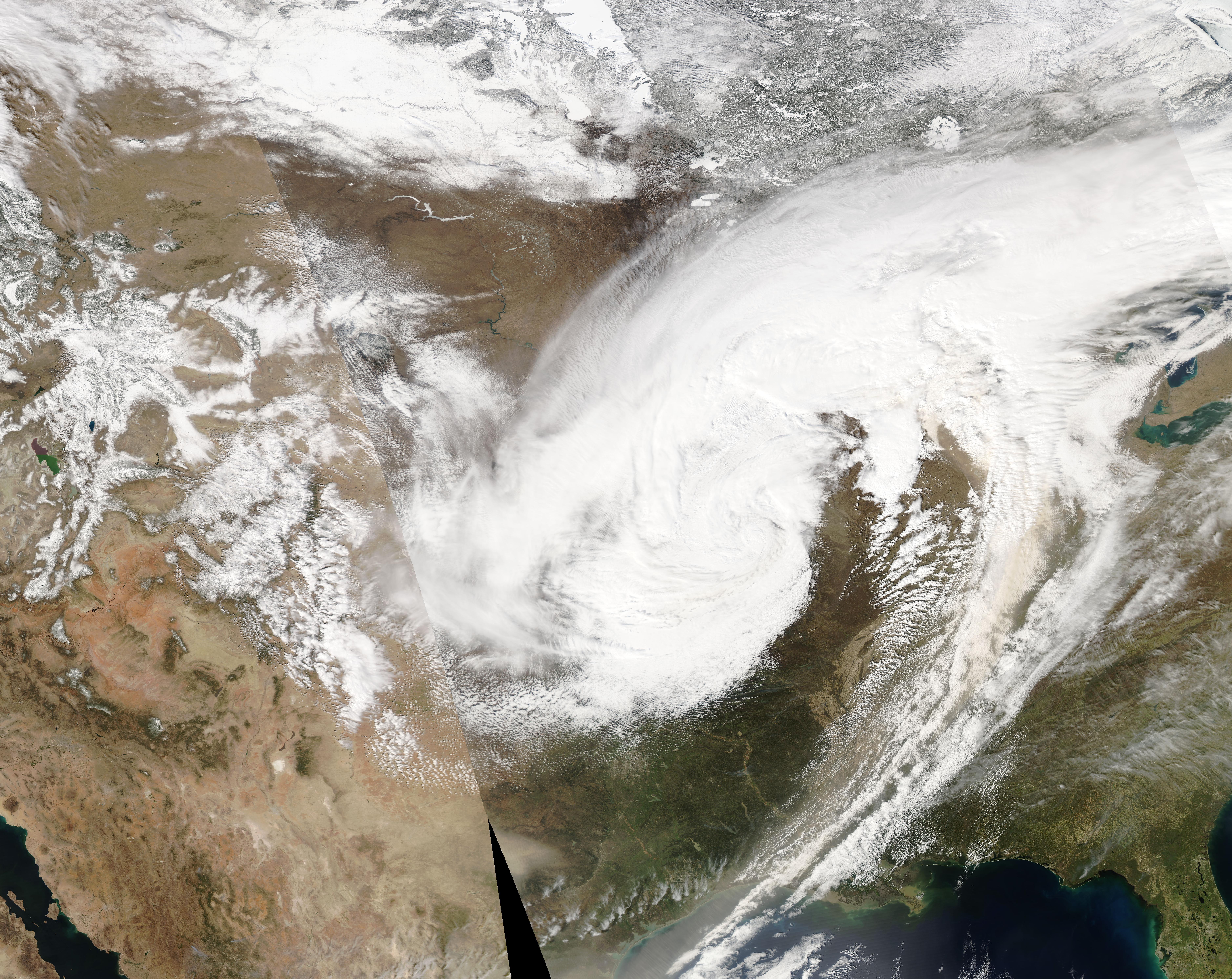
