
Images


November 9, 2017 - Fires and smoke in Pakistan and India
 Tweet
Tweet
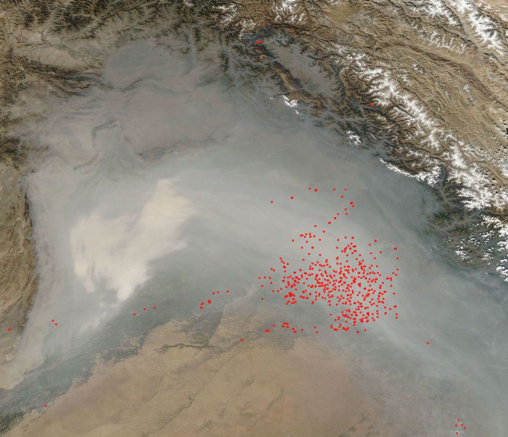
Since mid-October 2017, smoke from crop fires in Punjab and Haryana, India, has blown across northern India and Pakistan. With the arrival of cooler weather in November, the smoke mixed with fog, dust, and industrial pollution to form a particularly thick haze. A lack of wind, which usually helps disperse air pollution, worsened the problem for several days in November.
On November 3, 2017, the Moderate Resolution Imaging Spectroradiometer (MODIS) on NASA’s Aqua satellite captured this true-color image of haze and fog blanketing the region. Red hot spots mark areas where the thermal bands on the sensor detected areas where temperatures were higher than background. When combined with typical smoke, as in this image, such hot spots mark actively burning fires.
Several major cities—including Lahore, New Delhi, Lucknow, and Kanpur—faced elevated levels of pollution. In New Delhi, particulate pollution rose several times above the limit considered safe. On November 8, 2017, an air quality sensor at the U.S. embassy recorded a peak air quality index of 1,010—an extremely hazardous level. Values of 0 to 100 are considered acceptable.
In response, authorities in Delhi have closed schools, banned trucks from entering the city, halted construction projects, and increased parking fees to discourage driving. With hospitals recording a surge of people complaining of respiratory problems, the Indian Medical Association has declared the situation a public health emergency.
Image Facts
Satellite:
Aqua
Date Acquired: 11/3/2017
Resolutions:
1km (134.6 KB), 500m (448.9 KB), 250m (1.4 MB)
Bands Used: 1,4,3
Image Credit:
Jeff Schmaltz, MODIS Land Rapid Response Team, NASA GSFC
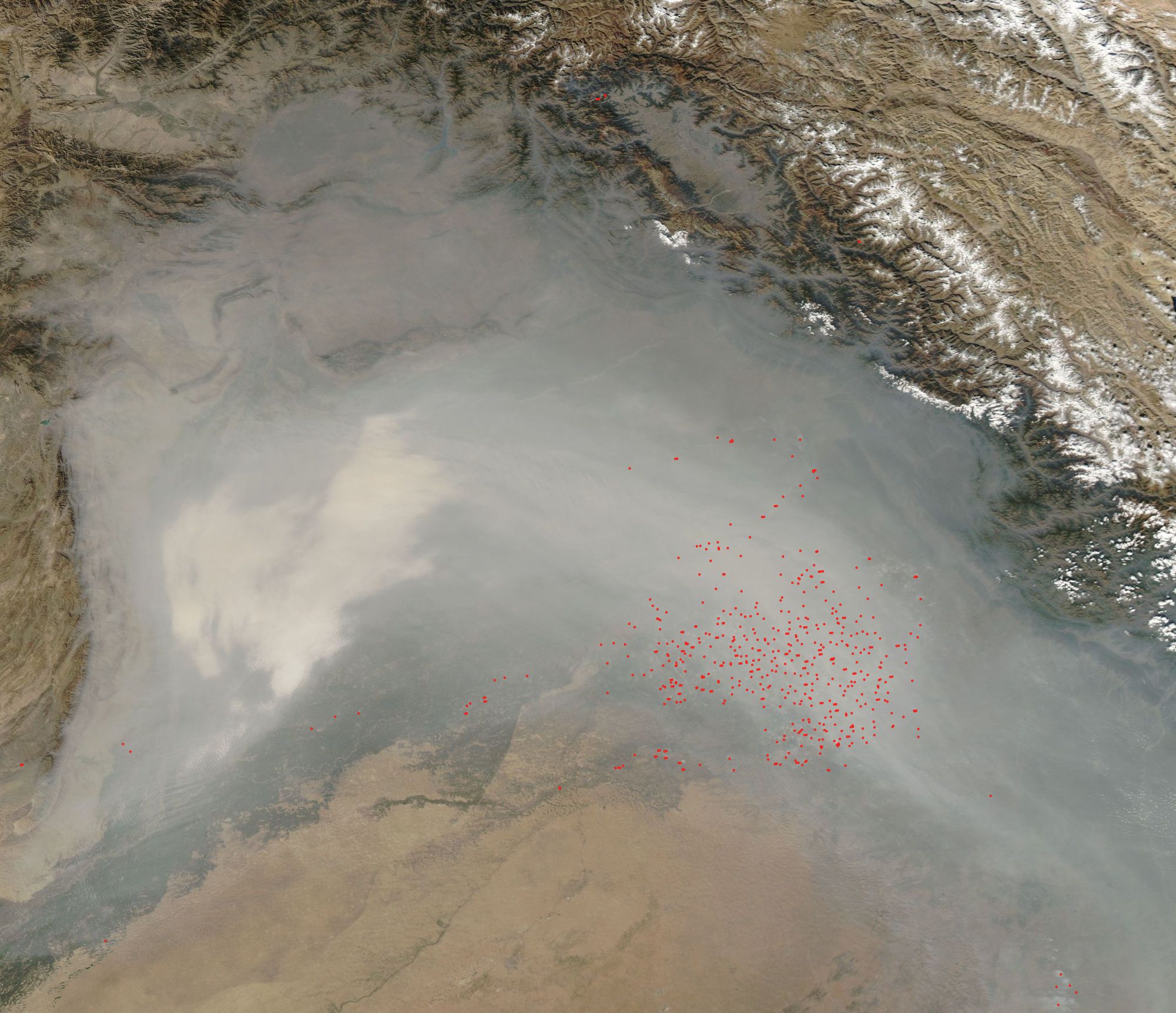
