
Images


January 5, 2016 - Pyrenees Mountains
 Tweet
Tweet
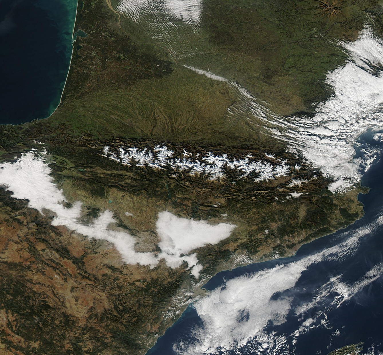
The snow-capped peaks of the Pyrenees Mountains ride ridge-tops which mark the border between France (north) and Spain (south), and also form a bridge between Central and Mediterranean Europe. The tiny country of Andorra sits between France and Spain in the high peaks of the Pyrenees.
Stretching between the warm Mediterranean Sea in the east and the Atlantic Ocean in the west, the rugged range covers about 500 square kilometers (193 square miles). The landscape is dramatic, with high summits rising over 3,000 meters (1,640 feet), rocky slopes, high plains and breathtaking canyons. The climate varies from west to east. The Atlantic Ocean's mild, humid air influences the western Pyrenees and the warmer Mediterranean bring heat and summer drought to the east. In between, the central section tends to be both cooler and drier.
Although the region faces substantial pressure from human use, including grazing, farming, logging tourist and ski area development, substantial pockets of the area remain in a natural state and several parks have been created to protect at least portions of this biologically rich region. About 3,500 species of vascular plant species are found in the mountains, with 200 estimated to be endemic. Sixty-four species of mammal live here, along with about 120 breeding bird species as well as roughly the same number of migrant bird species. Several of the mammals and birds are endangered and habitat fragmentation is a significant concern for their survival.
The Moderate Resolution Imaging Spectroradiometer (MODIS) aboard the Aqua satellite captured this true-color image of the Pyrenees Mountains on December 21, 2015.
Image Facts
Satellite:
Aqua
Date Acquired: 12/21/2015
Resolutions:
1km (433.9 KB), 500m (1.2 MB), 250m (1.1 MB)
Bands Used: 1,4,3
Image Credit:
Jeff Schmaltz, MODIS Land Rapid Response Team, NASA GSFC
