
Images


April 26, 2017 - Turkey and the Black Sea
 Tweet
Tweet
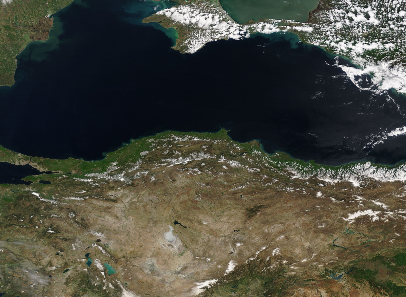
On April 25, 2017, the Moderate Resolution Imaging Spectroradiometer (MODIS) aboard NASA’s Terra satellite captured a beautiful true-color image of the Black Sea and northern Turkey.
The kidney-bean shaped Black Sea has been important since the time of the ancient Phoenicians, with the first navigational maps drawn by the Greeks in the 4th century BCE. The shores of the Black Sea have provided homes for a number of cultures since that time, while fisheries provided sustenance and livelihood. The Sea also provided maritime trade routes. The economic importance of the area, the fisheries, the maritime shipping rights, and the centrality of the shores of the Black Sea to a number of cultures continues to this day.
The Black Sea sits between southeastern Europe and Asia and is bordered by six countries. From the north, clockwise, they are Ukraine, Russia, and Georgia on the north and east, Turkey in the south, and Bulgaria and Romania on the west. The Crimean Peninsula juts into the Black Sea along the northern shore, with the Sea of Azov in the northeast. Tourists are attracted to many areas along the coastline, but the steep Pontic Mountains of Turkey make a dramatic rise from the shores of the Black Sea, making for a dramatic landscape.
The Black Sea spans about 168,500 square miles (436,400 square kilometers), not including the Sea of Azov. It connects with the Mediterranean Sea, but not directly. To reach the Mediterranean, waters must first travel through the Bosporus Strait, then through the Sea of Marmara and the Dardanelles Strait. The final journey takes the water south through the Aegean Sea and the Sea of Crete. In the southwest section of the image, the Bosporus Strait can be seen as a thin blue line cutting first green landscape then through gray pixels on its way to the Sea of Marmara. The gray pixels are created by the man-made structures in the city of Istanbul – a city which is divided, literally, between cultures, with Asia east of the Bosporus Strait and Europe.
Image Facts
Satellite:
Terra
Date Acquired: 4/25/2017
Resolutions:
1km (1.1 MB), 500m (3.3 MB), 250m (2.9 MB)
Bands Used: 1,4,3
Image Credit:
Jeff Schmaltz, MODIS Land Rapid Response Team, NASA GSFC
