
Images


October 4, 2017 - Northeastern Europe
 Tweet
Tweet
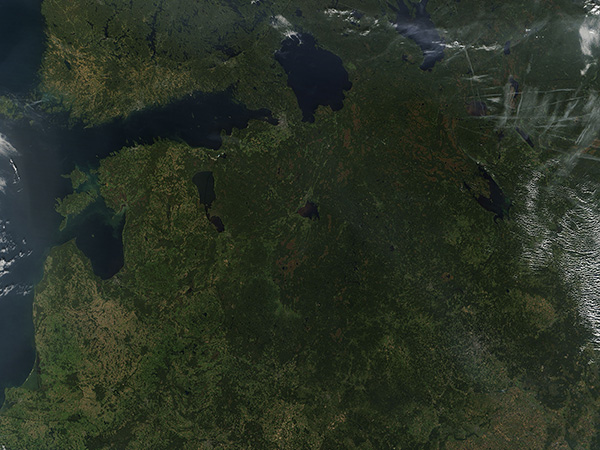
On September 24, 2017 the Moderate Resolution Imaging Spectroradiometer (MODIS) aboard NASA’s Terra satellite acquired a true-color image of Northeastern Europe on an early autumn day.
Broad banks of white cloud frame the image both in the north and the south. Black borderlines have been overlain on the image to delineate country borders. Russia sits in the east and the countries in the west, from north to south, are: Finland, Estonia, Latvia, Lithuania, and Poland. A small piece of Russia, the Kalingrad Oblast, sits between Poland and Lithuania on the Baltic Sea. Belarus and the Ukraine are located inland and south of Russia.
Smoke blows across Russia and to the west, likely originating in wildfires which continue to burn in peat-rich forests in Russia. The smoke thins and spreads over most of the sky, especially in the north. Thin white lines are contrails that form from planes flying in different directions at different altitudes.
Image Facts
Satellite:
Terra
Date Acquired: 9/24/2017
Resolutions:
1km (535.5 KB), 500m (2 MB), 250m (5.2 MB)
Bands Used: 1,4,3
Image Credit:
Jeff Schmaltz, MODIS Land Rapid Response Team, NASA GSFC
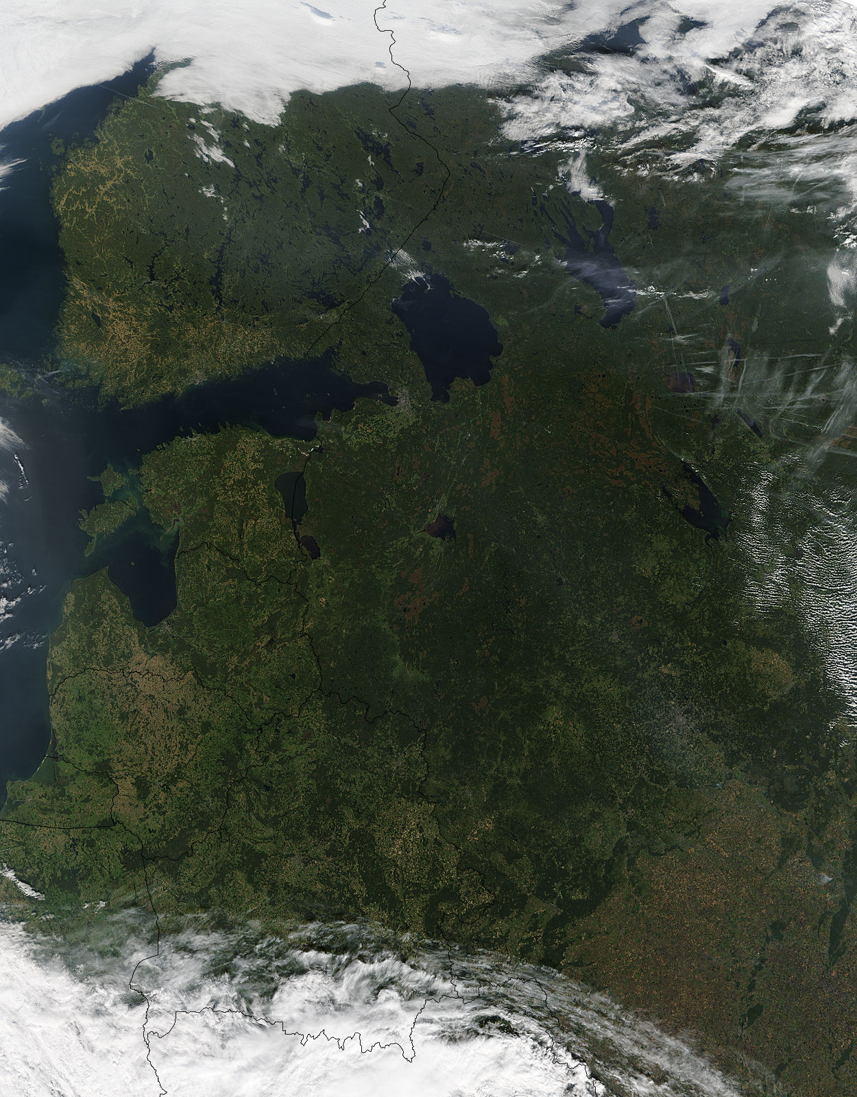
