
Images


February 27, 2018 - Vog from Ambrym volcano, Vanuatu
 Tweet
Tweet
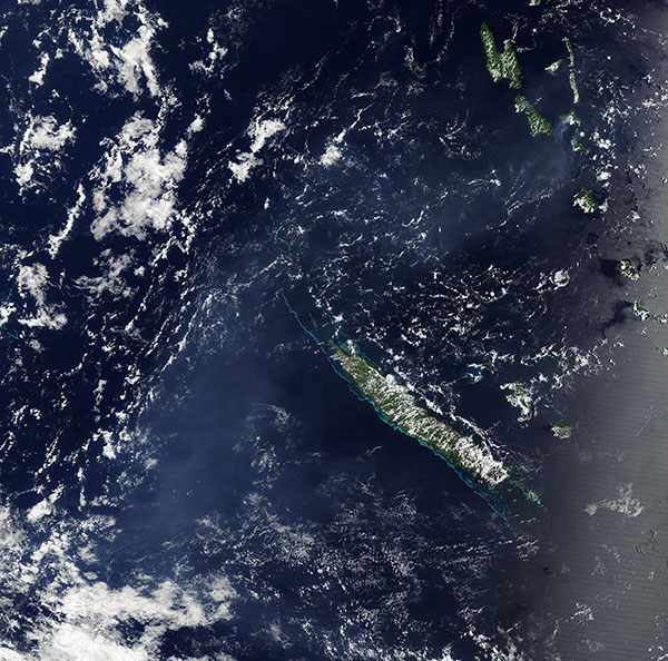
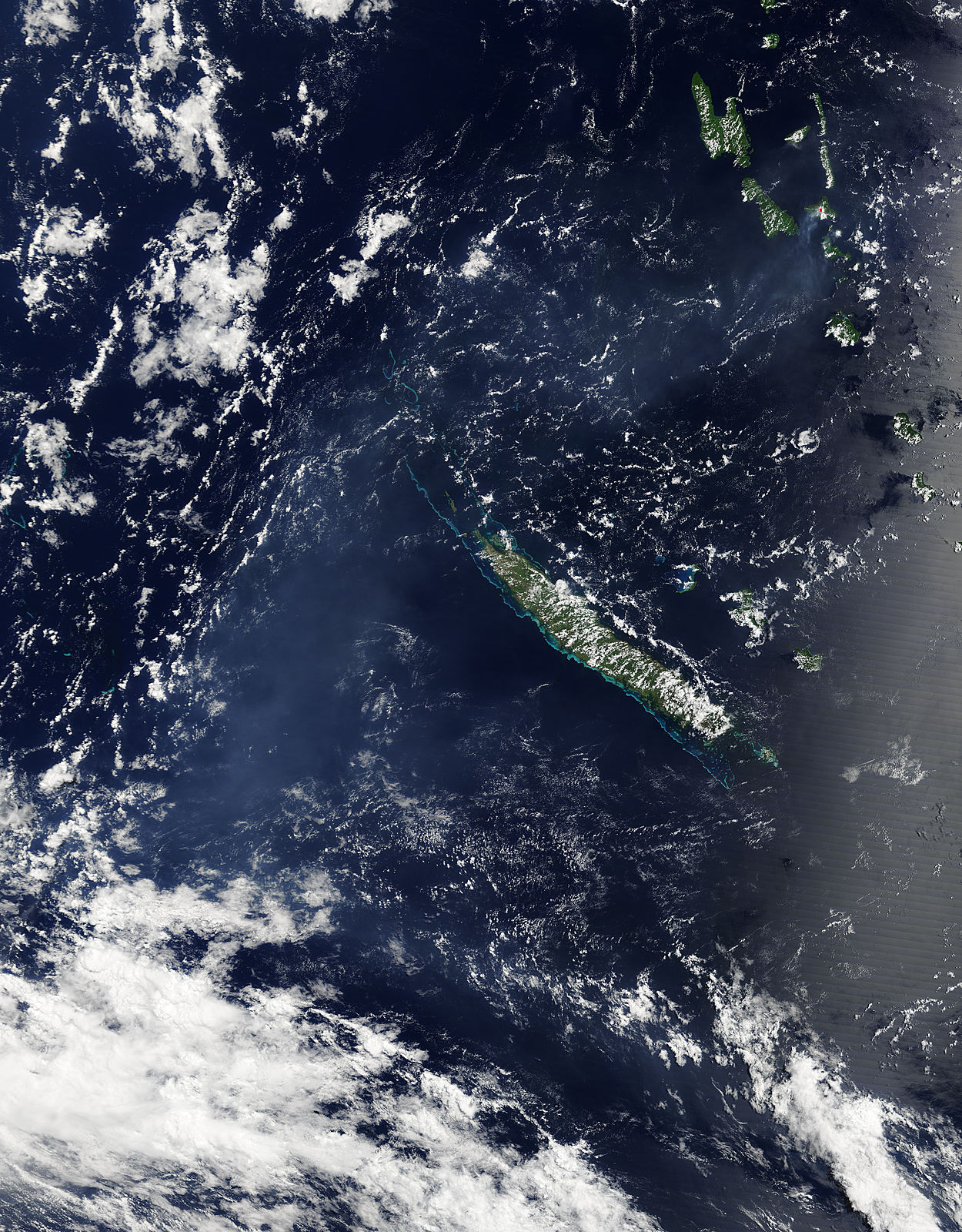
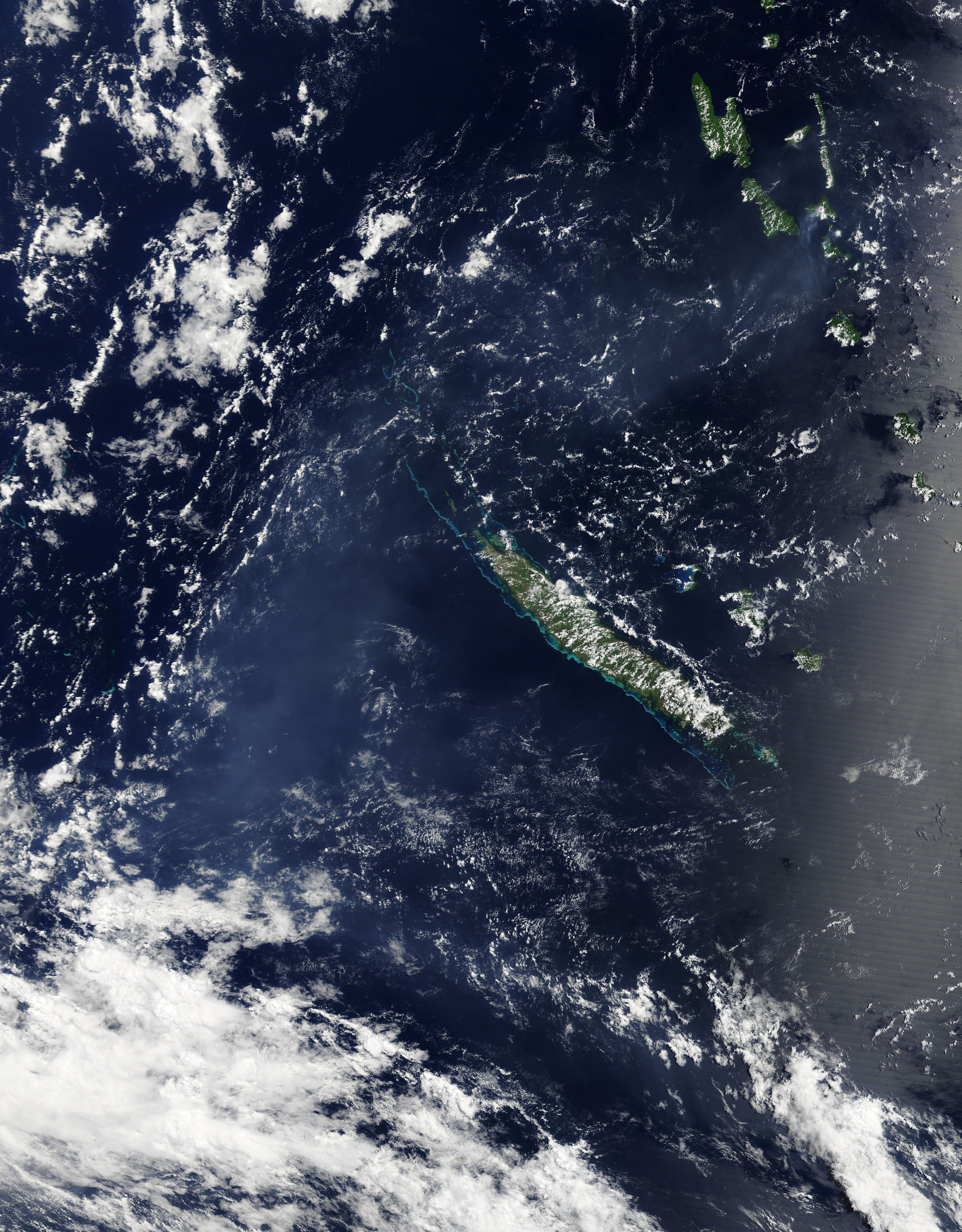
The Republic of Vanuatu sits in the South Pacific Ocean, about 1,200 miles (2,000 km) east of Australia and 1,000 miles (1,600 km) north of New Zealand. Ambrym Island is the summit of a massive volcano in the volcanic archipelago that forms Vanuatu. The 7.5-mile (12- km) – wide caldera lies at the center of the island, which rises 4,377 feet above sea level.
Two active craters are located in Ambrym’s caldera. Called Benbow and Marum, small eruptions occur frequently at both craters. The eruptions frequently release ash and gases into the atmosphere. When sulfur dioxide and other gases from a volcano react with sunlight, oxygen, and moisture, volcanic smog (vog) is created.
On February 20, 2018, the Moderate Resolution Imaging Spectroradiometer (MODIS) aboard NASA’s Terra satellite acquired a true-color image of vog from Ambrym volcano stretching many hundreds of miles from Vanuatu (upper right) across the long island of New Caledonia, and southwest across the Pacific Ocean.
The silvery area at the eastern edge of the region are not vog but sunglint. Sunglint is an optical phenomenon that occurs when sunlight reflects off the surface of water at the same angle that a satellite sensor views it. The result is a mirror-like reflection of sunlight off the water and back at the satellite sensor.
Image Facts
Satellite:
Terra
Date Acquired: 2/20/2018
Resolutions:
1km (625.5 KB), 500m (2 MB), 250m (5 MB)
Bands Used: 1,4,3
Image Credit:
Jeff Schmaltz, MODIS Land Rapid Response Team, NASA GSFC
