
Images


March 19, 2018 - Southeastern United States
 Tweet
Tweet
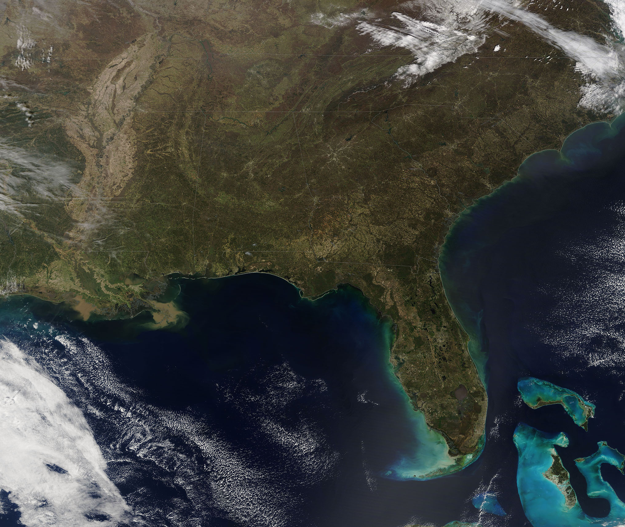
The Moderate Resolution Imaging Spectroradiometer (MODIS) aboard NASA’s Terra satellite acquired a true-color image of the Southeastern United States on March 15, 2018.
A smoky haze hung over the landscape from the Mississippi Valley in the west to the Appalachian Mountains in the northeast and even over the tip of southern Florida. According to the U.S. Air Quality “Smog Blog”, the PM 2.5 (small particulate matter) has been elevated over the Southeast due to fires burning across the region. Most fires in this location at this time of year are prescribed burns used to manage agricultural land and forests.
Image Facts
Satellite:
Terra
Date Acquired: 3/15/2018
Resolutions:
1km (826.2 KB), 500m (2.8 MB), 250m (7.3 MB)
Bands Used: 1,4,3
Image Credit:
Jeff Schmaltz, MODIS Land Rapid Response Team, NASA GSFC
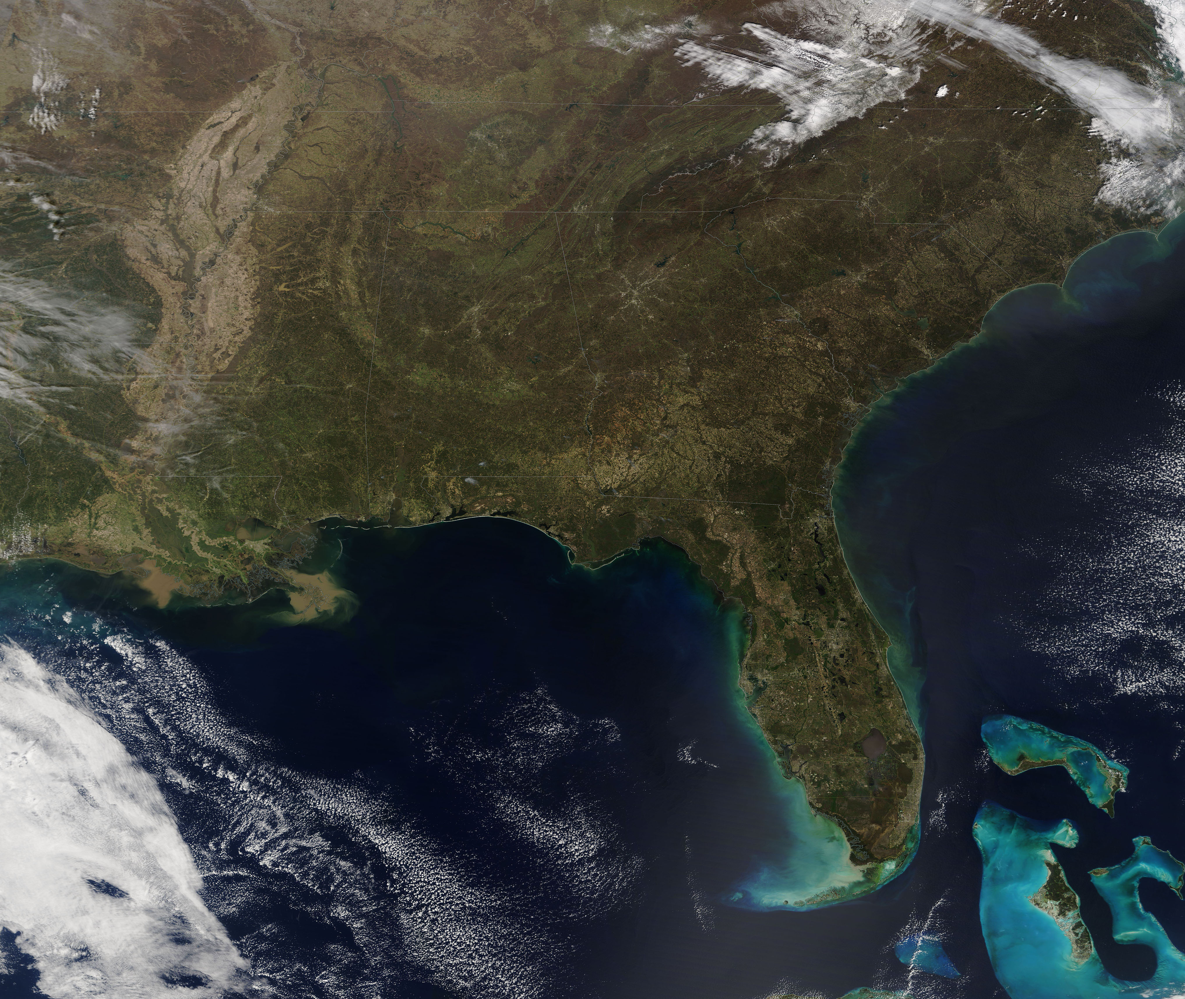
