
Images


March 26, 2019 - Tropical Cyclone Joaninha
 Tweet
Tweet
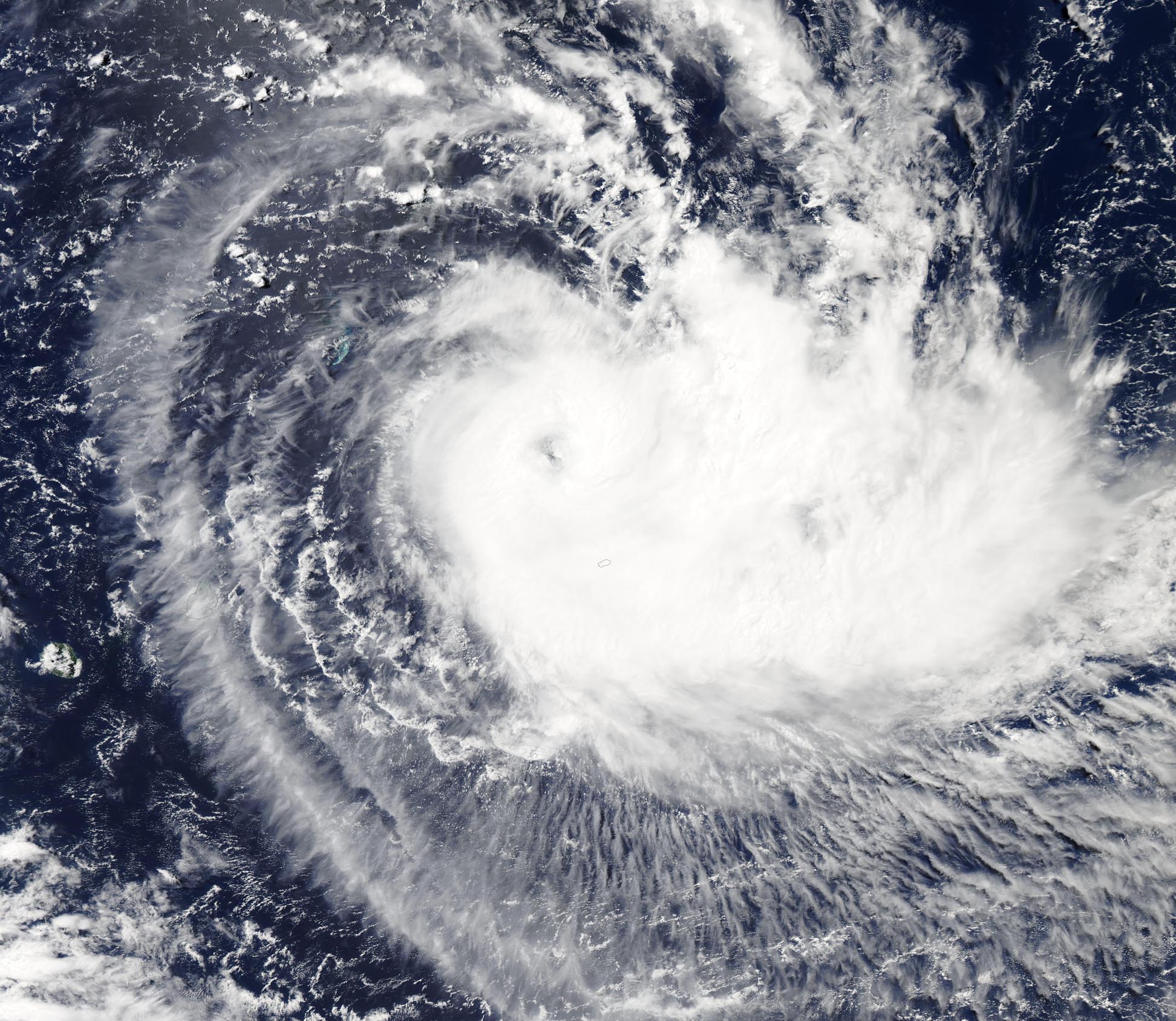
On March 22, Tropical Depression 22S strengthened to form Tropical Cyclone Joaninha in the Central Indian Ocean southwest of Diego Garcia. Diego Garcia is an atoll located just south of the equator.
By 5:00 p.m. EDT (9:00 p.m. UTC) March 25, wind speeds had increased to about 121 mph (193 km/h), according to the Joint Typhoon Warning Center (JTWC), making Tropical Cyclone Joaninha the equivalent to a Category 3 storm on the Saffir Simpson Hurricane Wind Scale. At that time, the storm was located approximately 80.5 mi (130 km) north of Port Mathurin, Mauritius, and was tracking southeastward at 3.5 mph (5.6 km/h).
According to the JTWC, Tropical Cyclone Joaninha is in a favorable environment with a robust poleward outflow, low vertical wind shear and warm sea surface temperatures (82-84°F/28-29°C). Joaninha continues to move to the southeast as it intensifies, heading for a very close encounter with Rodrigues Island—possibly even a direct hit. The island was beginning to feel the effects of the storm on March 25 and Joaninha is expected to continue to batter Rodrigues until March 27. According to a post by the Weather and Cyclone Mauritius on their Facebook page, as of March 25, 400 people on Rodrigues have been evacuated from their homes. As trees and electricity pylons have fallen to the ground, the island has lost internet and 73% of the residents are in blackout. They also report several houses have been destroyed, even though the island is only encountering the leading bands of the storm.
Tropical Cyclone Joaninha is expected to maintain the current strength and movement for the next 72 hours, according to the JTWC. After that time, it is expected to gradually weaken as it turns south-southeastward.
The Moderate Resolution Imaging Spectroradiometer (MODIS) on board NASA's Aqua satellite acquired a true-color image of Tropical Cyclone Joaninha on March 25, 2019.
Image Facts
Satellite:
Aqua
Date Acquired: 3/25/2019
Resolutions:
1km (532.9 KB), 500m (1.6 MB), 250m (4.9 MB)
Bands Used: 1,4,3
Image Credit:
MODIS Land Rapid Response Team, NASA GSFC
