
Images


November 1, 2019 - Lake Malawai
 Tweet
Tweet
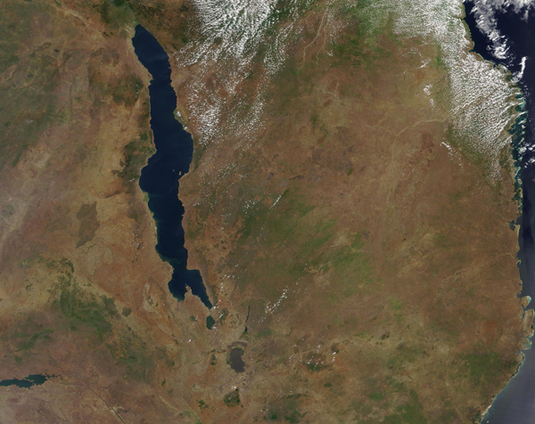
With coastlines in Malawi, Mozambique, and Tanzania, Lake Malawi (Lake Nyassa) ranks as the fourth-largest freshwater lake by volume, following only Lake Baikal, Lake Tanganyika, and Lake Superior. Bounded by steep mountains on all sides, the long lake stretches approximately 360 miles (580 km) in length and averages about 25 mi (40 km) in width. Lying within Africa's Western Rift Valley, Lake Malawi is one of the deepest lakes in the world, with a maximum depth of 2,316 feet (706 meters).
The southern end of the lake was named a UNESCO World Heritage Site in 1984. Named a site of global importance for biodiversity conservation, the area was also noted as an area of exceptional natural beauty with rugged landscapes around it contrasting with remarkably clear waters. A remarkable number of cichlid fish species exist here (at least several hundred), almost all of which are endemic to Lake Malawi. Known locally as mbuna, the diversity of the exhibit a striking example of biological evolution, having developed extensive adaptive radiation and speciation. About 30 percent of the world's cichlids species make these waters their home.
On October 27, 2019, the Moderate Resolution Imaging Spectroradiometer (MODIS) on board NASA's Terra satellite acquired a true-color image of Lake Malawi. The greens of spring vegetation growth can be seen in the ochre-and-tan landscape around the deep blue waters. Some popcorn clouds hang over vegetated, moist areas.
Image Facts
Satellite:
Terra
Date Acquired: 10/27/2019
Resolutions:
1km (735.8 KB), 500m (2 MB), 250m (3.9 MB)
Bands Used: 1,4,3
Image Credit:
MODIS Land Rapid Response Team, NASA GSFC
