Images
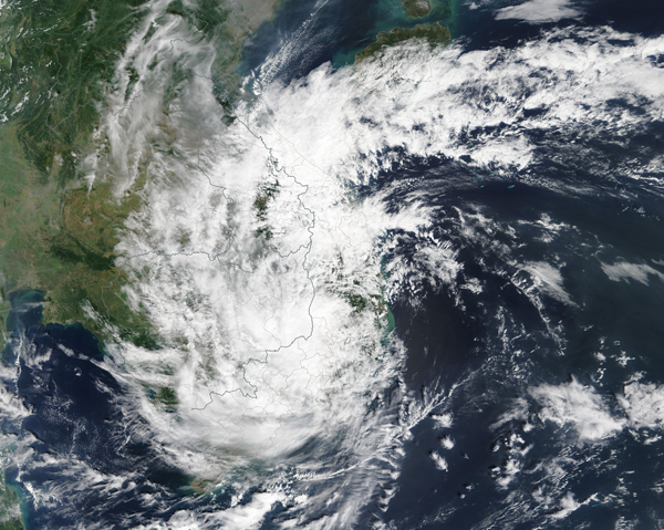
November 13, 2019 - Tropical Storm Nakri
Tweet
Tropical Cyclone Nakri made landfall about 20 miles (32 km) south of the city of Tuy Hòa, the capital city of Phú Yên Providence, Vietnam, at about 4:00 a.m. local time on November 11, 2019 (4:00 p.m. Nov. 10 EST). Once ashore, Nakri moved northwest into Cambodia, where it weakened to a tropical depression. The Moderate Resolution Imaging Spectroradiometer (MODIS) on board NASA’s Terra satellite acquired a true-color image of the storm on November 11 as it was moving inland. At that time, Nakri was bringing strong winds and rain as far inland as Laos and Thailand.
According to the Global Disaster Alert and Coordination System (GDACS), the storm left about 60,000 people without power in Vietnam. Prior to reaching Vietnam, Tropical Cyclone Nakri affected the Philippines from November 6-7. Damage in the Philippines included the loss of 7 houses and the closure of 46 roads and 16 bridges. Three people were reported injured and three died due to the storm.
Image Facts
Satellite:
Terra
Date Acquired: 11/11/2019
Resolutions:
1km (2.1 MB), 500m (6 MB), 250m (5 MB)
Bands Used: 1,4,3
Image Credit:
MODIS Land Rapid Response Team, NASA GSFC


