Images
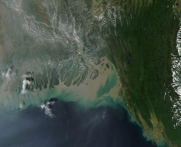
November 24, 2019 - Meghna River sediment in the Bay of Bengal
Tweet
After suffering extreme and damaging flooding from monsoon rains in July, 2019, floods once again rocked Bangladesh in November, after Tropical Cyclone Matmo (Bulbul) made landfall on November 9 near Sangar Island, West Bengal, India. Maximum sustained winds were about 74 mph (120 km/h) and rainfall of more than 200 mm (8.7 in) were reported in several places. An “extreme” storm surge also drove additional coastal flooding. According to Reliefweb, thousands of houses, most of which were made of muds and hatch, were completely destroyed, while the floodwater inundated farm fields, destroying winter crops and the almost-ripe rice crop. About 5,000 trees were reported destroyed in the Sundarbans, the world’s largest mangrove forest.
On November 21, 2019, the Moderate Resolution Imaging Spectroradiometer acquired a true-color image of heavy sediment pouring into the Bay of Bengal from the rivers that drain the flood-drenched region. Silt and sediment fill the Meghna River (far right), turning the river muddy brown. The Meghna, which reaches a maximum width of 12 km (7.5 mi), is the widest river among those that flow completely inside the boundaries of Bangladesh. Flooding is frequent in this region, both during the monsoon and from storms that strengthen in the Bay of Bengal.
Image Facts
Satellite:
Aqua
Date Acquired: 11/21/2019
Resolutions:
1km (309.1 KB), 500m (857.6 KB), 250m (694 KB)
Bands Used: 1,4,3
Image Credit:
MODIS Land Rapid Response Team, NASA GSFC


