
Images


April 11, 2020 - Madagascar and the Mozambique Channel
 Tweet
Tweet
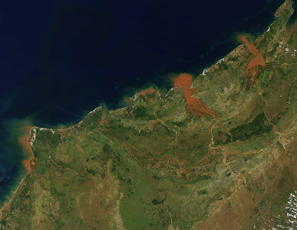
On April 10, 2020, the Moderate Resolution Imaging Spectroradiometer (MODIS) on board NASA’s Terra satellite acquired a stunning true-color image of red sediments pouring into the Mozambique Channel from northwestern Madagascar.
The Mozambique Channel separates the island of Madagascar from the southeastern coast of Africa. Bombetoka Bay, the brick-red estuary in the center of the image, is fed by the Betsiboka River. It is easy to see why it is famous for to its striking red floodplain sediments. To its right (northeast) Mahajamba Bay is fed by several rivers, including the Mahajamba and Sofia. Like the Betsiboka, the floodplains of these rivers contain reddish sediments eroded from their basins upstream.
Historical maps of Madagascar describe the sandy to clay-rich soils around the Betsiboka River as terres rouges, or “red lands.” (The island was a French territory from 1895 to 1960.) They were describing laterites—soils rich in iron oxides—that form in tropical climates from the chemical breakdown of iron-rich rocks. These soils and sediments lend the river a rusty orange color when the island experiences heavy seasonal rain or downpours from tropical cyclones. The opening months of 2020 have brought heavy rains to northern Madagascar, including a very large flooding event in January.
Image Facts
Satellite:
Terra
Date Acquired: 4/10/2020
Resolutions:
1km (58.9 KB), 500m (169.9 KB), 250m (263.2 KB)
Bands Used: 1,4,3
Image Credit:
MODIS Land Rapid Response Team, NASA GSFC
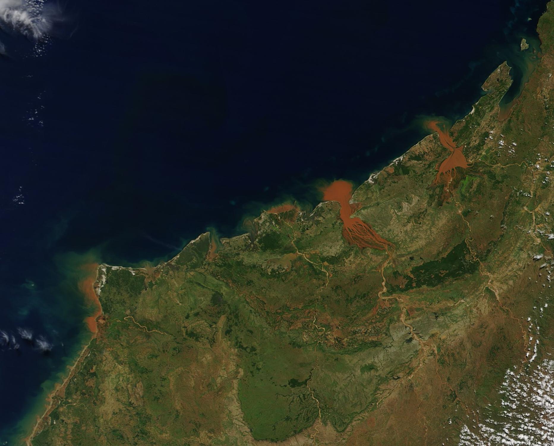
