
Images


April 21, 2020 - Fires in Paraguay and Argentina
 Tweet
Tweet
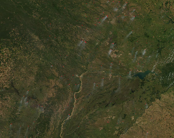
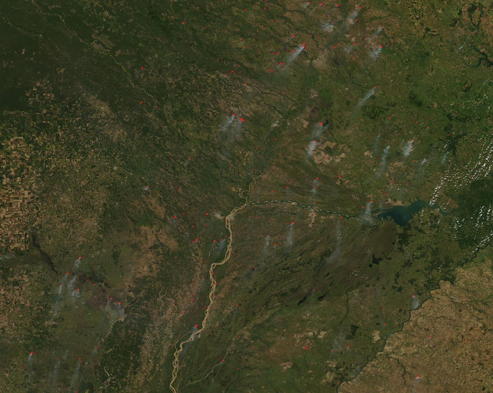
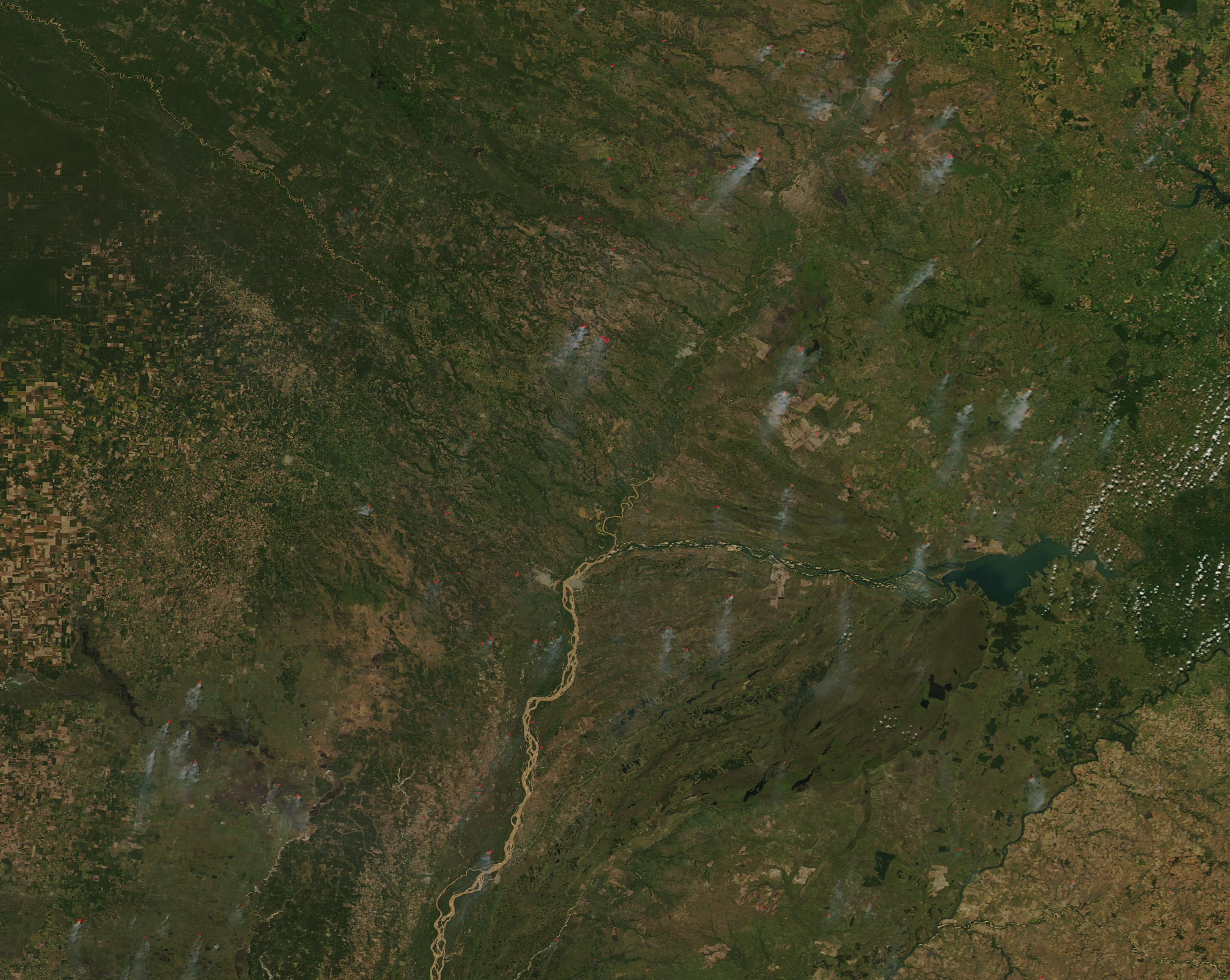
Many dozens of fires were burning in Paraguay and Argentina in mid-April, 2020, covering the landscape with a haze of smoke. The Moderate Resolution Imaging Spectroradiometer (MODIS) on board NASA’s Aqua satellite acquired a true-color image of the scene on April 19.
Paraguay sits in the north and east (upper right) while Argentina fills the western and southern (left and lower) section of the image. The silt-laden Parana River delineates the boundary between the two countries in most of the image. A small bit of Brazil can be seen in the far right (east). A small section of Argentina, the peninsula-like Misiones region, juts northward between Uruguay and Brazil. It is separated from Uruguay by the Parana River and from Brazil by the smaller, winding, Uruguay River. This area holds some of the last remaining tracts of a unique rainforest ecosystem known Atlantic Rainforest. This ecosystem, which is different from the Amazon rainforest of the interior portion of the continent, once stretched hundreds of miles inland along most of the eastern South American coastline, but it has been almost completely cut down or burned in the centuries since European settlement. Several fires burn in the Misiones region but most seem to be in farmland rather than forest.
Each red “hot spot” marks an area where the thermal bands on the instrument detect temperatures high temperatures. When combined with typical smoke, as in this image, these hot spots mark actively burning fires. While it’s not possible to tell how a fire started from satellite images, the large number of fires, the time of year, and the location of the fires suggest that these fires are primarily agricultural in origin, used to manage land for farming.
Image Facts
Satellite:
Aqua
Date Acquired: 4/19/2020
Resolutions:
1km (311.4 KB), 500m (311.4 KB), 250m (1 MB)
Bands Used: 1,4,3
Image Credit:
MODIS Land Rapid Response Team, NASA GSFC
