
Images


July 4, 2020 - Great Lakes
 Tweet
Tweet
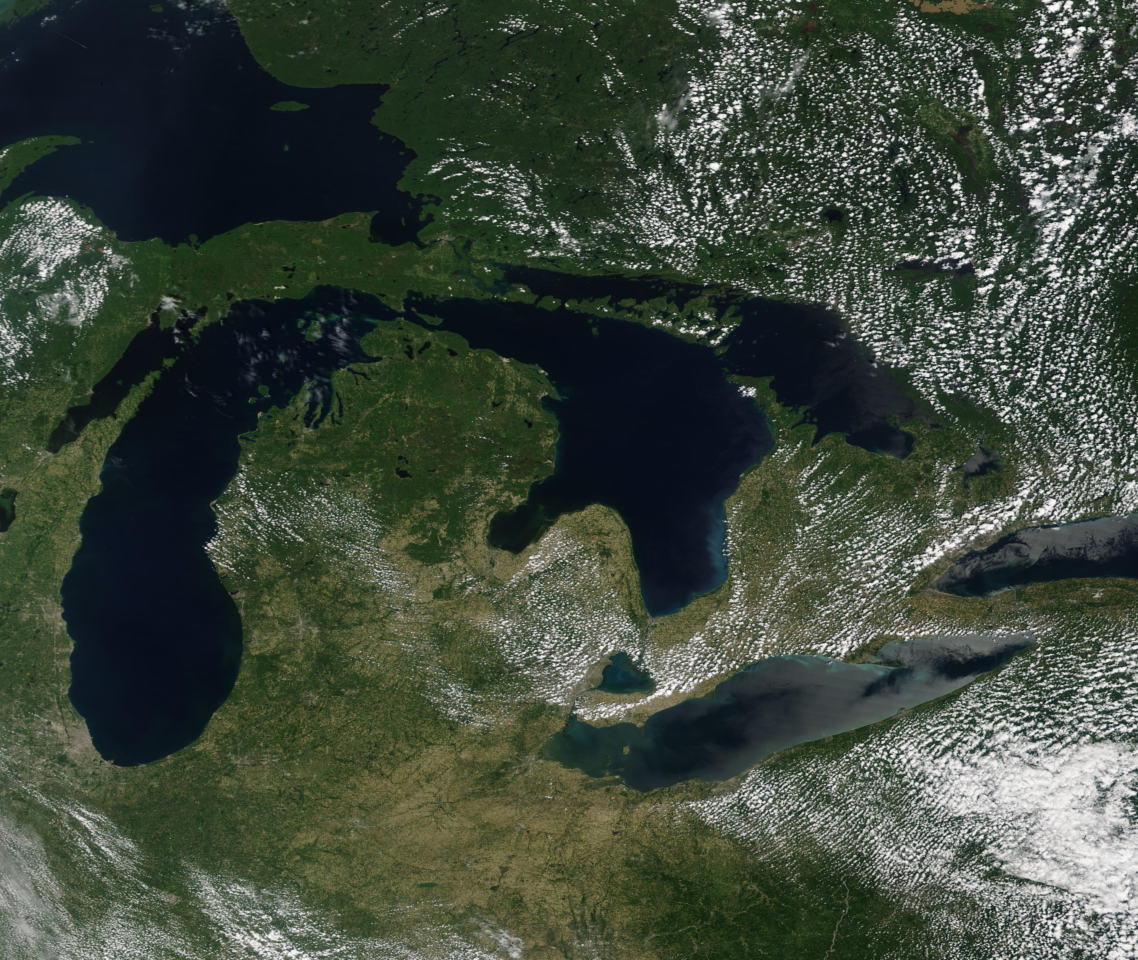
On July 1, 2020, the Moderate Resolution Imaging Spectroradiometer (MODIS) on board NASA’s Terra satellite acquired a gorgeous clear-sky, true-color image of the Great Lakes.
Both Canada and the United States share all of the Great Lakes, except for Lake Huron, which sits entirely within the United States. The shorelines of the lakes touch Ontario, Canada and, in the United States, the states of Michigan, Wisconsin, Minnesota, Illinois, Indiana, Ohio, Pennsylvania, and New York. From the northwest and moving clockwise the lakes are named: Lake Superior, Lake Huron, Lake Ontario, Lake Erie, and Lake Michigan. The lakes are not separate bodies of water, but are connected by a large numbers of rivers, streams, straits, and smaller lakes, making them hydrologically connected. With a surface area of more than 94,000 square miles, it is estimated that they hold 80 percent of the freshwater supply of North America.
The lakes were carved into existence by massive glaciers as they slowly ground across North America. Between 14,000 and 10,000 years ago, at the end of the Wisconsin Glaciation (the most recent period of the Ice Age), as the ice retreated and melted, the Great Lakes were revealed and filled with water.
People have inhabited these lakes for thousands of years. Except for Lake Superior, named from the French word for “upper lake” (lac supérieur), the names of the lakes are all derived from indigenous people for whom the lakes were a sacred and vital part of life. It is said that Lake Erie’s name comes from the Iroquoian work for “long tail” (erielhonan), which describes it shape. It is the fourth largest lake by surface area and the shallowest. The Wyandot people (Hurons) lived by Lake Huron, and the tribal language also gave rise to Lake Ontario, as “ontario” is the Huron word for “lake of shining water”. The Ojibwa word “mishigami”, which means “large lake”, became the name of Lake Michigan.
Image Facts
Satellite:
Terra
Date Acquired: 7/1/2020
Resolutions:
1km (547.1 KB), 500m (1.6 MB), 250m (3.2 MB)
Bands Used: 1,4,3
Image Credit:
MODIS Land Rapid Response Team, NASA GSFC
