
Images


August 20, 2020 - Mediterranean Sea
 Tweet
Tweet
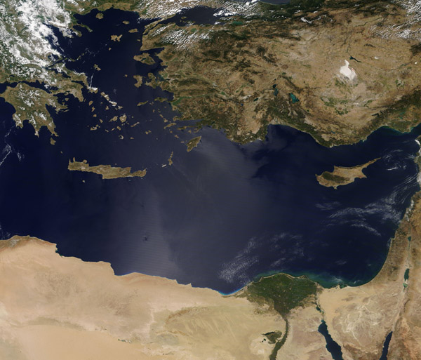
Sometimes called called the “incubator of Western civilization”, the Mediterranean Sea’s location has placed it at the center of human activity from ancient times through the present day. Once a superhighway for transportation, trade, and sharing of ideas between residents of places like Mesopotamia, Egypt, Persia, Phoenicia, etc., today the Mediterranean is one of the world’s busiest sea-lanes, ringed by some of the fastest-growing urban areas, industrialization centers, and extremely popular tourist destinations. While undoubtedly a popular and well-loved resource, the Mediterranean – like many places on Earth – faces pressure from population growth, industrialization, resource exploitation, and climate change.
On August 17, 2020, the Moderate Resolution Imaging Spectroradiometer on board NASA’s Terra satellite acquired a true-color image of a clear summer day over the Mediterranean Sea.
The coastal countries seen in this image, starting in the northeast (upper left) and moving clockwise are: Greece, Turkey, Syria, Lebanon, Israel, Egypt, and Libya. The island nation of Cyprus sits in the eastern Mediterranean south of Turkey. The green delta of the Nile River can be seen in Egypt while the hypersaline, mineral-crusted Tuz Golu (Lake Tuz) appears as a white oval in Turkey, north of Cyprus.
Image Facts
Satellite:
Terra
Date Acquired: 8/17/2020
Resolutions:
1km (530 KB), 500m (1.7 MB), 250m (3.3 MB)
Bands Used: 1,4,3
Image Credit:
MODIS Land Rapid Response Team, NASA GSFC
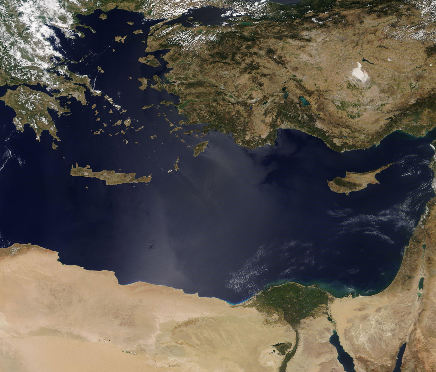
