
Images


September 20, 2020 - Tibetan Plateau
 Tweet
Tweet
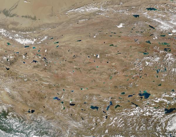
On September 17, 2020, the Moderate Resolution Imaging Spectroradiometer (MODIS) on board NASA's Terra satellite acquired a true-color image of the Tibetan Plateau.
Sprawling over 2.5 million square kilometers (0.97 million square miles) between the Himalaya Mountains and the Taklimakan Desert, the Tibetan Plateau encompasses about one-quarter of the land area of China. The average elevation of over 4,000 meters (13,123 feet) lends it the nickname “The Roof of the World”.
More than 1,500 lakes, both small and large, dot the landscape. The region also contains the world’s third-largest persistent ice mass, following only the Antarctic and Arctic. The lakes and glaciers give rise of many of Asia’s major rivers: the Brahmaputra, Indus, Ganges, Salween (Nu Jiang), Mekong (Lancang Jiang), Yangtze (Chang Jiang), and Yellow (Huang He).
Image Facts
Satellite:
Terra
Date Acquired: 9/17/2020
Resolutions:
1km (317.5 KB), 500m (1.1 MB), 250m (3.2 MB)
Bands Used: 1,4,3
Image Credit:
MODIS Land Rapid Response Team, NASA GSFC
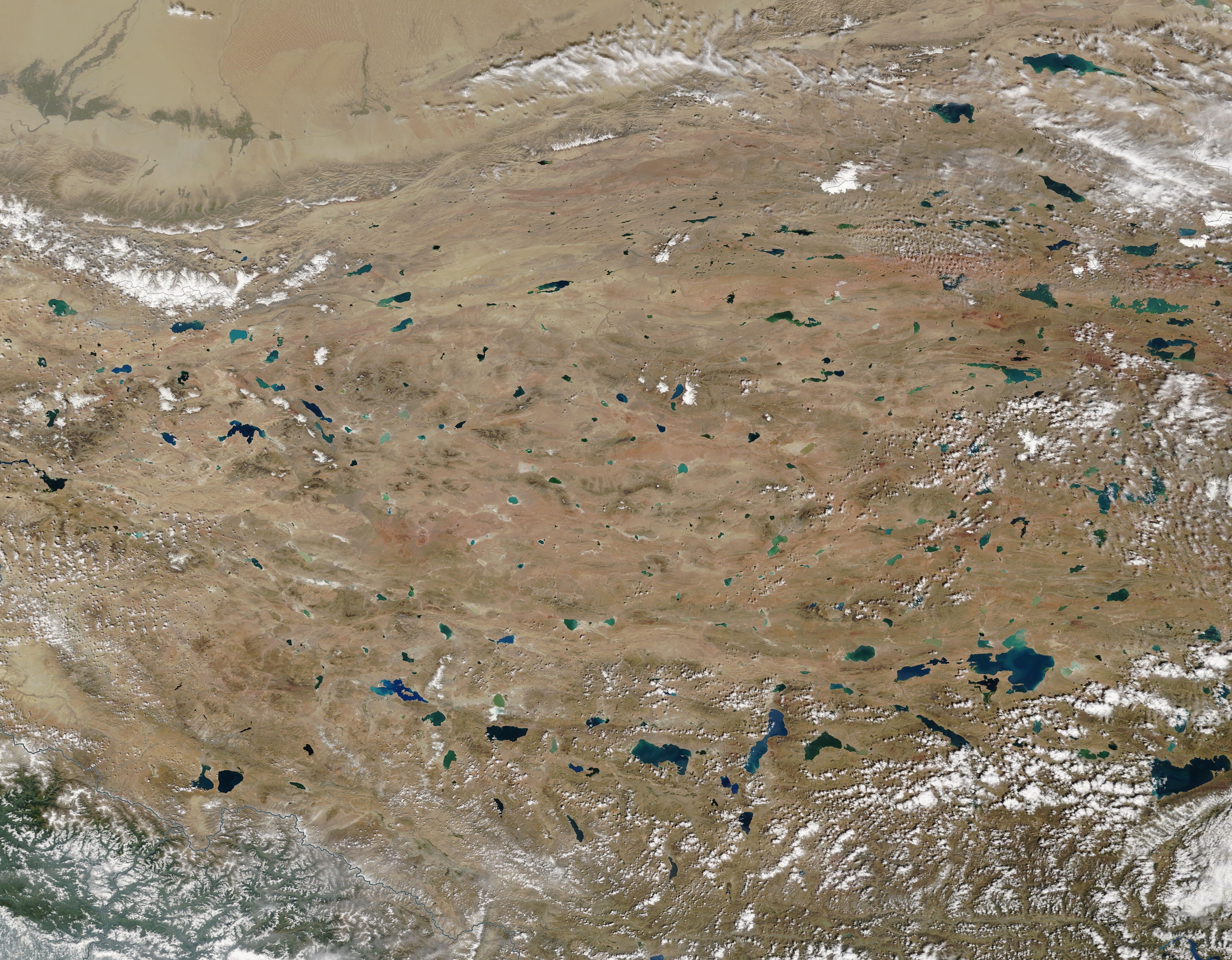
