
Images


November 25, 2020 - Antarctica
 Tweet
Tweet
On November 4, 2020, the National Snow and Ice Data Center (NSIDC) confirmed that Antarctic sea ice extent had reached its seasonal maximum on September 28. Measuring 18.95 square kilometers (7.32 square miles), this maximum extent was the eleventh highest in the satellite record. Between that date and November 4, daylight has lengthened and temperatures crept upward as austral spring advanced, prompting sea ice to begin its annual melt cycle.
According to NSIDC, between September 28 and November 4, Antarctic sea ice has declined by 1.30 million square kilometers (502,000 million square miles, but at a slightly slower rate than average, which means that there is currently a slight increase in the difference between the daily sea ice extent and the 1981 – 2010 average.
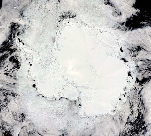
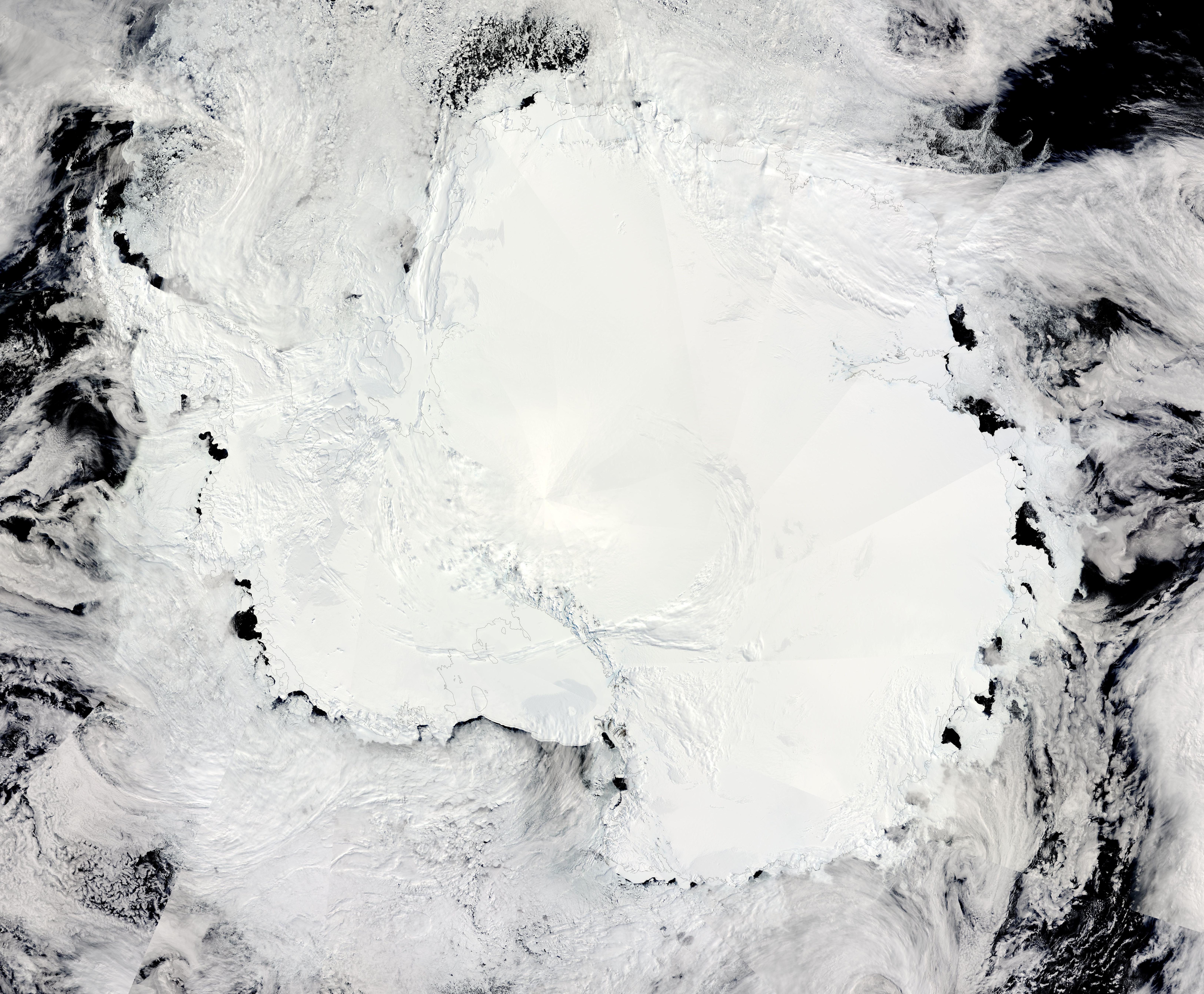
On November 23, 2020, the Moderate Resolution Imaging Spectroradiometer (MODIS) on board NASA’s Aqua satellite acquired a true-color image of Antarctica.
Thin black lines have been overlain on the image to mark the edge of the continent. Inside of these lines bright white snow and ice stretch across the frozen land of Antarctica. On the other side, sea ice floats on the deep dark waters of the Southern Ocean. Close to the continent the ice clings to the continent and is known as “fast ice”. Two large ice shelves are easily visible: the Ross Ice Shelf sits near the bottom of the image and the Ronne Ice Shelf lies between the Antarctic Peninsula (left side of the image) and the Weddell Sea. Both ice shelves cling to the coast along West Antarctica. In contrast, fast ice along the curved coast of East Antarctica has begun to visibly melt, leaving open water in many locations.
While fast ice clings to the land and juts out over ocean waters, much of the sea ice surrounding Antarctica is free-floating. Thinner and often made of various sizes of broken bits of ice, sea ice may appear roughened and somewhat dark when viewed from space – a significant contrast with the shiny, smooth, bright appearance of solidly frozen ice of fast ice or ice and snow that cover Antarctica. Carried by currents, sea ice may also create swirls and filigrees over the Southern Ocean.
Image Facts
Satellite:
Aqua
Date Acquired: 11/23/2020
Resolutions:
1km (4.1 MB),
Bands Used: 1,4,3
Image Credit:
MODIS Land Rapid Response Team, NASA GSFC
On November 4, 2020, the National Snow and Ice Data Center (NSIDC) confirmed that Antarctic sea ice extent had reached its seasonal maximum on September 28. Measuring 18.95 square kilometers (7.32 square miles), this maximum extent was the eleventh highest in the satellite record. Between that date and November 4, daylight has lengthened and temperatures crept upward as austral spring advanced, prompting sea ice to begin its annual melt cycle.
According to NSIDC, between September 28 and November 4, Antarctic sea ice has declined by 1.30 million square kilometers (502,000 million square miles, but at a slightly slower rate than average, which means that there is currently a slight increase in the difference between the daily sea ice extent and the 1981 – 2010 average.
On November 23, 2020, the Moderate Resolution Imaging Spectroradiometer (MODIS) on board NASA’s Aqua satellite acquired a true-color image of Antarctica.
Thin black lines have been overlain on the image to mark the edge of the continent. Inside of these lines bright white snow and ice stretch across the frozen land of Antarctica. On the other side, sea ice floats on the deep dark waters of the Southern Ocean. Close to the continent the ice clings to the continent and is known as “fast ice”. Two large ice shelves are easily visible: the Ross Ice Shelf sits near the bottom of the image and the Ronne Ice Shelf lies between the Antarctic Peninsula (left side of the image) and the Weddell Sea. Both ice shelves cling to the coast along West Antarctica. In contrast, fast ice along the curved coast of East Antarctica has begun to visibly melt, leaving open water in many locations.
While fast ice clings to the land and juts out over ocean waters, much of the sea ice surrounding Antarctica is free-floating. Thinner and often made of various sizes of broken bits of ice, sea ice may appear roughened and somewhat dark when viewed from space – a significant contrast with the shiny, smooth, bright appearance of solidly frozen ice of fast ice or ice and snow that cover Antarctica. Carried by currents, sea ice may also create swirls and filigrees over the Southern Ocean.
Image Facts
Satellite:
Aqua
Date Acquired: 11/23/2020
Resolutions:
1km (4.1 MB),
Bands Used: 1,4,3
Image Credit:
MODIS Land Rapid Response Team, NASA GSFC
