
Images


December 9, 2020 - Gulf of Martaban
 Tweet
Tweet
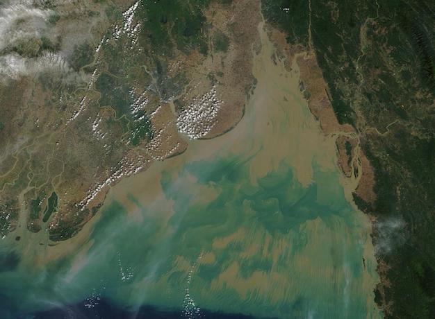
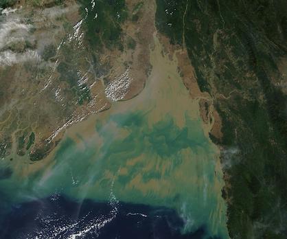
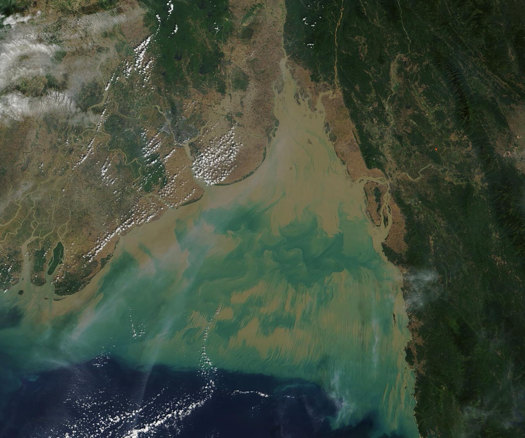
Sitting on the southwestern coast of Myanmar (Burma) and at the head of the Andaman Sea, the Gulf of Martaban receives sediment-laden water from four large rivers—the Sittang, Thanlwin, Yangon, and Ayeyarwady. The total amount of sediment output through these rivers has been estimated at 370-600 megatons a year, more than enough to create mud-laden waters. The Gulf is also subject to tides which are sometimes so strong they can temporarily reverse the flow of the rivers. Tides stir up sediment from the shallow bottom and erode shorelines, contributing to the muddy color of the water.
Strong tidal action and vigorous influx from rivers create complex and dynamic currents within the Gulf of Martaban and the northern Andaman Sea. In addition, as water flows over the many underwater canyons, mountains, and reefs found in this region, additional waves are generated. As the fresh river water pours into the salty Gulf water, differences in temperature and salinity create distinct layers within the ocean, and these layers add even more complexity to the movement of water within the Gulf of Martaban and the northern Andaman Sea.
The Moderate Resolution Imaging Spectroradiometer (MODIS) on board NASA’s Terra satellite acquired a stunning true-color image of the Gulf of Martaban on December 7 that captures sediment painting a picture of the complex currents at play. Sediment floating near the top of the water appears muddy tan. As sediment sinks, reflectivity changes and it appears green; the deeper it sinks, the darker the green. The intricate designs of varying shades of tans and greens are created by the motion of the currents carrying sediment higher and lower in the water column.
Image Facts
Satellite:
Terra
Date Acquired: 12/7/2020
Resolutions:
1km (24 KB), 500m (85.9 KB), 250m (273.3 KB)
Bands Used: 1,4,3
Image Credit:
MODIS Land Rapid Response Team, NASA GSFC
