
Images


February 21, 2021 - Tropical Storm Dujuan
 Tweet
Tweet
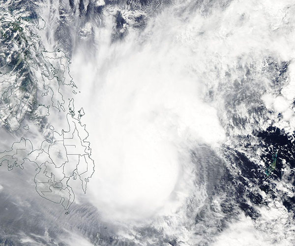
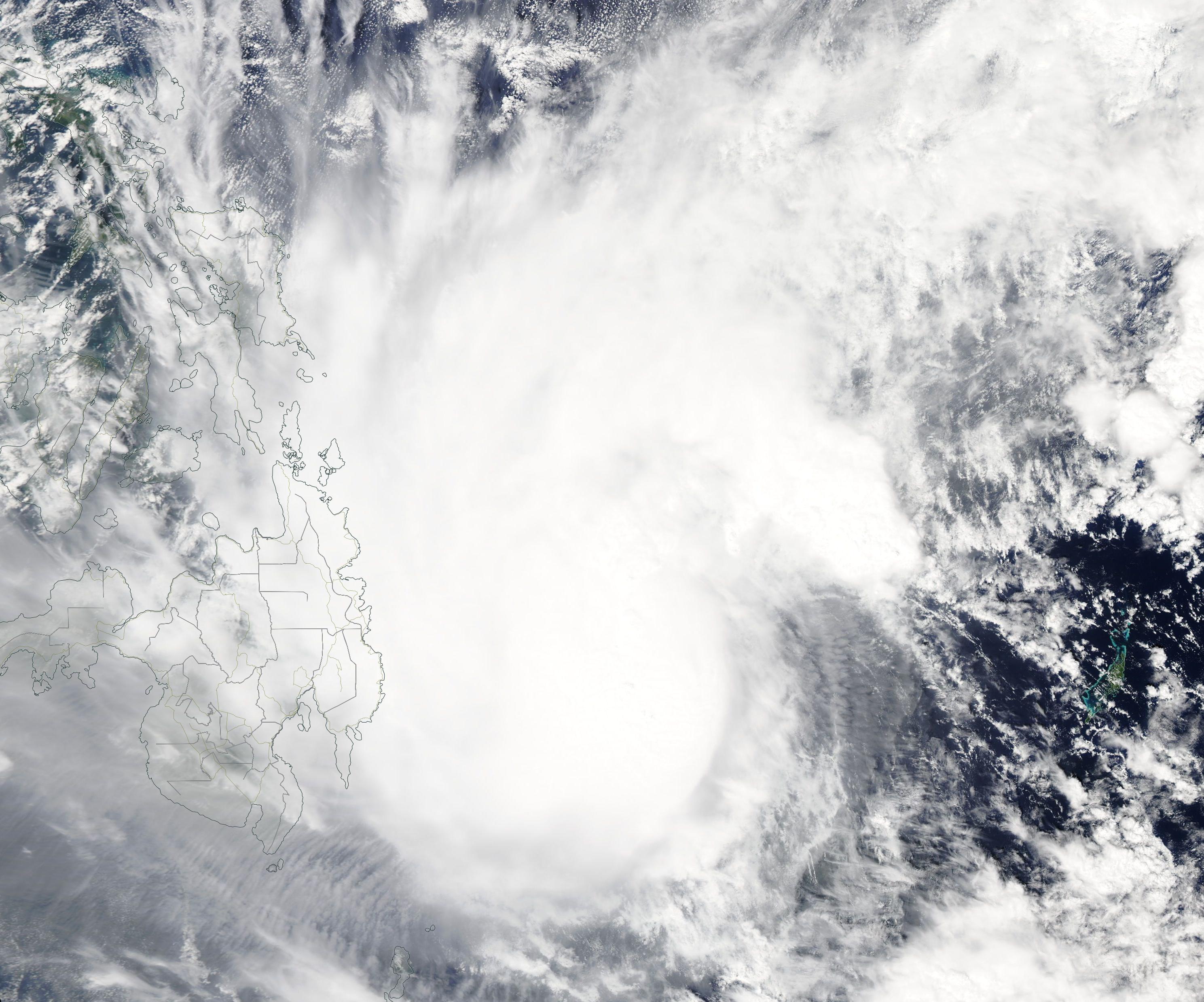
Tropical Cyclone Dujuan was strengthening as it travelled northwestward over the Philippine Sea on February 19, 2021. At 0000 UTC on that day (7:00 p.m. EST on February 18) Dujuan was located about 510 km (317 mi) off the southeastern coast of Mindanao, an island in the southern Philippines, and was packing winds of about 83 km/h (52 mph).
The Moderate Resolution Imaging Spectroradiometer (MODIS) on board NASA’s Aqua satellite acquired a true-color image of Dujuan on February 19. At that time, the asymmetric storm sported a cloud-filled center with rain bands extending over Mindanao in the Philippines.
Tropical Cyclone Dujuan, locally known as Tropical Cyclone Auring, is expected to make landfall in the Philippines sometime between the evening of February 20 and the morning of February 21. Authorities in the Philippines expect heavy rains for Surigao del Norte, Surigao del Sur, Dinagat Islands, and Eastern Visayas through February 21. A Tropical Cyclone Wind Signal Number 1 is in place for several locations through the Philippines. Sustained heavy rainfall could trigger flooding in low-lying areas near streams, creeks, and rivers or in urban areas with easily overwhelmed storm drainage systems.
At 2100 UTC (4:00 p.m. EST) on February 20, the Joint Typhoon Warning System (JWTC) advised that Dujuan’s maximum sustained winds had dropped to 30 knots (35 mph/56 kph), reducing it to a Tropical Depression.
Image Facts
Satellite:
Aqua
Date Acquired: 2/19/2021
Resolutions:
1km (96.1 KB), 500m (759.6 KB), 250m (2.1 MB)
Bands Used: 1,4,3
Image Credit:
MODIS Land Rapid Response Team, NASA GSFC
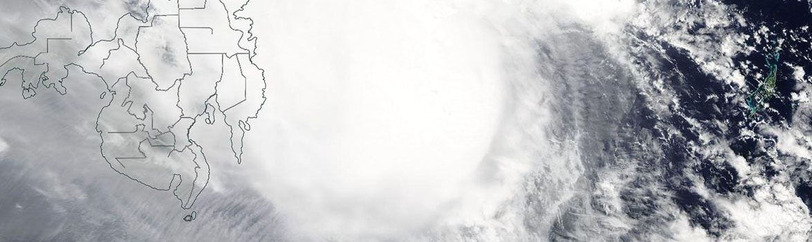
Tropical Cyclone Dujuan was strengthening as it travelled northwestward over the Philippine Sea on February 19, 2021. At 0000 UTC on that day (7:00 p.m. EST on February 18) Dujuan was located about 510 km (317 mi) off the southeastern coast of Mindanao, an island in the southern Philippines, and was packing winds of about 83 km/h (52 mph).
The Moderate Resolution Imaging Spectroradiometer (MODIS) on board NASA’s Aqua satellite acquired a true-color image of Dujuan on February 19. At that time, the asymmetric storm sported a cloud-filled center with rain bands extending over Mindanao in the Philippines. Tropical Cyclone Dujuan, locally known as Tropical Cyclone Auring, is expected to make landfall in the Philippines sometime between the evening of February 20 and the morning of February 21. Authorities in the Philippines expect heavy rains for Surigao del Norte, Surigao del Sur, Dinagat Islands, and Eastern Visayas through February 21. A Tropical Cyclone Wind Signal Number 1 is in place for several locations through the Philippines. Sustained heavy rainfall could trigger flooding in low-lying areas near streams, creeks, and rivers or in urban areas with easily overwhelmed storm drainage systems.
At 2100 UTC (4:00 p.m. EST) on February 20, the Joint Typhoon Warning System (JWTC) advised that Dujuan’s maximum sustained winds had dropped to 30 knots (35 mph/56 kph), reducing it to a Tropical Depression.
Image Facts
Satellite:
Aqua
Date Acquired: 2/19/2021
Resolutions:
1km (96.1 KB), 500m (759.6 KB), 250m (2.1 MB)
Bands Used: 1,4,3
Image Credit:
MODIS Land Rapid Response Team, NASA GSFC
