
Images


June 8, 2021 - Dust off of Western Africa
 Tweet
Tweet
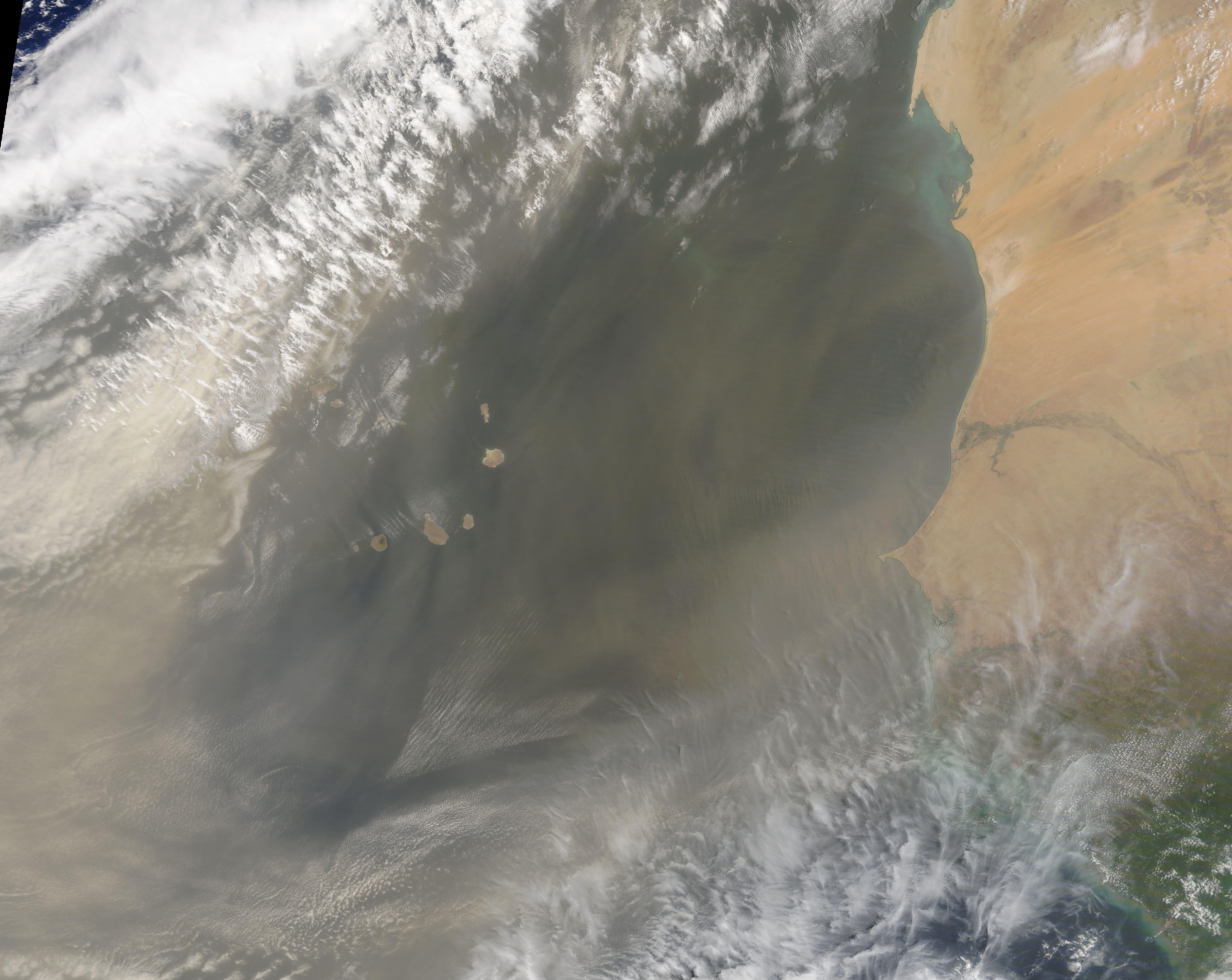
On June 7, 2021, the Moderate Resolution Imaging Spectroradiometer (MODIS) on board NASA’s Terra satellite acquired a true-color image of a vast cloud of dust blowing off of western African. The dust covers the coastal portions of the African countries of Mauritania (north) and Senegal (south) and passes over and beyond the Cape Verde Islands. To the west of Cape Verde Islands, the dust cloud is so thick it obscures the blue waters of the Atlantic Ocean completely from view. North and northwest of the islands the dust appears to have entrained with the cloud layer, suggesting that the dust does not lay close the ocean waters but high in the atmosphere.
Each year tens of millions of tons of dust blow out from North Africa, lofted out of the Sahara Desert by strong seasonal winds. Huge, showy plumes like this one sometimes advance across the tropical Atlantic Ocean towards North or South America. Through viewing the satellite records, this particular storm appears to have begun on June 2, when dust began to shift eastward from Mali, Algeria, and Niger. The plume has steadily increased its span since that day. On June 7, the dust plume measured more than 2,800 miles (4,500 km), stretching from inland Africa to far over the Atlantic Ocean.
Dust can degrade air quality and accelerate the melting of snow cover. But it also plays a major role in Earth’s climate and biological systems, absorbing and reflecting solar energy and fertilizing ocean ecosystems with iron and other minerals that plants and phytoplankton need to grow.
Image Facts
Satellite:
Terra
Date Acquired: 6/7/2021
Resolutions:
1km (1.5 MB), 500m (4.2 MB), 250m (2.2 MB)
Bands Used: 1,4,3
Image Credit:
MODIS Land Rapid Response Team, NASA GSFC
