
Images


September 16, 2021 - Nicholas off the coast of Texas and Louisiana
 Tweet
Tweet
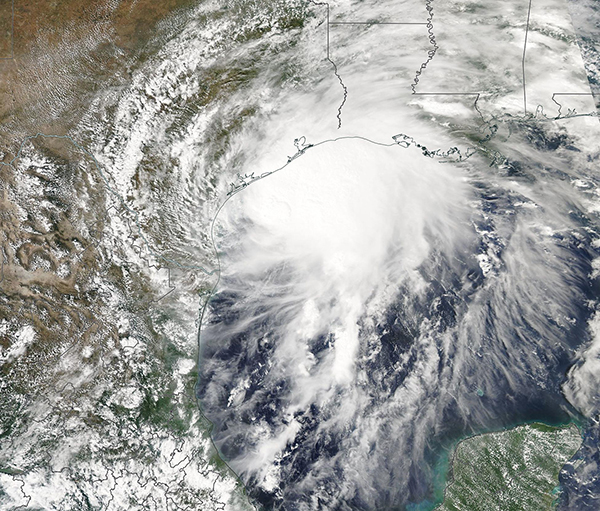
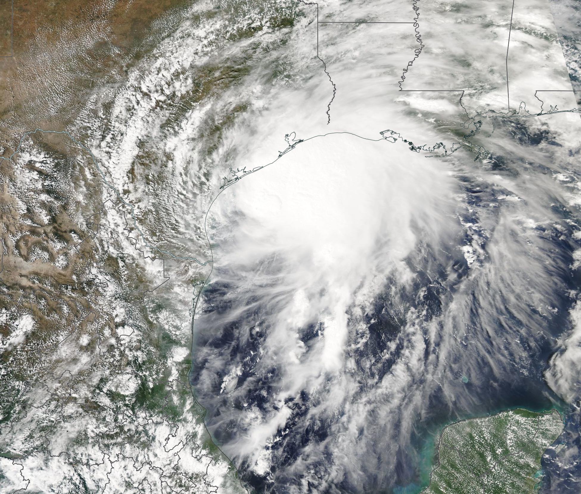
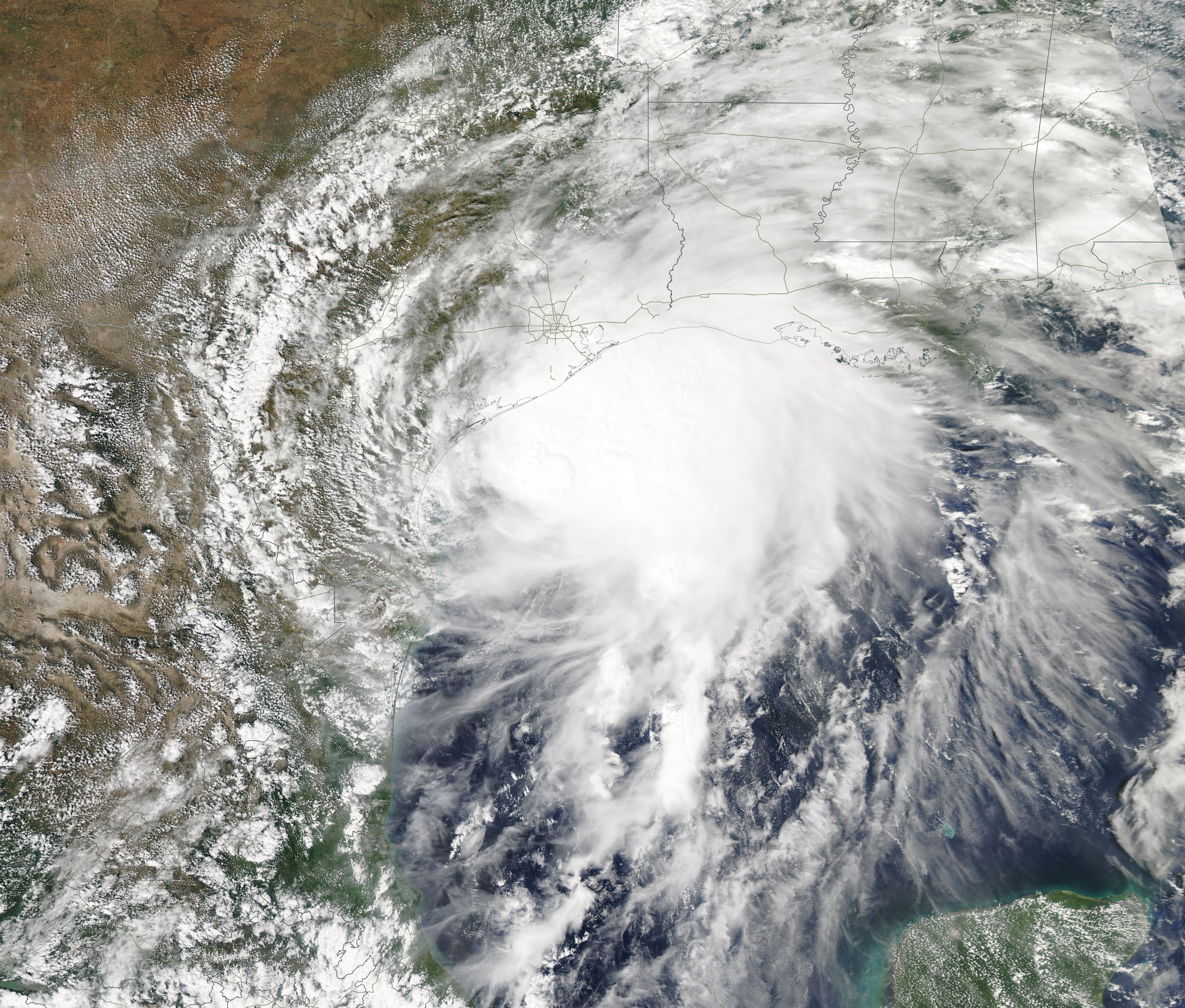
At about 1:30 a.m. EDT (0530 UTC) on September 14, Hurricane Nicholas made landfall on the eastern part of the Matagorda Peninsula, about 10 miles (15 km) west-southwest of Sargent Beach, Texas. The storm, which had strengthened to hurricane status only hours before landfall, brought torrential rainfall to parts of southeastern Texas and southwestern Louisiana on September 14 before weakening and stalling inland on September 15. By that date, the system had become a tropical depression that lingered over Louisiana, Mississippi, Alabama, and the Florida Panhandle, dousing the region that had recently been flooded by rains from Hurricane Ida.
Hurricane Nicholas came ashore carrying maximum sustained winds of 75 mph (120 km/h), placing it as a weak Category 1 storm on the Saffir-Simpson Hurricane Wind Scale. According to The Weather Channel, a WeatherFlow sensor at Matagorda Bay reported maximum sustained winds of 76 mph (122 km/h) and a gust of 95 mph (153 km/h). Storm surge of 3 to 6 feet (0.9 – 1.8 m) was recorded along the upper Texas coast and 9.85 inches (25 cm) of rain fell at Deer Park, Texas. Power was disrupted to more than 500,000 customers in southeastern Texas.
The Moderate Resolution Imaging Spectroradiometer (MODIS) on board NASA’s Aqua satellite acquired a true-color image of Nicholas on September 13, when was crawling just off the Texas coast at Tropical Storm strength. The storm featured a cloud-filled eye and a nearly-symmetric shape. Convective bands reached over the southeastern Texas and Louisiana coast, bringing wind and rain to locations such as Galveston, Texas and Lake Charles, Louisiana.
Image Facts
Satellite:
Aqua
Date Acquired: 9/13/2021
Resolutions:
1km (685.4 KB), 500m (6.5 MB), 250m (6.5 MB)
Bands Used: 1,4,3
Image Credit:
MODIS Land Rapid Response Team, NASA GSFC
